Miles Takes Us Home (Part Two)

We left Neys Campground in Northern Ontario with a light rain falling and the promise of the same all day.  Heavy fog met us as we passed through Terrance Bay and Schreiber and that eventually turned to heavy rain.   Northern Ontario offers so many beautiful roadside lookouts over Lake Superior but we were unable to take advantage of many of them today.

As we passed Rainbow Falls Provincial Park area, however, the rain had let up and we saw a bear taking advantage of human negligence.  The big trash container on the side of the road had not been closed tightly and Mr. Bear managed to pull most of the garbage out of it.  Orange peels, paper, containers…all strewed around the bin and he was a happy bear.  Lunch would be easy today!


At Nipigon, we hit an odometer reading of 112802 which signified 20,000 kilometers of travel since the May long weekend.  And Jim had driven every one of them.  I felt blessed to have been able to sit with the map on my lap and navigate us through this country while he did all the driving.


We arrived at Mirror Lake Campground, about 50 km east of Thunder Bay, to camp with Wendy and Brian.  They are seasonal campers there and have a beautiful set up on the lake that really does look like a mirror.  We pulled into a site nearby and enjoyed two nights with them.  Wendy spoiled us with great food and Brian kept the campfire stoked for all of us to enjoy.  We were happy to see that they had their grandson, Austin, visiting with them from Claresholm.  At two years old, he is a going concern and he made us miss our little ones so much!

img_2913

img_2914

img_2908The weather had been cloudy, damp and misty most of the time so when we woke to more of it on our third day there, we decided to pack up and head directly to Kenora. The morning fog didn’t lift until sometime west of Thunder Bay and heavy grey clouds loomed on the horizon ahead but we were teased with patches of blue sky along the way.  We were longing for sunshine again.

We arrived in Kenora in the late afternoon.  The sky was just clearing and the soon the warm sun was out.  A quick visit with some acquaintances, Kevin and Betty, at their home and then we checked into the campground on the lake.  The sun was lovely and we were able to sit out around the campfire until late that night, watching lightening flashing in the east.  We looked forward to a lovely day of sightseeing in the area tomorrow.

img_2920

It was not to be.  The next morning dawned clear and sunny but by the time we had eaten breakfast and packed up, the clouds had rolled in with a strong north wind.  Flocks of geese were honking across the sky, heading south for the winter.  Was this a sign?  We looked at each other and somewhere in that moment we decided it was time to hightail it home.  Maybe we could make it home by Wednesday to pick Carlo up from pre-school.  If not, it would be a surprise for the kids whatever time we arrived since they weren’t expecting us until  a week later.  We had hoped to see the MS Kenora but it was closed so a walk along the waterfront and a photo of Huskie the Muskie in the beautiful gardens along the waterfront sufficed.  Then we were on our way.

img_2921

We fought strong winds all day and drove right across Manitoba, arriving at Moosomin, Saskatchewan as the sun was setting.  Along the way, we stopped at a mall in Winnipeg to “mall walk” for an hour and then another stop for a short hike in the forest near Brandon. We also visited the Discovery Centre in Brandon, a beautiful interpretive centre dedicated to the preservation of nature in the area.

img_2936

img_2939

img_2941

img_2951IMG_2948 (3).JPGMoosomin must be train central!  We heard trains passing all night long…each of them blowing their whistle as they passed through town.  When we were woken by the 7am train, we decided to get up and hit the road again. The sun was just getting up and there was a chill of autumn in the air.  Coffee at Timmies and we were heading west again with a breakfast stop an hour up the road at a pretty little roadside rest area.  Birds and squirrels were busy in the trees and we learned from a plaque that this had once been a major wagon trail during the days of the fur trade and later for the settlers to the area.

IMG_2973 (2).JPG

Travelling west through the prairies was so beautiful in the early morning light.  Golden fields, cut with precision, fresh hay bales dotting the landscape, and cattle grazing in the pastures while trains snaked their way through the low hills and valleys.

IMG_2977.JPG

IMG_2975 (2).JPG

img_3083

We had a long drive ahead of us but we still took time to stop and smell the roses.  Wolesley, a tiny little town of 3500 was so beautiful.  A swinging bridge across the water beckoned and the colors of the trees reflected in the water was so gorgeous.

img_2982-2

IMG_2990.JPG

IMG_2987.JPG

Indian Head was our next stop.  Our niece used to live there so we knew it was a pretty town and we were anxious to see the Qu’Appelle Valley in its fall splendour.  She had recommended a stop at the bakery for a cinnamon bun so we grabbed one and headed north into the valley to have our snack.  Along the way, a big round stone barn caught our attention.  It was the Bell Barn, a reconstruction of the original barn built in 1882 for the first corporate farm in the area.  At that time, 27 houses had been built by the corporation on the surrounding land to house the farm workers.

img_3029-2

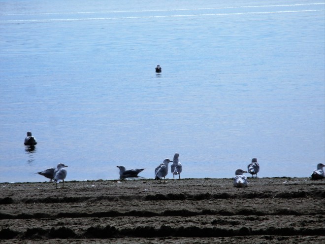
The valley was so, so beautiful.  The trees were splendid in their fall foliage and the lake was so calm.  Picnic tables were stacked, ready for cooler weather, and maintenance workers were busy marking trees that needed attention.  Some were spray painted with the word “DED” which at first we thought was a mis-spelling of “DEAD” but then realized it meant “Dutch Elm Disease”. Gulls and loons floated in the lake and we basked in the warm sunshine.

img_3008

img_3019

IMG_3002.JPG

IMG_3023.JPG

IMG_3017.JPG

Reluctantly, we left the valley.  Regina was our next stop…such a beautiful city.  A walk through Wascana Park gave us a great view of the Legislative Building and from there, we went on a tour of the building itself.

img_3035

img_3034

The Regina Legislature was built in 1909-1911 and officially opened in 1912.  It is built of Manitoba Tyndalstone in the traditional English Renaissance style, incorporating 35 types of marble from around the world.  It is magnificent, as would be expected.  The copper on the dome was just this year replaced so it looked so shiny in the sun.  Within the next two years it will oxidize and turn to green and eventually to black.

img_3049

img_3055

img_3053

img_3066

The gardens outside the Legislature were showing signs of fall but the roses were still in full bloom and most of the other flowers were keeping up their appearances!

img_3069-2

img_3070

Leaving Regina, we passed the Chaplin Salt Mine on Chaplin Lake.  This 18 km long lake is one of the richest and purest sources of sodium sulphite deposits in the world.  A little town that struggled agriculturally because of its poor soil in its early years came to life when the mine opened in 1948.

img_3076

As we made our way to Swift Current in the early evening light, what we thought was fog developing in the valleys turned out to be harvest dust as groups of combines worked their way across the fields.  The landscape looked soft and velvety in the low light and we were treated to another beautiful prairie sunset.

img_3027

img_3082

When we arrived in Swift Current, we treated ourselves to dinner out…it would be our last night on the road.  Following dinner, we took advantage of the beautiful Aquatic Centre where we soaked our tired bodies in the hot tub before turning in for the night in the Walmart parking lot.  It had been a long day.

How excited we were to get on the road the next morning!  We would see our family again!   We were amazed at how much we loved the look of the prairies.  After seeing mountains, forests, beaches, oceans, and lakes it was unbelievable how good it felt to see flat prairie and big sky.

img_2998

We started plotting our surprise tactic as we drove towards Alberta. Crossing into Alberta was nostalgic…it would not be long before we were back in our own town in our own house with our own family!

IMG_3086.JPG

We stopped to walk about in Medicine Hat at the largest Teepee in the world.  The Teepee is a tribute to the native heritage of the area and paintings by various artists depict the native culture and the impact of European settlement of the land.  One of the paintings is done by Nona Foster, a well known artist from our area.

img_3088

We stopped in Lethbridge for groceries, a stop that required a drive through the beautiful river valley.  Had we not been so excited to get home, we would have wandered through the valley or around Henderson Lake but we were on a mission now.

img_3094-2

Once we were on the road home, groceries to stock our fridge piled in the back of the van, we sent a dinner invitation by text to Holly and Trevor.  At first, Holly thought it was a joke…a sick joke, as she called it…but then realized we truly were on our way home.

img_3126After nearly four months living in less than 100 square feet, our house seemed humungous!  We had two young ladies living in it till the beginning of September and they left it spotless…we almost wondered if they even stayed!  The flowerbeds had filled with weeds and overgrown perennials, trees needed to be trimmed and planters required my attention  but that could all wait. We wandered from room to room, marvelling at the space!

IMG_3100.JPG

The kids arrived for dinner.  It felt so good to hug them all.  Carlo was pumped to see Papa again and went flying into his arms.  Lewis didn’t remember us…we had expected that…but it wasn’t long before he was smiling and crawling around the house as if he knew where he was!  Tears and hugs and chatter and excitement filled the air.

IMG_3105 (2).JPG

It was great to be home on the first day of fall after travelling 22,209 kilometers in 121 days.  What a great vacation!  Thank you, Miles, for an amazing holiday and getting us safely home.


Miles Takes Us Home (Part One)

Well, we did it!  We managed to take back roads and side roads and the odd main road to see the Prairies, Eastern Canada and the Maritimes…so many places in this beautiful country called Canada…in a matter of approximately 15 weeks or 103 days, to be precise.  Now we begin the journey home, keeping mostly to the well travelled Trans Canada highway.  Our aim is to be home by September 28th so that gives us 25  days without pushing ourselves too hard and time to stop and smell the roses along the way.

When we left New Brunswick, we stopped overnight in a campground in Riviere-du-Loup, QC.  We were lucky to get a site, being the middle of the last long weekend of the summer.  The campground we were in had a lot of seasonal campers so they were holding a bit of a party that night.  Karaoke was happening in the hall, and a 50-50 draw was won by some lucky camper…but not us!  We enjoyed a roaring campfire and would have joined in the festivities had we been able to speak the language but neither of us know enough French to carry on any sort of conversation and very few people speak English.  In fact, we were talking about our Quebec experience…it is such an incredibly beautiful province but we were unable to fully enjoy it due to the language barrier.  Even information and historic signage was only in French so we tried to make them out but mostly failed. We eventually stopped trying to understand them.  Stopping at small towns and attempting to get a feel for the town through conversation with the locals was out of the question.  But beauty in nature knows no language limitations so the camera was our salvation.

We drove as far as Thetford Mines the next day.  There was not much to see along the Trans Canada until we turned south toward the area called the Beauce, south of Quebec City.


Along the way we passed again through the area that Michael had lived when he participated in Katimavik.  We ate at the same great restaurant in Vallee Jonction…the waiter even remembered us!  And so did the girls at the train station museum that we made another quick stop at!  It was their last day of work and many items were being sold at half price.


As we drove through the small town of St-Joseph on the opposite side of the Chaudier River, we were shocked to be stuck in a traffic jam.  The town was holding semi-truck competitions along with a midway.  People, trucks, trailers and cars were everywhere…every available parking area and field was full!  We even noticed a semi from Mullen Trucking in Aldersyde, AB!


Passing beautiful homes sitting on rich farmland that produced grains, dairy, cheese, we eventually arrived at Thetford Mines.  The old King Asbestos mine which opened in 1878 and closed in 1986 after carcinogenic properties were identified in asbestos, is undergoing a revitalization in the form of an urban park with reference to the economic impact that it had been in the area.


We were surprised to find out the next day that asbestos is still being mined in the area!  We passed the huge open pit mine on the highway west of town.  From what I can tell, there is still an international market for it but it is limited to things like tires and siding and no longer used in insulation or anything else where the fibers are exposed.


Continuing through the lovely Eastern Townships, we drove through the little summer town of Disraeli on Lac Aylmer as fog was lifting over the water. The little town was already busy in the early morning hours, presumably the last of the summer tourists getting  ready to leave at the end of the long weekend.

We started to see more changes in the colours of the leaves as they gradually turn from green to vibrant red.

Weedom is home to a large lumber mill and the surrounding area is beautiful rolling hills with large groves of trees, fields of golden corn and Christmas tree farms.


We arrived at Ken & Lynn’s home in Saint-Lazare by early afternoon.    It had been seven weeks since we had said goodbye to them on our way east. The weather was stifling hot and extremely humid.  Certainly not ideal for a woman in menopause!  Thankfully, they have air conditioning in the bedrooms…we stayed three nights, celebrating my birthday while we were there.  And our van got another wash, cleaning, oil change and checkup.


Leaving Quebec, we arrived in our nations beautiful capital, Ottawa.  Trevor and Eliza had treated us to a stay at the famous Fairmont Chateau Laurier so we lost no time checking in!


What an opulent building…just magnificent!  Our room overlooked the Rideau Canal and its series of locks with the Parliament buildings in full view.


It seemed strange to park our old 1993 van, pack a couple of bags and spend the night in such luxury.  It was a big change from a Walmart parking lot!

We spent the afternoon checking out the area.  The Byward Market was an amazing market of fresh fruits, vegetables, cheeses, preserves, wines, shops, boutiques, restaurants, pubs and coffee houses.  It was evident that this is a favorite of locals and tourists alike.   It is part of historic Ottawa so the buildings had great character.


The Commissariat along side the canal is one of the oldest structures still standing since the time of building the canal in 1827.  It was used for storage of supplies during the construction of the waterway and today offers a history about the actual construction of the massive engineering feat that the Rideau Canal signifies.  Completed in 1832, it connected Bytown, now known as Ottawa, and Lake Ontario with a series of locks, channels and dams.  The original purpose for the 202 km channel was military defence but it was never used for that.  It definitely opened central Canada to settlement and trade and today it is used primarily for recreational boating and deemed a National Historic site operated by Parks Canada.


An evening walk along the canal gave a great view of the Ottawa River with two major bridges connecting Ottawa to Gatineau, Quebec. The sunset was lovely and as the lights came on all around us, the old buildings took on a whole new charm.  We walked back to the market area for supper, enjoying a night of people watching from the patio of one of the pubs.


When we woke the next morning in that luxurious hotel room, our thoughts went back to 38 years ago …our wedding day!  Memories of all our experiences over the years flooded in and we felt blessed to have spent so many good years together.


We checked out of the hotel and headed to Parliament Hill to take a tour of the building that determines all that happens in Canada.  The only tours left for the day were the French ones so we had to take that.  We didn’t understand much of the information being offered but we recognized so much from the TV news.  Seeing the House of Commons, the Senate, the Library of Parliament…even the hallways with the magnificent ceilings, arched doorways and windows, marble floors and columns…created an amazing sense of pride in all it means to be a Canadian citizen.  Having just seen so much of the country and understanding the history of the making of this great nation solidified that sense of patriotism even more.

The Memory Chapel, where every person who ever fought for our freedom is recorded in books for all to see created a sense of peace and humility.


The  view from the Peace Tower of the whole city was breathtaking.


We also did a short version tour of the Supreme Court of Canada.  This is the last chance for prisoners wishing to appeal their sentences.  Architecturally, it is not as ornate and magnificent as the Parliament building but awe inspiring nonetheless.  It is very symmetrical with marble and rich wood everywhere…even in the washrooms!


There are nine Supreme Court Judges appointed by the government, one of them is appointed Chief Justice.  At present, that position is held by Beverley McLachlin.


Across the street from all the beautiful government buildings we could see amazing modern architecture mixed with the old.  In fact, the Bank of Canada kept its original facade and built a huge glass structure around and behind it.  I love how the new reflects the old…like a symbolic salute to our history as we move through time.


By the time we had seen the Parliament buildings and taken a tour of the Supreme Court of Canada, the oppressive heat and humidity  (28 degrees but feels like 39)  was taking its toll on us.  It was mid afternoon, Friday, and the traffic was already getting heavy.  We decided to move on even though there were numerous other things to see in Ottawa.


Rideau River campground was only an hour south.  We had stayed there before and knew it was nice so off we went, arriving in time for a meal and a few games of cards before night fell.  The days are getting shorter!

There was no rush to leave the campground early.  With the weather so lovely, we hung around and hit the road mid afternoon again.  The Trans Canada led us to Peterborough for the night.

Overnight brought high winds and heavy rain but it had stopped by morning.  We treated ourselves to breakfast out and then decided to go see the big hydraulic lift lock on  the canal on the off chance that we might see a boat going through.  The canal was calm and lovely in the morning light.  The ducks and geese were going about their morning feeding and the maples lining the canal were starting to change into their fall colours.  We sipped on coffee, biding time, fingers crossed.


We were just about to leave when a large yacht from Washington came cruising ever so gently down the canal.  The gates to the lock opened, the yacht pulled in, the gates closed and up it went, 80 some feet in the air to be deposited in the lake on the other side.  This lock stuff never gets old for us.


Satisfied with our morning, we headed west through Orillia and on to a tiny place on the Trent Severyn Waterway called Big Chute.  It is home to the most unique lock that we’ve seen… And we’ve seen plenty on this trip.  What we have at Big Chute is a Marine Railway lock system operated by Parks Canada as most of them are.  So the way it works is this…a very large flatbed railcar travels down by way of cables on a double set of tracks into the water of one lake.  Because of the double rail system, the car remains level throughout the whole procedure.  Once it is immersed in the water, the boat enters the railcar and is suspended by slings to keep it in place.  If it has an outboard motor, the back end is lifted higher than the front to keep the motor from dragging.  When everything is secure, the car travels back up the track, across the highway with the railway guards holding back traffic, and then down the other side into the neighbouring lake. When fully immersed, the slings are removed and the boat carries on its way. Truly fascinating to watch!  Because it was Sunday afternoon of a lovely  weekend, the lock was very busy.  We stayed to watch a number of boats being transported from one lake to another.

While at the lock, we got chatting to a couple from Collingwood, ON. They were staying at the same campground as we were planning to check into just a few kilometres away.  Tom and Nancy asked us to join them for Happy Hour once we got ourselves settled.  We ended up staying two nights and reciprocated by having Happy Hour at our place the second night. This is one of the best things about travelling!  They had travelled to many of the same places as us so we had fun sharing stories!


During the evening of the first night, we were sitting by the fire in the dark. Jim left me alone while he walked to the privy at the end of the road.  Suddenly I heard a snort and a snuffling noise behind me.  I jumped from my chair, turned around, and noticed the garbage bag swinging from its hook at the end of the picnic table.   A creature larger than a raccoon lumbered off into the trees behind the van.  We had been visited by a bear!

We lingered in the campground till noon the next day, loving the late summer heat.  From this point on we knew the days would be cooler.

North of Parry Sound, we left the main highway for a short diversion to Bying Inlet.  What a treat…mama bear and three cubs scampered across the road just as we passed (the camera was not handy) and then a turtle stopped to say hello!


We got to Sudbury at the tail end of a huge rainstorm.  Sudbury is the nickel capital of the world and as such is a very industrial city.


Our plan was to stay the night but then decided to drive another 300 km to Sault Ste. Marie to spend the night by the river.  We were rewarded with a fantastic sunset as we approached the Soo.


We were so glad to be out of the van, walking the boardwalk in the fresh air.


We decided to go to a movie before turning in and thoroughly enjoyed “Sully” starring Tom Hanks.

Gas, groceries, and we were on our way around Lake Superior, prepared for at least two nights of provincial campgrounds.  Our first stop was Pancake Bay, just a short drive north of Sault Ste. Marie. We had missed this spot on the way out so didn’t want to miss it again, especially since we had warm sunshine and a long sandy beach!


It was at Pancake Bay that we were thankful for our AMA membership.  I ended up locking the keys in the van while Jim was at the beach.  “No worries,” I thought. “Jim will have his keys in his pocket as always.” Little did I know he had removed everything from his pockets when we did laundry earlier!  Everything we had was locked in the van, including cell phones, jackets and wallets. We made our way to the office to call CAA and waited close to an hour till they arrived from the Soo.  Because we have an older model van, the poor young man was presented with a bit of a challenge breaking into it.  A wire coat hanger would have come in handy but even those are hard to come by these days, especially in a campground!  He eventually got it open and we were glad to grab jackets and build a fire. Night had fallen during the process and so had the thermometer!

The down filled comforter went back on the bed that night.  It had been at least three months since we had last needed it.

The drive the next day took us past lovely scenic views of Lake Superior and a stop at beautiful sandy Katherine Cove with a view of the Lizard Islands and Caribou Island.  This area is a painter’s delight…sand, surf and trees.


Somewhere along the way, just north of Wawa I think, the maples disappeared and the birch started  showing off their fall yellows.  We are just a week or two early to see the full autumn splendour.


Highway construction was heavy.  Roads are being widened in many spots and bridges are being replaced. There likely isn’t much more time before snow falls around here so they are working from morning to night.

We got to Neys Campground in the late afternoon, giving us time to enjoy the sandy beach covered with driftwood. We stayed at this same place three months ago to the day!  We loved it then and we love it now.


From here we head to Thunder Bay to camp with friends. Keep posted for Part Two of our journey home.

Miles Meets New Brunswick (Part Two)

It was a long drizzly drive but by early evening Miles had steered us safely across the border into the sunshine of New Brunswick again, having visited Prince Edward Island, Newfoundland and Nova Scotia in the past few weeks.  Now it is time to visit the southern part of New Brunswick as we make our way back west.

We pulled into Moncton, pried our tired bodies…how does one get so tired sitting?…out of our seats and went for a long walk.  It felt so good to unfold and breath in the fresh evening air…the tensions of driving in poor weather on unknown country roads soon gone.

The next morning, after doing a little research on Hopewell Rocks, we knew we wanted to experience the area at both high and low tides.  High tide would be around 11:00 so we set off in that direction. We followed the Petitcodiac River, known fondly by the locals as Chocolate River because of the high amount of suspended reddish brown sediment in the water.  Instead of a clear river, it looked like chocolate milk!  And because it is a tidal river, it was filling up as we travelled to its mouth at the Bay of Fundy.


Because of the funnel shape of the Bay of Fundy, this area experiences the highest tides in the world.  Water levels can rise more than 40 feet in a matter of six hours.  We arrived at Hopewell Rocks in time to view the bay at its fullest.  From the viewing platform we could see the tops of rocks jutting out of the water.  People on kayaks were floating around them and through them.


We were told that we could come  back later at low tide to see the ocean floor.  That gave us a few hours to do other things.  In our haste to see this at high tide, we had not realized that Magnetic Hill, a popular tourist attraction was in Moncton where we had just come from.  So off we went, back to Moncton to see this weird phenomenon.  Sure enough…it was perplexing.  Our instructions were to drive down the hill, turn around and park by the white post, put our vehicle in neutral and take our foot off the brake.  We did as we were told and our van magically coasted back up the hill as if it were being pulled by a very huge magnet!  It was so interesting, we turned around and did it again.  I won’t tell you how it happens but be satisfied that if you’re in Moncton, it’s worth the $5 charge!

Back to Hopewell Cape where we visited the Albert County Museum.  Albert County was established in 1845 and Hopewell Cape was selected to be the “Shiretown” or capital of the county.  Many of the original buildings of the shiretown still exist and are still in their original spots.  These buildings now house the museum with each building featuring information on different facets of the area.  A few noteworthy points; Prime Minister Robert A. Bennet (1930-1935) was from there; kerosene, the first petroleum product to be extracted from the ground, originated there; and famous murderer Tom Collins (not to be confused with the drink) committed his crime there and was finally hung after three separate trials.

It was nearing the safe time to walk the ocean floor at Hopewell Rocks so we headed over there again.  What a change!  Where had all the water gone?  Without actually seeing it, I would have had a hard time understanding the change in the height of the tide.  What had been just a tiny opening in one of the rocks turned out to be a massive arch that crowds could walk through.  The floor of the ocean was covered with a sludge of slippery red mud which we had to walk carefully on to avoid slipping.  It was amazing!


Moving on, we followed the Shepody Bay, still at low tide, until we arrived at Fundy National Park.  We would camp high in the mountains just outside the little tourist town of Alma.  We booked in for two nights…a beautiful forested campsite where we had space to spread out.  Unfortunately, rain arrived shortly after but we didn’t mind the break from driving.  It was a chance to regroup after some pretty busy days again.


Two days later when we left the campground, we backtracked to Alma for one of their famous sticky buns…we had been told about them by another camper.  Yummy!  That bakery also makes great peanut butter cookies for the road!  Taking the scenic route through the park, we climbed slowly and steadily up the mountain.  Some of the maple trees were beginning to turn color, some of them even bright red.  We can only imagine how amazing this area must be in another month.


After leaving the park, we travelled past farmland…mostly corn…and past potash mines around the town of Plumsweep until we arrived at the village of St. Martins.


St. Martins marks the beginning of the Fundy Trail and the location of a row of sea caves along the rocky cliffs lining the bay.  The fog made it difficult to see them and the tide was high so we decided to drive to the end of the Fundy Trail in the hopes that the fog would rise as the sun got hotter and we would see them better on our return.


This part of the Fundy Trail is about a 25 km stretch of road along the Bay for driving or cycling and another 25 km further if hiking.  There are lookouts along the way and the road climbs and drops.  The 251 million year old rock cliffs show off colors of green, amethyst, blue, grey, white and pink…it’s really very lovely.  By the time we had reached the end of the trail at Long Beach, the fog had still not lifted. It gave the beach an eerie, forlorn look. We wandered around the beach, again collecting shells, and had a picnic lunch, the whole time waiting to see blue sky.  It never came so we headed back along the trail.


One stop, above the fog, led us down a set of cable stairs to Fuller Falls that were pretty and would have been awesome in the spring!  Then back to St. Martins where the fog was still too thick to properly see the caves.


In the 1800’s, this was a major ship building area, with no less than seven ship building companies in the area. Now, of course, that industry is no longer viable.  Fishermen still use the harbour but it is affected enormously by the tides. While we were there at low tide, machines were busy dredging the harbour because over time it has built up, causing the tide to leave earlier and come in later. By dredging the bottom and removing some of the build-up, they hope to add two more hours to the fisherman’s work day.


We arrived in Saint John by early evening and had supper in a restaurant on the wharf at Market Square.  There were crowds of people there celebrating the end of summer with live entertainment.  It was a happening place!


Saint John, incorporated in 1785, was once one of the busiest ship building areas in the world.  In fact, the Marco Polo, known as the fastest ship in the world was built here in 1852.  She easily broke the record for quickest round trip from Liverpool, England to Melbourne, Australia.


It is now a very busy working port, handling more than 25 million tonnes of cargo a year.  The city has done a great job of bringing the tourist element to the docks with a lovely boardwalk and interpretive signs along the way.  It is visited by cruise ships, barges, freighters, ferries and many other seacraft.


We stayed the night in the harbour parking lot and spent the next morning wandering around historic Saint John.  This city was influenced greatly by the settling of the English and the American Loyalists in the 1700’s.  Kings Square, a park area with a lovely gazebo, park benches and fountains is a tribute to the city’s past.


As well, the Loyalist Graveyard in the centre of town provides a peaceful spot to wander with graves dating back to the late 1700’s.


Saint John was ravished by fire in 1877 and within four years of the fire most of the buildings had been replaced giving the old part of the city a very homogenous look.  In later years, modern architecture has emerged among the old.  Old buildings are being repurposed as luxury apartments and condos with 18′ ceilings and 10′ windows as selling features.


Uptown Saint John, as they call it, is connected by a series of ped-ways and skywalks much like Winnipeg, making travel around the city in inclement weather easier.  At the center is Market Square which, besides being a great outdoor meeting area, has an inside shopping area, Canada’s first free public library (established in 1833),  the Museum of New Brunswick, restaurants and pubs with connecting ped-ways to banks, city hall, hotels, etc.


The Saint John River, which originates in Maine and flows through Quebec and New Brunswick empties into the Bay of Fundy here.  It is spanned by bridges connecting the city east and west but in the years from 1841-1954, ferries did the job.  A trip on one of the ferries in the early days would cost a person 3 cents…a far cry from the $184 fare that we would have paid for the ferry from Digby, NS to here earlier this week!

Before leaving Saint John later in the afternoon, we stopped at Reversing Falls.  This is a unique phenomenon caused by the elevation change between the bay and the river in combination with the huge tide levels.  The river is lower than the bay when tide is in so the water that should spill into the bay over the rocks gets pushed back into the river as the tide gets to its highest point.  When the tide lowers, the river can once again spill as rapids into the bay.  We saw it at full tide but did not see the low tide effect.  Regardless, it was quite something.


In Fredericton, we stopped for a walk along the river parkway.  We got side tracked when we approached a spray park with hundreds of kids celebrating their last Friday of the summer.  We watched as a huge bucket high above filled with water while the kids below waited with anticipation for it to topple over and spill water all over them.  Shrieks and laughter filled the air as the water tumbled down on them.  It was so much fun to watch!


Across the street, free tours of the Government House were being offered.  The Lieutenant Governor of New Brunswick lives there three or four days each week.  The third floor is her private residence.  We were able to tour the first and second floors which are still used for a variety of events over the course of a year, many of them political but not all.  An art gallery with changing art displays takes up a portion of the second floor.  It is a beautiful house and has been used for a variety of purposes over the years from government to prison to RCMP to government again.


Driving north, we had to make a stop at Hartland to see the longest covered bridge in the world.  At 1282 feet, it is considered an exceptional engineering feat given that it was built in 1921.  Covers were put on the bridges  because the bridges were made with wooden trusses and this would prevent them from rotting.  Most of the bridges, including this one, are still being used today.


Our last night in New Brunswick was at Grand Falls.  There is a deep gorge there with falls that, in the springtime, are apparently very impressive.  They claim that at that time of the year  9/10ths of the volume of Niagara Falls cascade over the rocks every second as snow melts in the Appalachians, rushing to the Saint John River.  This time of year, however, most of the water is diverted to the hydro plant so we didn’t see much for falls.  Incidentally, Grand Falls is the birthplace of Ron Turcotte, the jockey that rode Secretariat and won the Triple Crown in 1973.


On the highway again, we passed through Riviere Verte, a pretty little Acadian town with a covered bridge built in 1925. At only 194 feet, it’s not nearly as impressive as the Hartland bridge but it looks so quaint in its rural setting.


Our lunch stop was at Edmunston, a port of entry city for US residents from Maine, and just 18 km south of the Quebec border.  A picnic by the Madawaska River with a view of the big pulp and paper mill across the water was a great place to eat, walk and read our books in the sun.


We had enjoyed every moment of our stay in New Brunswick.   By late afternoon we were en route to Quebec and an hour later we checked into a campground in Riviere-du-Loup.