Miles Meets Nova Scotia 

img_2252

The ferry crossing from Port aux Basques, Newfoundland to North Sydney, Nova Scotia was generally uneventful.  The six hours passed rather quickly and within twenty minutes of disembarking, we were back to where we left off before heading to the Rock.  Jim’s cousin, Glennis, and her husband, Garth, once again opened their home to us.  This time, their son, Robin, and his girlfriend, Ashley, joined the party.

After a good nights sleep and the opportunity to get some laundry done, we hit the road for some touring.  First stop was Glacé Bay and a quick stop at the mining museum.  This area at the south east part of Cape Breton used to thrive on the coal industry but the mines have closed now.  Apparently, there is talk of opening up again at nearby Donkin, but preliminary studies have not yet determined the feasibility of it.  There is less and less demand for coal and the grade of coal here is not optimum grade.

By following the coastal road we arrived at Louisbourg.  It was at this location that the fortified town was occupied by the French from 1713-1768.  This was a period of ongoing struggles with the English over who had control of the land. Excavations have revealed the location of many of the buildings and over 500 documents have been found that allowed complete replicas of the town to be built to exact specifications of the original buildings.

img_1738

img_1740Operated by Parks Canada as a national historic site, all the staff are dressed in period costume and demonstrate daily activities in the life of a member of the fortress.  We got a glimpse into the past in terms of ship building, lace making, guard duty, etc.


Dancing was demonstrated in the great hall and the women in the kitchen explained their activities.


Just before closing, the drummer and bugler escorted the guards to the cannon which was then fired to remind us it was time to leave the park.  It was very well done.


Following that, we met Glennis and Garth just a couple of kilometres out of the park for the Beggars Banquet.  That was lots of fun.  Before being seated, we were taken to a room to be dressed in period clothing ourselves and then seated in the dining hall where we were treated to a great meal and fine entertainment.  Garth even got up and performed a couple of songs for us all.

We said our farewells to Glennis and Garth the next morning and headed for Baddeck for a round of golf at the Bell Bay Golf Course.  I was so proud…I was ahead of Jim through the whole game and then the last hole happened!  My game fell apart completely and he ended up beating me by two strokes!  That will teach me for being so cocky!


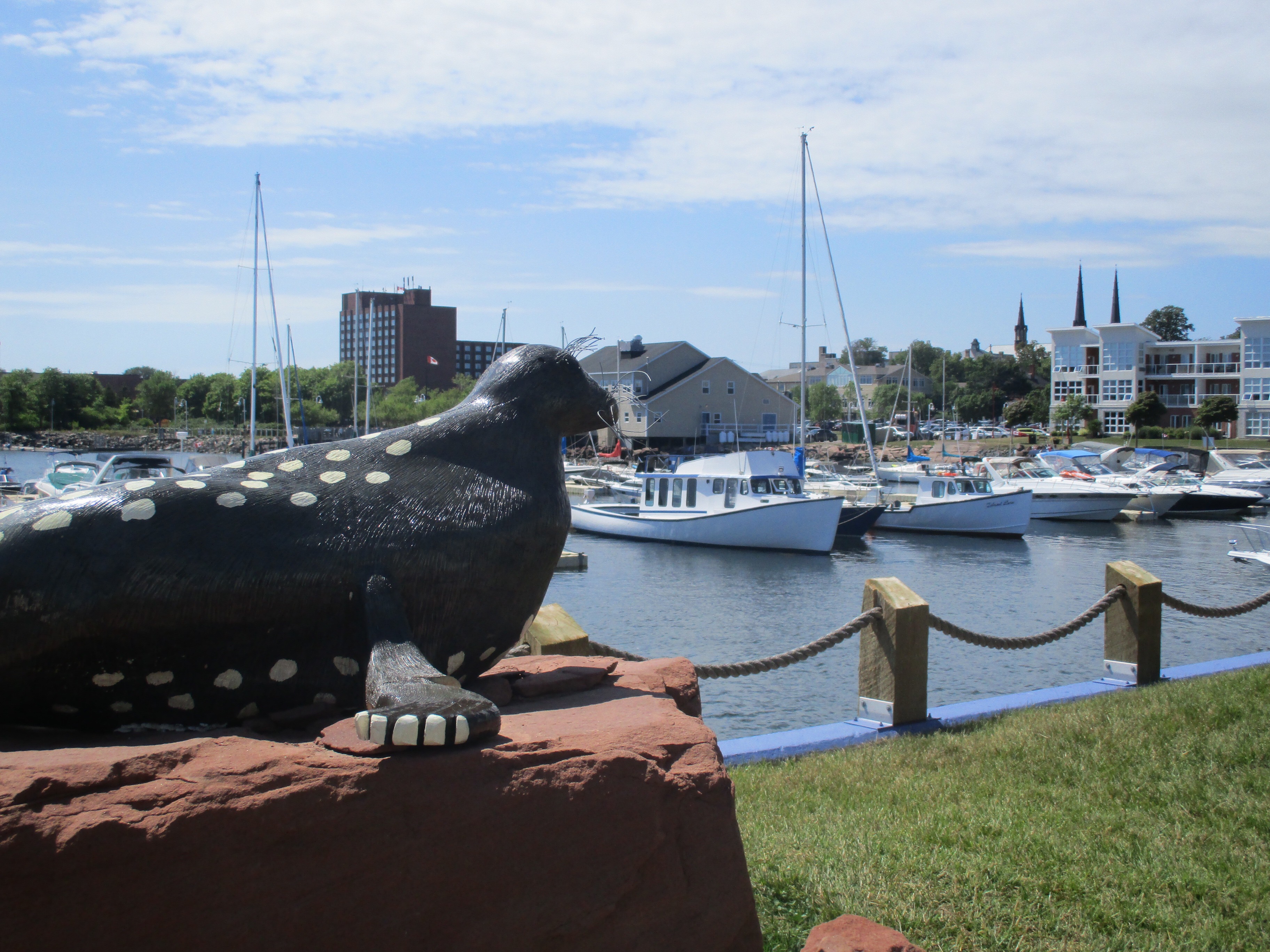
Baddeck is such a pretty summer town with a lovely harbour and lots of shops and restaurants.  We had originally thought we might stay there for the night but while we were enjoying a cold beer after our game, we changed our minds.  We were anxious to see the Cabot Trail so around 4pm we started out, heading north, taking the trail in a counter clockwise direction so we would always be on the outside lane and therefore have an unobstructed view of the water at all times.

We got on the trail at Englishtown by taking a 5 minute ferry ride.


There was lots of construction which caused delays but we were glad the repairs were being done.  In some areas, potholes were really bad but the road was in generally good condition.   Passing all manner of Artisans shops…pewter, leather, glass blowing, pottery, painters, quilters, sewing, soap making…we began a slow steady climb of more than 2km up Mount Smoky.  By the time we reached the top, the view of the mountains and the Atlantic Ocean was phenomenal!


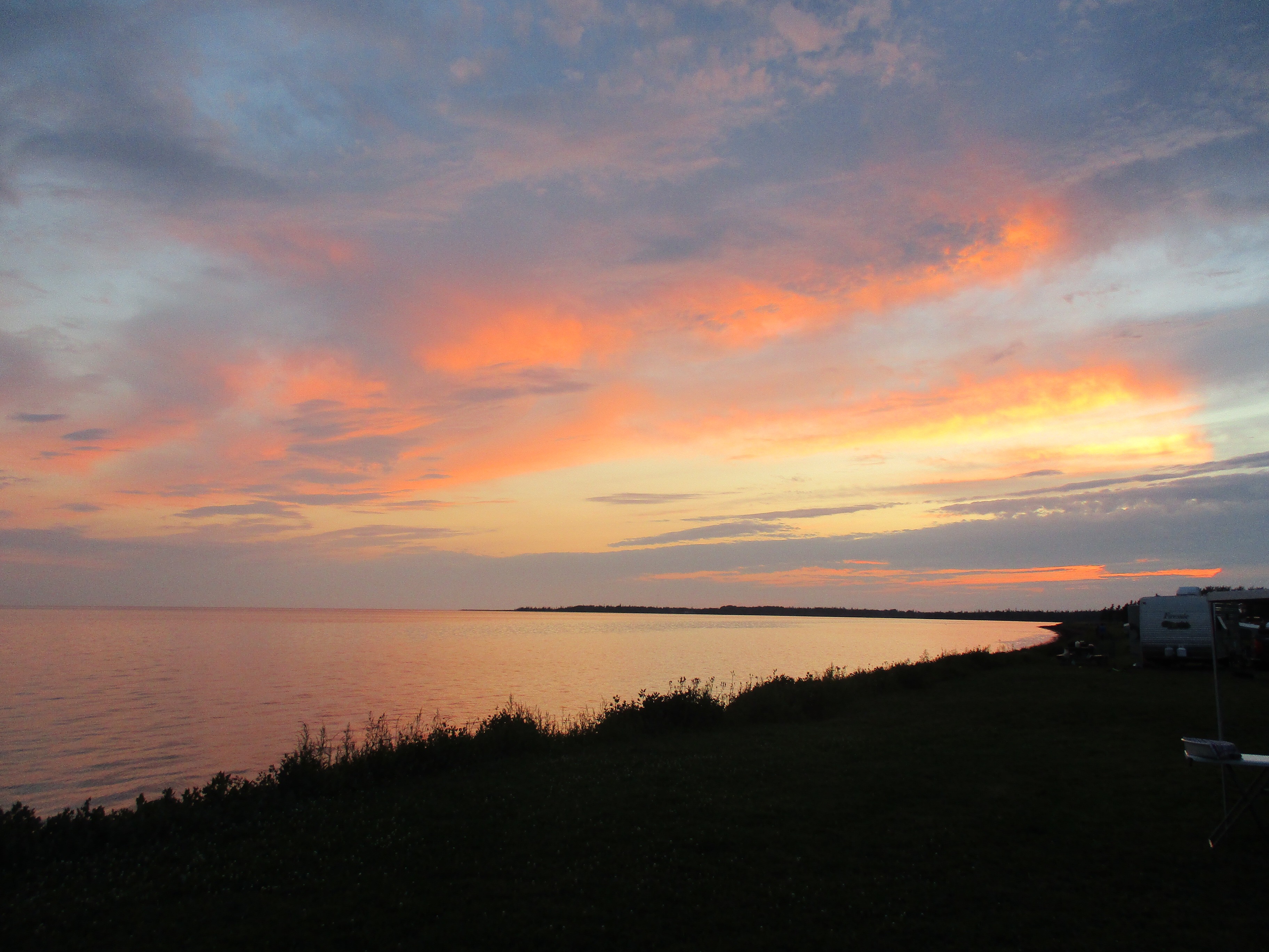
From there, it was a steady drop to Ingonish at water level.  It was beginning to get late.  We stopped to get photos of the bay from the wharf and the beach and then decided to stay there on the beach for the night.  People were coming and going all evening to watch the sun go down or stroll along the pier. The sunset was amazing over the bay.  When we were the only ones left except a couple of guys fishing from the wharf, we had a late supper then settled down for the night, setting our alarm to get up early to see the sun rise as well.

Sunrise was 6:12 so we set our alarm for 6:00.  I woke at 5:30, anxious to see the sun rise.  I was surprised that the sky wasn’t brighter by that time.  I waited and waited and still it was quite dark.  Then I realized that our clock in our van was still on Newfoundland time, a half hour ahead!   Oh well, by the time the sun started to rise, we were packed up and ready to move on!  After getting our photos there, we were able to stop at a view point a few kilometres further north and get more.


The Cabot Trail is breathtaking.  There are lookouts placed strategically along the highway as it twists and turns uphill and downhill, offering views of picturesque bays and stunning mountains.  It is hard to pass without stopping, and if you’re not in a hurry, it would be foolish not to stop. In some places we were watching surf crashing in, others we were looking over vast hardwood forests full of red spruce, sugar maple, hemlock, beech, yellow birch and red oak.


The forested highlands are riddled with hiking trails of various lengths and levels of ability.  On one short walk we took in the Great Anse Valley we came to a “shieling” or shepherd’s hut, built in the middle of the oldest hardwood forest in the Maritimes, to commemorate the settling of the Cape Breton highlands by the Scots in the 1700’s.  They came expecting a similar landscape to home but got much more wood and much less stone.  Temperatures dipped far lower than they were accustomed to and they relied on the Mi’kmaq to teach them how to survive.


The bays and coves are pristine, most of them settled with little homes and offering some sort of water adventure.  Whale watching, charter fishing, and kayaking bring tourists from around the world.  We were content to walk the beaches and watch the many activities in the busy little harbours.  In early morning and later in the evenings, these same harbours are quiet little spots to stroll around and savour the sounds and smells of the sea.


South of Margaree Harbour, the landscape begins to change.  The mountains are not so high and small farms blend with sandy beaches.  This is the Evangeline Region, predominantly proud Acadians.  This is home to many famous Celtic singers like the Rankin Family and Ashley MacIsaac.  Many of the pubs offer Ceilids, or musical gatherings, in the evenings.


It is also the home of Glenora Distillery, a small operation that distils  single malt Scotch Whisky that has won awards internationally.  We went on a tour and were given a taste of their 10 year aged Scotch…how do people drink Scotch?


The Inverness area is known for its beautiful sandy beach which we were happy to soak up the sun on! Many of the beaches in Nova Scotia have lifeguards on them…something I don’t think I’ve seen in Alberta for many years.


This area recently opened two new World Class golf courses which have given a much needed source of employment for more than 300 people directly and many more indirectly.  Apparently many big names have been flown in from all over the world to play here.

We stopped for a picnic supper in Mabou, washed it down with a drink from The Red Shoe Pub, owned by the Rankin Sisters, and then headed west over the Canso Causeway and on to Antigonish where we would spend another night with Tom and Chris…Newfoundland and Cape Breton under our belts since we left them three weeks ago.


With our tummies full, thanks to Tom, we were on the road to Pictou Harbour to see the replica of The Ship Hector.  She was the ship that  brought the first wave of Highland Scots to “New Scotland” in September of 1773.  They set sail more than three months earlier with 189 passengers and only 90 bunks. Hurricane gales set them back two weeks as they were rounding the cape at Newfoundland.  They ran out of food and water and were overcome by dysentery and other diseases.  Somehow, most of them survived and persevered through that first cold winter.  Much of Nova Scotia’s heritage is based on this voyage that would be the beginning of many more immigrants from Scotland, all with the dream of owning and thriving on their own piece of land.  When we toured the boat, we were shocked at how small it was and could imagine the stench of the steerage area by the time they arrived.


The town itself has many features that distinguish it as having Scottish heritage.  Many of the old stone buildings, for example, as well as the tartans for all the various clans hanging from the lamp posts.


While in Pictou, we also checked out the Fisheries Museum and learned more about fishing in the Northumberland Strait.  There was a poster there which helped us identify the various shells we’ve scavenged from the beaches out here.


Then on to Truro.  Many moons ago, my forefathers settled in this area from England to farm before eventually moving out to Saskatchewan.  We checked out the graveyards to see if we could find anything.  We came across a ‘Grover DeArmond’ but according to my Aunty he is no relation.   It was fun searching…graveyards offer so many possible stories.

It was late afternoon when Miles pointed us towards the area of Halifax.  We drove through Cole Harbour, the home of Sidney Crosby, and followed the shore east, twisting in and around all the little inlets, stopping finally at Cow Head to have our picnic supper.  There is a huge marshland area there that has been donated to the province for conservation purposes.  There is also a long beach that would be very busy in good weather but rain was threatening and wind was blowing.  The lifeguards were having an easy day.


Heading into Halifax, we passed the industrial city of Dartmouth.  Refineries, Irving Oil headquarters, Baden Powell Centre and a huge auto complex were all on our way.  We were amazed at all the new cars that have arrived off the ships and are now being loaded onto trains for distribution across Canada.

After locating a Walmart in Halifax, we parked our van and hopped on a bus to take in some of the nightlife in Halifax.  It turned out that Glennis and Garth were in the city for their semi-annual Costco run.  They were staying in a hotel not far from the city centre so we met them at the Split Cow Pub, renowned as Halifax’s original tavern, dating back to 1749.  Mr. Shippey, the original owner of the building, was allegedly granted the first license to sell beer and spirits in Halifax.  Local entertainment offered a great mix of traditional Maritime songs along with good old rock and roll.  We met a few other people and had a great evening supporting the local brewing companies!


In the morning, we headed into the city with the van.  Parking on the street would be free since it was Saturday and plentiful since it was early.  We were lucky to find a spot right near the harbour so it sat there for the day while we walked the length of the harbour Boardwalk.

Halifax has a great waterfront, filled with yachts of all sizes, motor boats, cruise ships and even Theodore the Tugboat for the little ones!


Restaurants, pubs, stores, souvenir shops, kiosks for tours of the harbour…all along the water front.  Chairs, benches and even hammocks are available.  The farmers market bustles with yummy food and exceptional artisans. Helicopters fly back and forth across the harbour showing it off to hundreds of tourists daily.


But truly, this harbour has been the lifeblood of Halifax and Nova Scotia as a whole for centuries. It is ice free year round and has frequently served as a naval base during times of world conflict.  It is often used as the first inbound stop or last outbound stop in North America for international shipping trade.  The working end of the harbour is equipped to process all kinds of commerce with cranes to lift a very diverse cargo from around the world.  Work goes on in the industrial port around the clock, just as entertainment is available at the waterfront into the early morning hours.  As the shipping industry modernized, the old buildings, “the Historic Properties” were no longer utilized and have since been refurbished and repurposed as shopping areas, pubs and restaurants.


Pier 21 is the terminal that the cruise ships arrive at but years ago, it served as a point of entry for many European immigrants.  Following the Second World War, it either welcomed, detained, or rejected close to a million immigrants until it closed in 1971. Now, at that same spot, an amazing exhibition giving the history of immigration in Canada and the building of our country is offered for all to see and read.  We spent hours there, amazed at the courage of those that fled horrible conditions at home in the hopes of a new and better life in Canada.  How heart wrenching it must have been to say goodbye to family, certain that they would never see each other again but uncertain as to what the future would hold for them.

Pier 21 also had a temporary display about the sinking of the Empress of Ireland in the Gulf of St. Lawrence in 1914.  The cruise ship left Quebec Port bound for Liverpool on May 28 in the late afternoon.  In the middle of the first night, while still in the Gulf, it was struck by a freighter in the fog and it sunk in 15 minutes.  Very few survived.  We were surprised we had never heard of this disaster…it was two years after the sinking of the Titanic…but it has piqued Jim’s interest and he’ll be looking for the book when we get home!

By evening, the parking lots were clearing and we noticed that you could park for $6/night.  That seemed like a pretty reasonable camping fee so we moved our van off the street and backed it into a parking spot on the harbour!  Too bad we hadn’t known about this last night.  It would have saved us a bus ride to the pub and a late night cab fare back.

After supper on the roof top of Nova Scotia’s famous Alexander Keith’s Brewery and Pub, we walked along the boardwalk, lights from the boats, pubs and restaurants giving the harbour a whole new look. On one section we could hear music playing.  As we neared, we noticed that a whole group of couples meet there for ballroom dancing on the boardwalk!  In another area, a group of girls, out for a bridal shower, were laughing and having fun.  One of the restaurants along the pier offered red shawls to all their guests to allow them to linger over their drinks in the cool of the evening. Being from the prairies, the life on the water was intriguing to us.


The next morning we were on the road early following the south shore past small bays and lakes, so quiet and serene in the early morning.  This seems to be a wealthy area of Nova Scotia…pleasure crafts, as opposed to fishing boats, were moored at private wharfs beside big homes and summer cottages.


We arrived at Peggy’s Cove before 9 am.  There were only a few people there.  We’ve all seen pictures of this iconic spot…it looks just like the pictures…just beautiful.  We climbed on the rocks for over an hour, watching more and more cars and tour buses arrive.  When it got too crowded for our liking, we moved on.

Not far from the cove, at Indian Harbour,  is a memorial for all the passengers and crew who were lost in the crash of the Swiss Air flight 111 on September 2, 1998. The flight was bound for Switzerland from New York when it experienced engine failure and crashed into this harbour after getting clearance to land in Halifax. Nobody survived and many local people were involved in the recovery of the plane and the bodies.

As we continued west along the shore, beauty surrounded us. The little towns of Chester and Mahone Bay…so pretty with their coloured houses and beautiful gardens.  The hydrangeas grow as big as trees here…making me wonder how mine are doing back home!


Lunenburg was our next stop.  Wow!  So many well restored heritage homes in lovely bright colours…purple, blue, green.  The streets are lined with gift shops and restaurants.  In the harbour, we had expected to see the Bluenose 11 but it was out sailing.  The Bluenose 11 is a replica of the famous Bluenose, “queen of the North Atlantic fishing fleet”.  She was a schooner built at Lunenburg in 1921 and winner of The Herald Trophy, an international sailing championship.  She was never defeated in her home waters and held the trophy for 4 years.  She was wrecked and lost off Haiti in 1946.  The Bluenose 11 represents the pride of Nova Scotians and offers tours of the bay aboard her deck.

Our next stop was The Ovens to see the sea caves along the rocks of the cape.  A short half hour hike took us up and down steps and into caves caused by years of crashing waves.  The views were spectacular and we even saw the Bluenose 11 after all…there it was out on the water, sailing back to Lunenburg on the far shore!

img_2245

IMG_2252

IMG_2263
Another interesting thing about this area is the fact that gold was discovered here in 1841.  The rush lasted only three years and the town that sprang up because of it was deserted six years later. You can still pan for gold along the coastline but you won’t get rich!

From there we headed back to the main highway at Bridgewater and followed it to Liverpool and then on to Hunts Point where we stayed the night in a campground that we would not recommend to anyone although the owners were friendly.

It was our last day in Nova Scotia.  Our plans were to drive across the south section of the province from Liverpool, through Kejimkujik National Park…the locals call it Keji…to Digby on the Bay of Fundy where we would take the ferry to Saint John, NB.  Our plans changed, however, en route to Kejimkujik.  The weather had turned cool and rainy and we started to compare the costs of taking the ferry…$184 for a three hour passage, or $80 in gas for a four to five hour drive. The drive won, and we turned east to get around Mina’s Basin at Truro and then west into New Brunswick.  This took us through the heart of the forest, past Christmas tree farms, orchards of apples and pears as well as hay fields, corn fields and dairy farms. Lovely old homes with gabled roofs dotted the countryside.

IMG_2282

IMG_2280.JPG
The Trans Canada highway from Truro to Amherst is a toll highway.  We weren’t aware of that since we entered the province a few weeks ago via PEI on the north coast road. The highway was great and we cruised through the rest of the province quickly, blasted with heavy rain, interrupted with teases of blue sky ahead.

This had been a very long day of driving…because of the route we took it was 500 km by the time we pulled into Moncton…and we vowed not to do that again.  Our nerves were shot, our butts were sore, tempers were short.  We were thankful to get out of the van and take a nice long walk in the fresh air. By bedtime, all was once again right with the world!

Miles Meets Newfoundland (Part Two)

There are things we left undone…we didn’t get northeast of St. John’s where shrimping is apparently the main industry, we didn’t get a chance to visit The Rooms, apparently an amazing museum, and we didn’t get “screeched in” but you can’t do everything!  It was hard to leave the St. John’s area of Newfoundland but we have a lot of area to cover in order to be home by the end of September.  So, with Miles perched on our dash, we headed west on the Trans Canada highway, more or less void of potholes.  It felt foreign, but good, to drive at a normal 100kph for long stretches!

A short diversion of about 5 km took us to Southern Harbour, another little fishing village in Placentia Bay.  Not a store or restaurant to be found…people must all go into the city for everything.  We had hoped to grab a coffee!  Instead, we poked around the harbour a bit…the tide was out.  And when the tide is out, the garbage is in!  Amazing the amount of trash that is left on the shore when the ocean retreats…cups, bottles, etc.  It always makes me wonder why people litter in the first place.


Back on the highway and a stop for lunch in Clarenville which used to have a fishery that employed a major part of the population.  While we were having our picnic, one of the locals was chatting with us.  He has been working in Ft. McMurray since the fishery closed a few years ago.  He says it is too expensive to live in Newfoundland anymore.  We have noticed as well that everything is more expensive here than anywhere else in the country.  Gas is at least 25% higher and kicking our budget to death!

We left the Trans Canada at Clarenville to explore the Bonavista Peninsula. Our overnight spot ended up being the absolutely beautiful town of Trinity.  Although there are only about 500 residents, the town houses many more in the summer.  It has numerous Bed & Breakfasts and is a centre for whale watching and other boat adventure experiences.  It has been used in a TV mini-series called Random Passage as well as a location in a couple of movies…I don’t remember the names of the movies but apparently Kevin Spacey starred in one of them.


The other thing the town is renowned for is its live theatre.  It offers four or five plays throughout the season with showings six days a week.  We went to see “West Moon”.  It was unusual in that all the cast were actually dead!  Once a year, on All Souls Night, they communicate with each other and get news of happenings above from the most recently perished.  It dealt with the problem of resettlement, a very real issue here as the government, many years ago, could not sustain all the tiny villages so it forced people to leave the villages and resettle in larger communities where schools and hospitals could be provided.  This, of course, left all the little graveyards unattended so you can imagine the way the play went!


The next day we headed for Cape Bonavista.  Cape Bonavista is where John Cabot first landed in 1497.  There are more historic sites here than we could possibly see in a day.  We had heard from others that this would be the best place to see whales and they were right.  We saw many!  One we watched for more than half an hour, rolling, jumping, and slapping his tail against the water as he dove.  It was fascinating!  I wish I had a camera with a telephoto lens to capture such a magnificent mammal.  Instead, it is etched in our memories.


From Cape Bonavista we drove a few kilometres more to Elliston, the root cellar capital of the world!  There are hundreds of root cellars here, some still very much in use.  They are an example of the ingenuity of the pioneers from this area…frost free rooms built into the cliffs to preserve the root vegetables that grow so well here so they could be eaten all winter.  An early version of our present day cold rooms.


Although the root cellars were interesting, the real reason for going to Elliston for us was to see the Puffin Colony.  Hundreds…no, thousands…of these cute penguin-like birds nest on the loam and moss covered rocks overlooking the ocean.  We saw a few at Cape Bonavista but for some reason there are so many more here!  We loved it.


On our way back to the Cape we noticed a somewhat sandy beach area and people swimming.  No way was it hot enough for me to swim in the Atlantic!  Rounding the Cape and heading down the west side of the peninsula, we stopped at Knights Cove to watch the waves crashing against the rocks, something we never seem to tire of.


By evening we were in Gander enjoying a pleasant walk around Rotary Park, watching the sun set before heading off to find something to eat. We were surprised at how small Gander is.  For some reason, we expected a major city…maybe because it has an international airport but it must be on the map because of the airforce base there.  Huge military planes came and went throughout the night.


From Gander, we left the main highway again, taking “The Road to Islands” highway to Gander Bay.  From there we headed northwest along causeways connecting the islands in the water passage called Dildo Run.  The largest of the islands is called New World Island.  We continued on to Twillingate Island.  In the spring and early summer this would be an ideal spot to see icebergs floating by but it is too late in the season for that now.  This part of Newfoundland was pretty remote until the causeways were built in the 60’s so some of the people have pretty thick accents.  Jim was getting the propane filled on the van and he couldn’t understand a word the fellow was saying to him!  He just nodded and smiled!


We were pleasantly surprised to come across a winery in the area.  Auk Island Winery produces about 15 varieties of fruit and berry wines.  Grapes do not grow in the region.  I was able to taste a number of them…some were good, some not so good…but I came away with a couple to serve at our next family dinner.

We headed back towards the Trans Canada, passing lumber mills in the interior and then more fishing villages along the coast.  We drove through Campbellton, quite different from the Campbellton of Jim’s youth in New Brunswick and stopped to sit on a rocky beach with our books for a break.  Lewisporte gave us a history of the Newfoundland Railway which really never should have been built given its poor record and many accidents during the few years it was in operation.


We stopped at Bishop’s Falls to have supper by the dam.  While there, we walked across an old train trestle, the longest in the province at 927 feet, longer than the Titanic, built in 1901 and spanning the Exploit River.   The evening was beautiful and the river was calm.  Then on to Grand Falls-Windsor for the night.


The next morning we were up and on the road relatively early.  Our destination for the next few days:  Gros Morne National Park.  We passed small lake villages surrounded by dense forest and steep mountains.  The day was overcast, our first day here without sunshine and what a pity.  The rounded tops of the Appalatian mountains would have looked even more spectacular against a blue sky.  We checked into a campground at Norris Point and got our awning out just as rain started to sprinkle.  To be honest, it didn’t matter.  We had been on the road for close to five hours and were ready to just veg.  We would have a few days here.


The forecast had looked bleak but we woke to a lightly overcast day with the sun trying to make an appearance on and off throughout the day. We had decided to spend the day in the campground, leaving the van parked.  There was a nice trail…The Moose Path…that circled the small lake which we walked a couple of times but mostly we played games and enjoyed the solitude of the forest.  By evening it was pouring rain and we were forced inside, thankful to be in a van rather than a tent!


It rained heavily throughout the night and into the morning.  We packed up in the dampness, determined to see some of Gros Morne Park, regardless of the weather.  A short drive into Norris Point offered us an opportunity to go on a guided tour of the marine aquarium there.  We were able to view and sometimes hold a huge array of marine animals including the likes of crab, periwinkle snails, moon snails, Connors, starfish, sea urchins, anenomies, blue, red and green lobsters and a wolf fish that, given the chance, could and would bite your finger off!  The animals are kept in huge tanks with water circulating continuously through them from Bonne Bay.  This maintains as natural an environment as possible as they study the different species.  At the end of the season, most of them are returned to the bay along with the tank water.  A few of the more rare species are kept over the winter and maintained by a skeleton crew of marine biologists.


Also in the aquarium were samples of whale bones, including a nearly complete skeleton that was recovered from a beached whale in 2014.  Pieces of baleen, the weird part of a whales mouth that filters the krill from the seawater, is also on display…it feels like a brush of horsehair!


By the time we left the aquarium, bits of blue sky were visible.  We headed out on a 3km hike which followed the shore of the bay along a slate path that was efficiently draining the forest of the water of last night’s rain.  As we neared the corner of the bay, the path took an abrupt turn and headed up the mountain with the help of many wooden steps and natural steps made of tree roots and slate outcropping through dense spruce and birch.  Occasionally we would get a glimpse of the bay and the mountains across. By hiking path standards, this trail would likely be rated as moderate.  As we huffed and puffed our way up and down the 302 wooden steps…yes, Jim counted every last one…our poor old out of shape bodies were challenged!  Note to self: get back in shape when we get home!  We were rewarded with a nearly clear blue sky as we descended the last of the steps down to shore level again.  Yay!


Off we went, through Rocky Harbour, and north along the Viking trail.  If we were to follow this road for another 550 km or so, we would arrive at L’Anse aux Meadows where the first Viking settlement was established in North America in the year 1000 A.D.  And we would most assuredly see moose and caribou…But we don’t have time for that trek.

A stop at Lobster Cove gave us a panoramic view of the Gulf of St. Lawrence where it enters Bonne Bay.  The beacon on the lighthouse there can be seen from 22 km away.  A tour of the lighthouse reminded us of the isolated life of the light keeper and his family in the early 1900’s.  Keeping the light burning (using oil) was a daily job, not to mention the daily chores of tending to a small mixed farm to feed a family of seven year round.  Music was and is a big part of Newfoundland culture but a lighthouse keeper could not leave for an evening of socializing.  Luckily, neighbors a few miles away would sometimes come to them and the lighthouse home would turn into a kitchen party.


Our drive ended at Shallow Bay, just north of Cow Head. Here we found a true sandy beach stretching 5 km along the coast of the Gulf.  This is the first time we have seen fine white sand here…most of the beaches are cobblestone or gravel size rocks, sometimes a bit smaller but never what we would call sand.  We wandered up and down the beach searching among the seaweed for unique shells to add to our collection.  Mussels and periwinkles seemed to be all we could find, along with bits of crab that we left lie.  The sky had cleared completely and the hot sun felt good on our faces as we watched the shadows grow longer.


Back at the campsite, with a full moon shimmering on the water, we tried to locate the various constellations in the sky, watched for satellites orbiting above us, and were warmed by the blazing campfire…a perfect end to another day.


Our last full day in Gros Morne was terrific.  We were booked onto a cruise of Western Brook  Pond.  Around here, a lake is called a pond.  It was a 3km hike over the bogs on a gravel and boardwalk path from the parking lot to the lake.  That in itself was wonderful as we could see the mountains looming closer as we inspected all the wild flowers along the way and checked out the weird formations in the trees that have been stripped and killed by the winter winds.


This would be ideal moose country but in the nearly two weeks we’ve been in Newfoundland, we’re beginning to think the whole moose thing is a lure to get tourists here…we’ve not even seen one!  We always “just missed a big bull half an hour ago”, or “two cows just went through the campground ten minutes before you got here.” Sure! Right!  Anyway, we are always on the lookout.


While we were standing in line to board the boat, chatting with people around us, I jokingly mentioned my moose theory to them.  Of course, every one of them, even the couple that had just arrived yesterday, had seen at least one…some had seen several.  Lamenting our lack of good fortune as our time on the Rock was coming to an end, the lady next to me pointed across the lake.  “Look at that…there’s a bull moose right there!” Finally!  And what a magnificent creature!


The boat tour took us deep into the mountains.  Steep cliffs and granite rock faces were right beside us.  Many years ago, this lake was an inlet of the Gulf of St. Lawrence so it would have been filled with salt water, a true fjord.  Whales and other sea creatures would have lived in here, as evidenced by fossil remains that have been found.  Then, after at least six glaciers carved their way through, the earth shifted, the bog we walked through rose, the inlet became landlocked. The water, over many years, lost its salinity as glaciers melted.  Today it is one of the purest water sources in the world, so pure that very little plant life can grow in it, making it very clear and deep.  There are some fish, and moose and caribou roam the mountains around it.  Because it is landlocked with no roads to it, activity on the lake is limited to these tours and the odd canoe that a hunter may portage in.


The mountains are old…much older than our Rockies.  They are like old men, backs hunched, years of hard work and struggle weighing heavily on their shoulders. They are rounded on top, having lost their peaks over millions of years of erosion. Crevices formed by shifting and heaving have created an amazing picture for us to enjoy.  Waterfalls happen only if there has been rain and since we have had some recently, we were treated to a few of them.  Our favorite was the one called Pissing Mare…or is it Mayor?  Such unique names around here!

Because the pond is not fed by any streams or glaciers, it takes much longer than average to fully replenish its water supply.  Where an average lake of this size would take 6-7 years, this one takes 15 plus, depending on the rain and snowfall in the area.


By the time we had finished the cruise and hiked back to the parking lot, it was getting late in the afternoon. We still needed to drive 100 km to the south part of Gros Morne Park.  The park is separated by the Bonne Bay and Bonne Lake.  Our destination would be about 15 minutes by ferry from Norris Point where we were camped for the last three nights to Woody Point area where we had planned for our last night in the Park.  But since the road was built, ferry service no longer exists except for walking passengers.  So, up and down and around we went through the steep mountains to camp near the base of the Tablelands.


The Tablelands are quite fascinating.  A UNESCO World Heritage site, they are one of the few areas in the world where the earth’s mantle has been heaved up and sits in a mountainous pile above the ground.  As we walked over the yellowish rocks, void of any vegetation, it felt like we were walking on the surface of the moon!  In the lower areas, surrounding the mountain, vegetation is starting to get established between the rocks.  Moss and low lying alpine type plants are filling in the spaces but the Tablelands themselves are barren.


That evening, in a campground that was no more than a parking spot overlooking the bay along the side of the road,  Jim got talking to a couple of men and a young boy fishing off the wharf.  They were pulling mackerel out of the lake three and four at a time.  They ended up giving four of them to Jim!  When the sun went down, we were invited in to visit our next door neighbors, Marcy and Tex, in their big Pace Arrow bus…it seemed as big as our house after being in our little van for three months!  They were from Corner Brook, not far away and they were out on their first road trip “just getting their feet wet” as they said.  No wet feet in that fancy unit!


The next morning we were on the road early, stopping for breakfast just out of the National Park and then back on the Trans Canada heading south.  As suggested by our neighbors, we stopped at the lookout on the mountain for a view of scenic Corner Brook, it’s north arm and its south arm reaching out into the Bay of Islands.


Then on to Stephenville Crossing on St.George’s Bay to visit Bernice and Kevin, the couple we had met on our first night in Newfoundland.  They had insisted we stay with them on our last night here as they were only a two hour drive from the ferry at Port aux Basques.


They treated us to an authentic “jig’s dinner”: roast beef, salt beef, potatoes, carrots, turnips, cabbage and gravy. Then we all piled into their car to explore the area.

Stephenville Crossing is suffering from population depletion like so many other small towns across Canada. During World War II, the Americans had occupied several acres of land there for an Airforce base.  It was the perfect spot to refuel its military planes on their way to Europe.  25,000 soldiers were living in the barracks there and a large number of civilians were employed at the base.  Many people, including Bernice’s parents, moved their young families there from elsewhere in Newfoundland for work as carpenters, mechanics, etc. After the war, the Americans moved out, selling all the hangars and barracks to the Government of Newfoundland in 1966.  The buildings were eventually sold off privately, and reused.  The barracks were renovated into apartments and condos, still in use today.


Kevin drove us west along the coast to see the huge limestone quarry.  This is an international operation that supplies limestone, dolomite and rock aggragates  to many places in North America, Africa, and other points in the world.  We watched the huge trucks and cranes as they dug and dumped the rock from the pits right to the ships via large conveyor belts that went underneath the road.


We stopped on Father Joy’s Road to see a massive wooden Roman Catholic Church, the largest wooden structure in Newfoundland, built in 1914. Apparently the inside has been conserved beautifully but it was closed by the time we got there.  It is still used for special events like concerts and weddings but no longer used as an actual church.


We also stopped at an Alpaca Farm to feed the alpacas and get our daily dose of ice cream.


Back to the house for an evening of chatter around the kitchen table and then a night of sleep in a real bed.   We were up very early the next morning to make the two hour drive to the ferry for our 9:30 check-in.  One more moose sighting was our hope but it didn’t happen.  It’s really hard to believe that the island is suffering from overpopulation of this massive animal.  Apparently, it is not at all indigenous to the island.  The first two were brought to Newfoundland a number of years ago.  They flourished well, so four more were brought from New Brunswick.  With no natural predators, the population grew steadily until, when they reached 10 per square kilometre, the government knew they had a problem to deal with. Now, they open hunting season for the moose every year to get the population down, even allowing hunting in the National Parks. Presently there are approximately 3 per square kilometre, the goal being two.  Studies, using vegetation enclosures to keep the moose out, have recorded an annual 10 percent loss in forest growth due to overpopulation over the years.  Sustainability is now in sight.


Through strong winds, drizzly fog and rainbows in the mist, we approached Port aux Basques ferry terminal, sad to be leaving this wonderful island but excited to know we still have the whole of Nova Scotia and Cape Breton to explore.

Miles Meets Newfoundland via Nova Scotia (Part One)

The decision to visit Newfoundland before properly exploring Nova Scotia and Cape Breton was purely due to timing.  Knowing we would want to spend about two weeks on the Rock, we felt that we should get there earlier in August rather than later.  The days would be getting shorter and the nights cooler.

Coming back over the Confederation bridge from Prince Edward Island, Miles lead us back into New Brunswick for a short time, following the shore of the Northumberland Strait past the wine region and into Nova Scotia at Tidnish.  We continued east on the North Shore road past small lush farms and fishing villages…working people’s homes rather than summer resort towns.  Little houses painted in bright colours were spaced along the water’s edge making it easy for the fisherman to identify them from the water.  Piles of firewood and lobster traps or small herds of dairy cattle gave us some indication of where their income came from.

We passed the town of Pugwash and then Tatamagouche!  Nearby was Camp Tim Horton.  Tatamagouche had a local craft brewery that Jim stopped to check out.  At $27 for a six-pack he decided to leave it on the shelf.  At the small town of Seafoam, we stopped to see a Lavendar farm.  I was amazed at all the different varieties of Lavendar, as well as all the uses for it.  This farm had recently been featured on a couple of Culinary TV shows as well as the “Live with Kelly” show so they were having trouble keeping their shelves stocked with products like tea, sea salt, chocolate, oils, etc.


At New Glasgow we decided to get on the main highway since it was getting late and we had made plans to meet up with our friends, Des and Vicki, whom we hadn’t seen since Sault Ste. Marie.. .remember way back when?  They were now heading west again and would be in Antigonish to visit family of our mutual friend, Jean, from Claresholm.  The four of us had been offered a space for our motor homes and a home cooked BBQ dinner that evening…certainly not something we would want to deny ourselves!  We ended up having to detour off the main highway and back onto the Shore road when we were just 25 km from their home!  This added more than an hour to our trip, making it one of our longest driving days since leaving home in May.  This route, of course, was much more scenic.  The homes here were larger and so well kept with a beautiful ocean backdrop. By the time we got to the home of Jean’s family just east of Antigonish, we were glad to be out of our van!


Two nights we stayed with Bernie & Jane, Chris & Tom.  And what fun we had!  They fed us an amazing BBQ that first night and we all sat up visiting around the pool and in the house till past midnight.


They toured us around the area, showing us the house they and Jean had grown up in, the homes of other family members in the area, their one hole golf course and the Pipers Pub in town. Vicki and I each managed to get our hair cut as well.  Then time to say farewell with the promise to stop for a visit on our way back.


When we left on Saturday morning, we had planned to take the shore road again but the wind was blowing so hard we decided the inland road would be better.  Just east of Antigonish we crossed the Canso Causeway into Cape Breton, the St. George’s Bay on our left and the Chedabucto Bay on our right. Road signs became bilingual…not English and French but English and Gaelic!

We passed the very pretty summer town of Baddeck and made a mental note to stop there on our way back.  From there, we drove straight through to Sydney where we were spending the night with Jim’s cousin, Glennis and her husband,  Garth. The last time Jim had seen her was 1959 so there was some catching up to do!  The four of us got along superbly and we look forward to a few more days with them when we return from Newfoundland.


We had the 5:30 ferry booked for Sunday from North Sydney to Argentia, NFLD.  That meant we had a bit of time to see the Sydney Harbour and some of the downtown area before lining up for the ferry.  Sydney used to be a steel town but that industry died out quite some time ago.  Unemployment is high and the city relies much on the tourist industry now.


We boarded the ferry and set sail on time.  This would be a 16 hour trip.  I prepared myself for the crossing by using the “motion sickness patch”. And thank goodness!  With a storm brewing out in the Atlantic and a show of lightening, the Atlantic Vision was pitching and rolling quite noticeably.  After listening to the band in the lounge and having some dinner on board, we settled into some recliners with pillows, blankets and things to keep us busy. We had opted to save $200 and not take a private cabin. We soon found out that the chairs do not recline very far and a good nights sleep would not happen in them.  Off we went for a walk around the ship and found we were allowed to stretch out to sleep on the benches in the lounge after the band had finished playing.  So we hauled our pillows and blankets out of the recliners and into the lounge.  We both ended up having pretty decent sleeps and feeling glad we had not stayed in the recliners all night!


By 10am we were docking in Argentia and it wasn’t long before we were driving on Newfoundland roads!  We went about 3km to the Visitor Information Center, pulled into the parking lot, closed our curtains and slept soundly in our bed for two hours…and we weren’t the only ones to do that!  Now we were ready to explore the Rock!

Most people head straight to St. John’s when they arrive.  We, however, decided to head south to Cape St. Mary’s, following a rugged coastline and climbing steep mountains.  We were surprised at how mountainous the province is, even along the coasts.  They were covered with stunted evergreens and shrubs…gooseberry, cranberry and other hardy ground cover.  Daisies and thistles lined the highways and purple rocket encircled the shrubbery.  The road to the cape was horrific beneath our tires!  We bumped along over deep potholes, sometimes only able to travel at 30kph.  There were times I felt I should be wearing a crash helmet!


But the drive was so worth it!  When we got to the cape, we hiked a couple of kilometres out to the Ecological Reserve where thousands of seabirds nest on the cliffs.  The walk took us through fields of daisies, asters, wild iris, thistles and clover.


The steep cliffs as they met the blue ocean were magnificent with the waves crashing against them.  In the distance we were fortunate to see three whales playing in the water.  What a great first impression of Newfoundland!


By evening, we were checked into a campground, our van facing a meadow backed by forest.  Now all we needed was a moose but it was not to happen.  But we did experience the friendliness of the locals…Kevin and Bernice from the other side of the province introduced themselves and offered some advise on places to see. We also met a woman from Ontario who, when she found out we were from Alberta, told us her sister lives in Granum!  What a small world!

The next day, we followed the “Irish Loop” around the Avalon Peninsula.  In contrast to the sandy beaches of PEI, the beaches here are rocky.  At the south end of the peninsula is St. Vincent’s.  In the spring, the humpback whales make their way past here all the way from the Carribean.  We didn’t see any but it must be quite a sight when they are migrating north.


All along the peninsula, the little villages look similar…small houses built into the mountainsides facing the water, a church somewhere amongst them and all types of fishing paraphernalia nearby.  The houses all seem to be staggered so nobody blocks another persons view.  Each village has a little harbour with fishing boats moored there.  We didn’t see many people.  With the lobster and crab season over, many of them are likely off to Alberta to work in the oilfields.  Nearly everyone we meet seems to know someone working in Alberta or used to live there for a few years!


Our first glimpse of the Atlantic Ocean, as opposed to the Gulf of St. Lawrence, was at Cappahaden as we rounded the south end of the peninsula. Wow!  It felt so strange to know we had actually arrived on the east coast of our country.


We stopped at Bear Cove where many shipwrecks have occurred over the years,miscalculating their position on the coast and wrongly thinking they had passed Cape Race, especially on foggy days.


After speaking to a local at a pub in Fermeuse (and not understanding a word he was saying!) we headed for Ferryland where an archeological dig is in progress.  The Colony of Avalon is currently being pieced together with evidence of inhabitants dating back to the 1500’s and proof of actual settlement dating back to 1621.  We were able to see the dig site and a 17th century kitchen has been recreated complete with a fair maiden that bakes yummy cookies in a cast iron oven over a fire!


Our campground that night overlooked a marshy lake with a beautiful sunset and sunrise.  The provincial campgrounds here are so cheap…$11 for unserviced, $18 if we had services.  It’s hard to get serviced spots unless you book ahead but we don’t need them.  The only drawback is that the water needs to be boiled before using it.


We were up early and on the road north towards St. John’s.  We stopped to have breakfast at a little place overlooking Witless Bay.  From here we could have taken whale watching and puffin colony tours on zodiacs but given my experience deep sea fishing, we didn’t even entertain the option!

Travelling north, we noticed that the roads were in much better condition and homes started looking much more modern, were larger in size, and lacked the obvious connection to the fishing industry. We drove through the city to Cape Spear, the most easterly point in North America. Canada begins or ends here, depending which way you are traveling.


We toured the original lighthouse, the first of many to be built around the shores of the Colony, built there in 1836. It was a low, two story house for the lighthouse keeper and his family of twelve children built around a stone tower….very interesting.  It was operated continuously by one family until a new lighthouse was built in 1957.


Also at Cape Spear is a military battery built during the First World War to protect against invasion.  It never saw any action but must have been cold and damp for the soldiers that manned it.


Before leaving we were lucky again to see a whale.  It was fairly close to shore and we usually heard him before we saw him…the hiss of his spray alerted us to his position in the ocean.  I was unable to get a photo but he was fascinating to watch.

From that point, our journey would be generally a westward one.  As evening approached, we headed into one of the oldest cities in Canada.  St. John’s is a true harbour city, with massive freighters in the harbour either loading or unloading supplies for offshore drilling rigs.


The city has had a couple of fires over the years that have had a devastating effect on the buildings but each time they have rebuilt.  Apparently, any new construction in the downtown area now has to conform to the existing architecture.  We saw a condo being renovated and the new floors being added were being built  to match the existing building.


We wandered along Water Street and then onto George Street.  George Street is where it all happens…traffic is not allowed on the street after 6pm and the street is lined with restaurants and pubs, each one offering live music and great food.  The menu looked foreign to us with things like Jig’s Dinner, scruntions, toutons, seal fin pie, cod tongue and blueberry spotted dick!


Jim’s cousin’s son, Tim, met us for a drink.  He, his wife and daughter are the  token McDavid family in Newfoundland, having moved here  from New Brunswick when he was 19.  It was fun to meet and get to know him.


The next day, we explored the Baccalieu Trail, stopping first at Dildo….really, where do these names come from?  We toured the museum there and discovered that the name may have French or Spanish origin but nobody really knows for sure!  Anyway, it was the location of the first cod hatcheries in the 1800’s, it was a busy whaling centre until whaling was ordered to be stopped in 1972, it was the location of a crash landing in the bay by the largest plane ever before the Spruce Goose, and the spot that a giant squid, measuring approximately 23 feet, was washed up on shore in the  mid 1900’s.  Who needs a name like that to give a town a place on a map?


Our journey north along the shores of Trinity Bay took us through towns named Heart’s Delight, Heart’s Desire, and Heart’s Content. Heart’s Content is where, in 1866, the first transatlantic telegraph cable arrived on the Eastern Star.  It had made a formidable journey, being dragged along the uneven ocean floor until it was pulled ashore and hooked in to the cable house, connecting North America with Europe.  This allowed instant communication with Europe, making the world a smaller place overnight.  The cable company was a huge employer in the area, bringing many of its staff from England and thereby creating a wealthy lifestyle previously unknown to the shores of Newfoundland.


Continuing to Old Perlican at the north end of the peninsula, we were in the heart of the fishing industry.  Quinlan and Quin Sea fisheries are major employers.  As we walked along the windy shoreline, flags flapping, gulls soaring, we spotted discarded hair nets, empty water bottles and pop cans along with broken shells brought to shore with the tide.  Men on forklifts were busy loading fish from boats to trucks and the salty smell of fish and sea was in the air.


We returned south via the easterly road of the peninsula, eventually coming to Carbonear where we pulled into Walmart for the night.  Lo and behold, right next to us was Kevin and Bernice, the nice couple we had met on our first night!  We visited in their motor home till 11pm then crawled into bed just as thunder and lightening rolled in and dumped rain on us.

Carbonear is the hub of the area.  The railroad station, no longer used, serves as a museum explaining the importance of the fishing industry to the area.  John Roarke, who was one of the original wealthy merchants from England, had a huge influence on the success of the industry in the area.  It was a true balancing act.  Without him, the fishermen would have had no market for the barrels and barrels of salt cod they pulled in every year, and without them, Roarke would not have had the control of the efficient fish industry with England.  His original warehouse still stands and his stone residence has since been converted to a restaurant.  It originally served as a store on the main level, his family living quarters on the second floor and the maids quarters on the upper floor.


Carbonear’s old post office with its clock tower showcased a bit more information and artifacts from days gone by.  The structure built in the early 1900’s is quite beautiful.


Continuing south, we stopped at Harbour Grace, known for its aviation involvement.  Many  people have registered their flights from the airport here, most notably Amelia Earhart when she embarked on her solo flight across the Atlantic.   The SS Kyle, which used to serve as a ferry from Newfoundland to Labrador, is anchored in the harbour there.


In Brigus, we had hoped to take part in their annual Blueberry Festival but unfortunately nothing would be taking place till the next day.  Campgrounds and hotels were all fully booked for the event.  We did stop to tour the Hawthorne Cottage, however.  This is the residence of captain Robert Bartlett who was the famous skipper for Peary’s expedition to the North Pole in 1908. In all, he made 23 voyages to the North Pole in his career.   Built in 1830, it was lived in continuously by his family until the 1960’s when it was donated long with much of the contents to Parks Canada as a national historic site.


Our last day in St. John’s was packed.  We started out with a visit to Quidi Vidi village, the iconic fishing village in the city.  There, we could see fishermen cleaning their catch of the day, as well as visit the local brewery that makes Iceberg beer.  Apparently, there is a company that goes out in the ocean to gather “Bergie bits” which are then melted down right on the boat, tested for purity…no more than 8 parts per ml impurities (drinking water is 50-60) and then delivered to this and only one other brewery.  It produces a crisp, clear beer and is served in most of the pubs around here.


Then off to Signal Hill.  There is so much significance to this area.  First of all, it served as a guard against attack from any ship approaching the St. John’s harbour with a canon aimed ready for firing and a fortress on the rock.  Ships had to come in through the narrows to get into the harbour so the harbour was well protected.


Also at Signal hill stands the Cabot Tower, built in 1897 to mark the 400th anniversary of John Cabots Landing in Newfoundland in 1497. At one time, two other buildings occupied the site as barracks which were later used as a prison and then a quarantine hospital until it was destroyed by fire in 1920.


Most significant, however, about Signal Hill is the fact that it was here that Marconi received the first transatlantic wireless signal on December 12, 1901.  Communication would be changed forever!

The view of the city from the hill is magnificent.  St. John’s has literally burned down twice over its many years.  Today it is a colourful array of houses built on the side of the mountains with a safe, busy harbour.  I couldn’t get enough of the unique houses!


Our trip through the city also took us past some beautiful estate homes facing the park and the river.  In areas like this, it is difficult to believe that times are depressed.


Having seen the spot that Terry Fox ended his Marathon of Hope near Thunder Bay, Ontario, it was good to see where he dipped his artificial leg in the Atlantic and started his journey on April 12, 1980.  He has been inspiring so many for years now.


Another walk downtown before heading to our campsite at Pippy Park Campground.  We stopped at Jungle Jim’s for the infamous “sticky toffee pudding” which was sinfully delicious!


There is so much to do and see but with wild roses blooming all over the countryside, reminding us of home, it is time to head west.


There is still much to experience as we travel the 900 km across this province to board the ferry at Port-aux-Basques.

Miles Meets Prince Edward Island

When Miles steered us over the 13 km Confederation Bridge from New Brunswick  into Prince Edward Island, it was like stepping into a charming miniature world encircled by red sand!  The map, which took up the same amount of page as any other provincial road map (except Ontario!) was difficult to get accustomed to at first because every inch was only 8km!  When we expected to be driving on one road for a bit of time, we were suddenly at the intersection that we needed to turn at!  And every turn produced amazing scenery.


img_0506
Confederation Bridge


Because of the shape of the island, it is easiest to explore it in three sections…The west cape, the centre, and the east cape.  Tip to tip, the island is probably about a three hour drive but we spent a lot more time than that exploring!


All the straight roads provide views of small, tidy farms.  The island is fairly self sufficient so you see all types of crops from potatoes to soya to wheat to corn and everything else in between. Dairy farms, cattle operations, sheep, goats, horses…everything is here…just in smaller scale than we see on the prairies.

img_0514

All the curved roads provide views of water.  The north side of the island is on the Gulf of St.Lawrence and the south side is on the Northumberland Strait.  These two major bodies of water meet at North Cape, the most northwestern tip of the province, and at East Point, the most northeastern tip of the province.  And all along the shores communities have been settled by fishermen around the various bays and coves.


Tourism is a very major industry here and for good reason.  The numerous beaches, each unique and yet each the same, provide all kinds of recreational activities.

We started out by exploring the west part of the island, loosely following the North Cape Coastal Drive as suggested by the tourist map.  We had arrived on the island late in the day so we immediately checked into a campground close to the bridge we came over on.  Situated in Sandy Cove on Bedeque Bay on the south shore of PEI, we were more than happy to accept an unserviced lot that overlooked the bay.  We watched the sun set over the water and woke the next morning to songbirds in the thicket next to us.  Large flocks of swallows swooped as though synchronized to the beach to feed off the insects along the waters edge, cormorants skimmed the water’s surface in search of breakfast and we cooked sausage and eggs with the hot summer sun on our backs!

IMG_0521.JPG


sunset over the bay

Driving along the west coast which, like the east coast of New Brunswick, was settled in the 1700’s by the Acadians, we came across an old church and graveyard.  The graveyard is the resting place for all the descendants of the first settlers to the area…the Gallants and the Arsenaults.


Many of the original settlers of the island


We stopped at Cap Egmont to have a look at a house made of all kinds of bottles.  What started out as a retirement hobby for the late Edouard Arsenault turned into a labor of love as he cemented over 25000 bottles together to create three structures as well as planting trees and gardens that rival Butchart Gardens in BC.


We arrived at North Cape as the tide was coming in.  Apparently, at low tide, you can walk a kilometre out on the longest natural rock reef in North America.  The lighthouse there, one of about 40 on the island, was built in 1865 and is still operational.  While we were there,  a big black Hummer Limo pulled in with a wedding party to take photos…what a beautiful spot for that!

hundreds of inuksuks all over the cape 


Also at the cape is the Wind Energy Institute of Canada and a number of wind turbines producing electricity for the island.


We passed the little fishing port of Seacow Pond where we saw lobster traps piled high.  The lobster catch is done for now but many of the restaurants have lobster pounds so they can serve fresh lobster year round.


love the little fishing villages


Our next campground, although not as lovely in terms of our particular space, offered a beautiful red sand beach on the Gulf of St. Lawrence.  Being a long weekend, we took what we could find!


From there, we headed to the centre portion of PEI.  En route, at Bideford on Malpeque Bay, we passed the beautiful historic residence of Lucy Maude Montgomery, the author of one of my favorite childhood book series, Anne of Green Gables.


Near there, we visited a ship building museum that highlighted the glory days of the ship building industry which had a major economic influence on the island in the early 1800’s.  By 1860, more than 400 marine merchants were located on the island.  With the advent of trains, and then trucks, ship building saw a steep decline for that industry.


mementos of ship building glory days


We also toured the restored Victorian  home of James Yeo, Jr., presumed to be one of the wealthiest and most influential ship builders in the colony.  The house is magnificent, complete with maid and manservant quarters.


Kensington was our first stop in the centre of PEI.  It was just a small village called Five Lanes End until the railroad announced it was planning to connect the Colony. Small businesses  in outlying areas moved inland in anticipation of greater transportation opportunities if this became a major stop on the line.  Due to the geography of the island with its odd shape and soft red sandstone, it was expensive to build a railroad.  Rock had to be hauled from New Brunswick to lay the tracks and every mile of track had at least two curves, bringing  the Colony to near bankruptcy by 1863.  When the Fathers of Confederation met in 1867 in Charlottetown, the Colonists, who were not too enthused about joining the Dominion of Canada, changed their minds when the Government promised to finish the PEI Railway, becoming Canada’s 6th provincein 1873 and the railway was finished and operational in 1875. Today, the railway no longer exists in the province, shutting down completely when the Confederation Bridge was built in 1993.


Arriving at the centre of PEI, we were surrounded by lush farms.  Cavendish Farms is a huge industry in the area.  So is tourism.  Large Fun Parks, water slides, mini golf, executive golf courses and plenty of traffic.  The north shore is operated by Parks Canada but we were unable to get a campsite there with it being a long weekend.

We settled for one inland and asked the locals where to get a good lobster dinner.  We were advised that the New Glasgow Suppers were worth every penny so off we headed to New Glasgow.  It was easy to spot the restaurant…the long lineup of people waiting to get in gave it away!  This place began operating in 1958 as a fundraiser offering a full lobster supper.  By 1963 they were doing weekly fundraisers and by 1968 they were offering daily suppers from 4-8pm.  The place was bought, expanded, houses a lobster pound holding 20,000 lobster and has lineups every day!  The supper, which sold for $34.95, included unlimited fresh rolls, seafood chowder, mussels, salads, dessert and non-alcoholic beverages along with a one pound lobster, served with a bib!  Amazing value for your dollar and soooo delicious!  We were sure we would not have to eat again for a week!


only a small part of the huge line-up we waited in
we finished off a full bucket of mussels before feasting on lobster!


We left the center and headed for the east cape stopping to see the Hillsborough River, the longest in the province, traversing 45 km until it reaches the bay in Charlottetown . With its combination of salt water bay and freshwater marshes, it is a World Heritage Site.


The white sand dunes and red sand beach of Crowbush Cove beckoned us!  We walked the beach in the sunshine for close to 3 km and back, hunting for shells as the tide was going out.  Imagine having a summer cottage along here…as many do!


amazing sandy beaches


we walked for miles


the red, red sand


After stopping for a cold one at St. Peter’s, a tiny little fishing village, we headed cross country to Souris.  This is where you would board the ferry for the little Quebec island of Iles de la Madeleine, 134 km away.

We picked up a few supplies and started making our way along the coast again, this time heading for East Point.  We stopped at Basin Head Beach, a very popular sandy beach lined with sharp red cliffs.  Piers have been built so people can jump into the deep channel where the river meets the bay.


another amazing beach

the river meets the sea

A quick stop at East Point to see the meeting of the waters again and another lighthouse.  The cliffs are steep here and there is no rock reef to walk on but they sell ice cream!

East Point


We checked in to another beachfront campground after a busy day!  Campbell’s Cove treated us to another amazing sunset and an equally amazing sun rise!


more amazing sunsets

and then the sun rise
exhilerating


We were up early in the morning to be at North Lake Harbour by 8:30 to go deep see fishing.  By 9 am the fishing charter and a crew of 22 left the harbour.  We bounced along the waves about 20 km northeast.  The wind was strong and the gulf was pretty rough, soaking us with it’s salty spray.  Along the way we saw a colony of seals swimming and playing.  We watched for porpoise and whales but saw neither.  By the time we were in the area to fish, I wasn’t seeing anything but the bottom of a bucket which I hugged tightly in front of my face for the remaining hour or so!  Jim, however, was feeling fine.  He and most of the others on board eagerly cast their lines into the water, each hoping to bring home supper for the night.  It would not be uncommon to catch some nice size fish in this area. It wasn’t long and he was pulling his line in.  By the time we were ready to head back to shore, he was fortunate to catch three fish, all too small to keep but he was pretty happy with his catch!  I would have got a picture of the fish but I couldn’t hang on to the camera and the bucket at the same time…the bucket won!  I now know for sure I am a landlubber and will not try anything like that again!


off to catch some fish!
Jim managed to pull three in…I just didn’t handle the camera well!

Thanks to my queezy stomach, I was done for the day!  We had planned to follow the coast to our campground at Seal Cove near Murrays Harbor on the east coast but I was in no position to deal with the curvy roads…so straight to the campground we went to relax the rest of the day.  A nice cool breeze blowing off the lake was just what the doctor ordered! In the evening we found out why it is aptly named Seal Cove….there in the middle of a platform in the cove was Mr. Seal enjoying the late day sun.  Jim was more than happy to share the binoculars with the children in the campground.
On to the historical city of Charlottetown, the birthplace of Confederation.  The city is steeped in history and has a wonderful small town feel about it.


The busy waterfront offers all kinds of water activities…harbour tours, deep sea fishing (no thanks!), seal watching tours, cruises, canoe and kayak rentals…as well as the marina to moor your yacht and places to eat, drink and shop.  Free musical entertainment is offered throughout the summer and city tours originate there.  It is a bustling area for sure!


The Charlottetown harbor


Not far from the port and harbour is the historic business district, flanked by old churches with intricate spires reaching to the bluest of blue skies.


downtown area
Look up…look waaaaay up!


church spires reach to the heavens


I loved this group of old buildings painted in lovely colours, each one of them named.  The buildings were all built between 1812 and 1853, two of them served as hotels in the 1800’s and now the cluster of 15 buildings serve as The Great Geoge Hotel, an upscale boutique hotel in the center of the city.  Definitely a lot more posh than our van!


1864 was the turning point for the Maritimes and Canada as we know it now.  In that year, a group of delegates from Nova Scotia, New Brunswick and Prince Edward Island were meeting in Charlottetown to discuss the possibility of a union of the three colonies.  Unexpectedly, politicians  from the Province of Canada arrived with the hopes of persuading these colonies to join them in forming one nation.  Funnily enough, when they arrived in port they couldn’t find any hotel rooms because the circus was also in town and there was no vacancy in any of the hotels!  They were forced to spend the night once again in their ship’s quarters!


That was the beginning of the confederation talks and in 1867 it was finalized.  Had these men not met, we may not being doing this trip today!  That also explains the reason for all the people wandering around the National Historic Site in period costumes, playing croquet, offering tours, etc.  We had hoped to tour the Province House but it was closed for conservation purposes.


Province House


Our last stop in PEI was the National Historic site, Green Gables.  This is the magical setting for the Lucy Maude Montgomery’s book series, Anne of Green Gables. So fun to see the house she grew up in and the whole farm that inspired the antics of that lovely red-head, freckle faced girl from PEI.  We walked through the “Haunted Woods” and marvelled at the imagination she had to write such wonderful stories about seemingly everyday farm activities.


Green Gables

Anne


Unlike the other provinces we’ve visited, leaving PEI was sad, knowing there would not be another chance to see it on our way home.  It is a beautiful province!  By mid-day we were heading back over the Confederation Bridge.  PEI to New Brunswick to Nova Scotia…three provinces today…heading to Antigonish to visit with the family of a dear friend from Claresholm as well as meeting again with Des and Vicki to spend a few days together as they are now on their way west.