With our tour of Ireland completed, we arrived at the airport in Dublin to begin the next leg of our adventure with our friends, Kathy and Dennis. Our bags were packed as compactly as possible and sent through the baggage drop. We quickly scanned the list of Departures and realized that our Ryanair flight to Birmingham, England, was delayed a significant amount of time. It seemed like a good time for one more pint of Guinness. Twenty minutes later, I glanced once again at the board and discovered that the gate was closing and our flight was ready to take off! Had we missed the call? Panicking, we grabbed our bags and started running through the airport to the specified gate, only to see the plane taxiing onto the runway. What had gone wrong? And how do we get back to the other side of the security gates to find out?
Photo by Marc Linder on Pexels.com
This is how our vacation began! Hopefully it was not a foreshadow of future events! After summoning help from an Airport Security Guard, we found our way back to the other side of the glass and arranged another flight for two hours later. The second flight cost considerably more than the original one we had booked months earlier. This had turned into an expensive pint of beer! Our luggage had been offloaded so we had to collect it and check through again. A discussion with airport personnel revealed that Ryanair was a cheap airline for a reason…no announcements of last minute gate and time changes…basically, if you fly with them, keep yourself at the gate and your eyes glued to the departures board. Lesson learned!
With two hours to kill, we had lunch and wandered the shops. Jim stretched out on a bench and caught up on sleep. But when our departure time neared, we stayed put! Boarding of the next flight was without incident and we touched down in Birmingham in the late afternoon. We joined the lineup at the car rental kiosk and eventually hit the road in a fancy Mercedes Benz SUV. We had driven in separate cars in Ireland since we were on the road for so many days there but with only four days in Wales, we decided to travel in one vehicle.
Our accommodation for the night was a couple of hours drive southwest of Birmingham in the little English town of Martley in Worcestershire. It was September 9th, the day of our 40th anniversary and we were pleased to arrive to a beautiful room overlooking the garden of the house. After checking in, we headed down the road a bit for dinner and a glass of bubbly to celebrate.
The next morning our host, John, served up breakfast complete with champagne and orange juice in honor of our 40 years of wedded bliss. He recommended a few stops worth making in the area before we journeyed into Wales. Leigh Court Barn was our first stop. This is a huge oak cruck framed barn built in the 14th century. It would have housed livestock and produce for the estate farms of Pershore Abbey. It is one of the earliest and largest of its kind to survive in Britain.
Leigh Court Barn; Cruck construction
Just a few steps from the barn stands a very old church that is still in use today. Nobody was around but the door was open so we popped in for a look around. We thought the entrance was particularly elegant!
On to Lower Brockhampton to see a moated mansion that has been in continuous use since the 12th century. In 1960 it was donated to the National Trust and displays throughout the house give an historic account of its use over the years.
The bedcover; rules for the maid
The surrounding trees were loaded with damsons, a plum-like fruit that we had never seen before.
Well, it was time to move on. Destination: the Swansea area of Wales in the southwest corner of the country. We stopped for lunch at a great little coffee house called Sprok Wobbles in Usk, just over the England/Wales border. We checked into our cute little renovated barn Airbnb in the farming community of Cheriton. It came complete with a small kitchen, a second bedroom in a loft, and a hot tub in the yard. It wasn’t long before we were taking advantage of this great little back yard overlooking the green countryside.
The white building in the distance was our home for two nights.
We spent the next day exploring the beaches in the area. Who knew that Wales was a land of beautiful beaches? Our first was Horton Beach at Port Enyon, the most southerly point of Wales on the Gower peninsula. We walked for miles on the sand, watched a group of school kids learning to surf and clambered around the ruins of an early 16th century house that reputedly served as a front for a very lucrative smuggling career for a fellow by the name of John Lucas, a local privateer. By the mid 16th century it had been converted to a Salthouse and became one of the most advanced of its kind in Wales, extracting the salt from the seawater by pumping it from the pools into heated pans where the water would evaporate and leave the salt behind. Salt was a valuable commodity at the time and this is the only surviving ruins of salt mining in Wales.
We ate a picnic lunch then drove to Worms Head, still on the Gower Peninsula. This was a magnificent spot with a beautiful beach that stretched for miles and a peninsula that, at high tide, looked like an island. Walks out to the rocky peninsula had to be timed perfectly to allow time to return before the tide came in. Even with signs at the trail head , people regularly get stranded and the volunteer coast guard is on alert for any danger. A pod of seals likes to hang out in the tidal pools. With binoculars we could see a few of them in the distance.
With all the fresh air and walking, the hot tub felt great back at the house. A fun packed day behind us, we started planning our route for the next day along the west shore to Snowdonia, the northern part of Wales.
We passed many sunny little beach towns as we traveled north. Aberdovey, Twynn, Barmouth; all the spots the English come to spend their summer vacations.
By late afternoon we had arrived at our home in Tai’n’Lon. Again we were staying in a remote farming community, only a few other residents in the area. A walk down the road to pet the horses at sunset was such a peaceful way to end our day.
The morning brought another packed day. Jim and I used to live in the community of Caernarvon in Edmonton so we couldn’t miss going to visit Caernarvon Castle while we were in Wales. It stands high on the hill overlooking the town of Caernarvon (Caernarfon), an imposing stronghold built for King Edward I in the 1200’s. The castle itself is still in use today for ceremonial functions for the Royal Family. The investiture ceremony for HRH Charles, Prince of Wales took place at Caernarfon Castle in 1969. The castle is in remarkably good condition and the Royal Welch Fusiliers Regimental Museum is set up in two of its towers.
The Snowdonia region of Wales is mountainous, and known for its castles and its steam trains. We decided to get tickets for the Llanberis Lake Railway which took us on a steam train past a working slate mine and along the shores of Llanberis Lake. The scenery was lovely and the vintage steam train chugged along at vintage speed!
It was our last night in Wales. We went out for our “last supper” and took a walk along the waterfront in Caernarfon before heading back to our house.
The next day we would head back to Birmingham to board another Ryanair flight; Kathy and Dennis would fly back to Dublin to catch a flight home the next morning. We would fly to Torremolinos, Spain to lie on the beach and recover from our whirlwind past three weeks. It had been a great vacation with great travel partners.
It was a place we had always wanted to visit. After all, my husband, Jim, had family roots there. We had backpacked Europe in the early days of our marriage…1980 to be exact…but had chosen not to see Ireland at that time due to the “troubles” and vowed someday we would return. This trip in September of 2018 marked our 40th wedding anniversary.
We began our planning months ahead. We basically had 19 days, including travel time, to see the whole of Ireland and Wales. We were travelling with another couple so finding accommodation on the fly for four seemed like a bad idea. Therefore, we made sure our Airbnb’s were booked in advance. That meant pouring over maps to determine what to see in each area and trying to determine travel times on unknown roads. For the most part, we did pretty good but there were a couple of times that there was far more to see and longer travel times than we expected so we had a few very long days on the road. At the end of the day, we chalked up times like that as a learning experience!
First stop would be Saint John’s, Newfoundland. We had been there on our cross Canada trip but our friends had never been. Flying from Calgary to Dublin required a stop in either Toronto or Saint John’s so we opted for the obvious! We arranged a flight that got us into St. John’s early in the morning and didn’t leave again until late at night, giving us a full day to rent a car and tour around. Since Newfoundland was primarily settled by the Irish during the years of the potato famine in Ireland, it seemed a perfect spot to begin an Irish holiday.
After picking up our car at the airport, we drove about 15 minutes to Portugal Cove to board a small ferry to Bell Island. This island, the largest in Conception Bay, is only about 10 km long and 4 km wide with a sparse population. Rich in iron ore, an important mine operated on the island from 1895-1966. Tours and a museum are offered for the public but time restraints did not permit us to go. We toured the lighthouse and enjoyed brunch at the Lightkeeper’s Café which was originally the home of the lighthouse keeper.
Leaving the mainland
Driving around the island, we stopped at Lance Cove to see the only spot in Canada that took a direct hit from a torpedo fired by a German U-boat on September 5, 1942 and again on November 2, 1942. Ships anchored in the Cove were destroyed and seamen were killed. A monument is erected there to commemorate all the people who lost their lives in these wartime events.
Lance Cove
Lance Cove is also home to a number of species of ducks…I can’t remember the story behind them but the ducks and their ducklings were a joy to watch and to photograph.
The ducks of Lance Cove
From Bell Island, we ferried back to the mainland and headed to Cape Spear, the most easterly point in Canada. There, we could see far out into the Atlantic and imagine the ships making the perilous journey from Ireland, filled with sick and poverty stricken passengers hoping to make a better life in this new found land. Imagine their relief to see the lighthouse indicating the approach to the harbour!
The vast Atlantic, seen from Cape Spear
We toured the lighthouse and had a wander around. Parks Canada has recently installed a couple of their famous Red Chairs there so we used them as a photo op.
Thank you, Parks Canada
Then off to Qidi Vidi, one of the oldest neighborhoods in Saint John’s. It is small, quaint, unique and picturesque. And it is home to the most popular microbrewery in the province. Qidi Vidi Brewery, with its many brew varieties including our favorite Iceberg beer was a welcome mid-day thirst quencher!
Qidi Vidi harbour
A quick stop at Signal Hill gave a panoramic view of Saint John’s harbour, the first economic gateway between North America and Europe. Its narrow entrance and the strategically placed cannons has kept it a safe harbour for many years.
St. John’s harbour seen from Signal Hill
We made our way down the hill to walk along the harbour where on any given day you might see an assortment of freighters, yachts, cruise ships and fishing boats.
St. John’s HarbourFinally, a visit to the downtown core and a meal on George Street. Our mini vacation within a vacation was drawing to an end. It had been a day well spent before boarding the night time flight to Dublin. Hopefully sleep would not elude us on the plane as we would be arriving in the early morning hours once again.Farewell to St. John’sThe flight from Saint John’s was uneventful. We arrived in Dublin, excited to meet the day and all it would bring us. A full Irish breakfast and a good cup of coffee at the airport seemed a good way to start the day. We had purchased tickets on-line for the Hop-On-Hop-Off bus so we could get a glimpse of Dublin and decide where we would like to spend more time.Dublin, the Liffey River
Our accommodation was walking distance from the Guinness Storehouse and although we could not check in until 3pm, we had arranged to drop off our luggage earlier. The Storehouse is one of the main tourist attractions in Dublin so it was on the HOHO route. When the bus got there we hopped off, took our luggage to the condo and then walked back to spend a few hours learning about the Guinness family and the secrets to pouring a good pint of the frothy ale.
The StoresPerfectly poured Guinness By the time we had finished at the Storehouse, we were ready to check in to our condo. Happy hour on the small patio led to a quick easy supper from things we had picked up at a small grocery store and by then we were ready for a relaxing evening and an early night to bed. We were all in need of a good night’s sleep.
Morning came and we were back on the HOHO to the downtown core…there was so much to see! First stop was the highly recommended General Post Office. A post office? Yes, the GPO houses an amazing presentation/museum called Witness History that leaves you with a much better understanding of all the past and continuing conflict between Ireland and the UK, of which Northern Ireland is a part of. Coming from Canada, we realized that we only heard about the bombings and revolts when in actuality, there were many factors involved…political, economical and personal.
Back out on the street, we were struck by the age of the buildings….all so beautiful and repurposed in unique fashion. The Henry Markets offered all kinds of produce, flowers and other products. Walking along Liffey Street, we came across a statue called Two Women (known locally as Two Hags with Bags!) and I was struck by the everyday-ness of it. A testament to a nation known for their ability to take the time to sit and chat with each other.
Henry Markets
Two Women…Two Hags with Bags
Further along, across from the Custom House, we came across a very moving sculpture called Famine. The Famine Memorial was sculpted by Rowan Gillespie and presented to the city in 1997 as a tribute to all who lost their lives in the Potato Famine in the 19th century. Much of Canada saw a huge population increase as the Irish, affected by the famine in the worst ways, emigrated to save their lives.
Famine Memorial
Near the memorial is the Jeannie Johnson, a tall ship fitted with a Famine Museum. The ship is a replica of one of the Famine boats. We didn’t get through the museum but if time had permitted, I’m sure we would have.
Phoenix Park is a quiet oasis in the centre of the hustle and bustle of Dublin It is the largest enclosed park in any European capital city and was originally formed as a royal hunting ground in the 1600’s. Today, it is open to everyone and is full of walking and cycling paths.
A visit to Dublin would not be complete without a stop at O’Donahues Pub. This pub, located near St. Stephen’s Green, dates back to the 1700’s. In more recent times, it has been a hub for music lovers…the walls are lined with photos of some of Ireland’s finest musicians who have performed here over the years. We stopped for a pint mid-day so there was no band playing at the time.
St. Stephen’s Green was our next stop. A beautiful Victorian park with lovely walking paths and picnic areas. A huge lake in the centre is home to hundreds of ducks, swans and of course…pigeons!
Home of the park’s Groundskeeper
On to our next stop… Christ Church Cathedral. Founded c1028, this cathedral is the spiritual heart of the city, and one of the top visitor attractions in Dublin. The cathedral’s interior is beautiful, and the medieval crypt is fascinating!
Christ Church Cathedral
It had been a full day of walking, exploring, and enjoying Dublin. It’s a lovely city with so much to see and do. We barely did it justice in the two days we had there. But we came to see a whole country, not just a city. We would head back to the airport the next morning to pick up our rental car and head north to Belfast.
Driving in Ireland is another adventure in itself! Thankfully, we rented a little BMW with automatic transmission, a luxury we paid extra for, since most cars in Ireland have manual transmissions. Driving on the opposite side of the extremely narrow roads seemed like enough of a challenge without having to shift gears as well. We also made sure our car was equipped with Navigation so we wouldn’t have to rely solely on our maps.
From the airport, we were immediately on the major freeway (M1) heading north. Travelling speed is 120km/h which seemed excessive in an unfamiliar car. We both found ourselves tense that first day. I had sore shoulders from constantly straining my body to impulsively avoid objects which seemed far too close to the left side of the car! In reality, Jim was travelling in the centre of the lane but that’s not how it seemed in the passenger seat!
The drive from Dublin to Belfast is only about 165 km by freeway but we chose to take a more scenic route. We left the freeway at Newry and headed east passing through Warrenpoint, Kilkeel and Newcastle before arriving at Downpatrick where we stopped to see St. Patrick’s grave at Down Cathedral. St. Patrick, the foremost patron saint of Ireland, was a fifth century missionary who died on March 17.
Down CathedralSt. Patrick’s Grave
From Downpatrick, we traveled to Stranford, took a short ferry and then drove the inner coastal road to Belfast. The roads were narrow and scenic.
By evening we had arrived in Belfast. We would spend two nights in an apartment close to the downtown core. We had to be aware of parking restrictions and make sure we moved our car occasionally since there were time limits to parking spaces. Our friends did in fact get a parking ticket…another vacation expense!
On foot, we explored the City Centre. At the City Hall we came across a very moving memorial to the many missing soldiers of WWI. The Shrouds of the Somme is Belfast’s part of a greater exhibition throughout the Commonwealth. It includes 3775 shrouded figures, all laid out shoulder to shoulder, each representing a serviceman from the Ulster and Irish regiments who died at the Battle of the Somme and have no known grave.
City HallShrouds of the Somme
After exploring the downtown core, we crossed the bridge to the Quay and headed to the famous state-of-the-art Titanic Experience, which tells the story of the RMS Titanic from construction and launch to her tragic maiden voyage. We heard varying reviews on this but we loved it.
At the Quay, we discovered a little non-profit coffee shop called The Dock that operated on the honesty system. After placing your order for coffee, tea, baking, etc. the customer is asked to pay whatever they feel is fair. It is run by volunteers and has a comfy, unpretentious atmosphere that lends itself to great conversation or quiet solitude. The home baking is great. I would definitely recommend a stop there.
On our way back to the city centre, we stopped at Victoria Square shopping centre, not to shop but to ride the elevator to the Dome. Panoramic views of the city can be seen from all sides and major landmarks are pointed out by signage.
Leaving the mall, we were thirsting for a bit of Irish entertainment. When the Wee Toaster Tour buggy passed us, we realized it was time to find a good Irish Pub. Pug Uglys turned out to be a great spot to listen to some good traditional Irish music and have a cold one at the same time.
We were on the road early the next day. Our route was Belfast to Letterkenny in the northwest but we planned to explore the northern shore en route. It was a clear sunny day and the views of the green fields and blue ocean were breathtaking.
Our first stop was Carrick-a-Rede Rope Bridge near Ballintoy. Suspended almost 30 metres above sea level, the rope bridge was first erected by salmon fisherman about 350 years ago. Jim and Dennis crossed the bridge to the small island at the northeast corner of Ireland to view the lone fisherman’s cottage and feel the force of the wind off the ocean. In the distance, we could see the Mull of Kintyre and the faint coastline of Scotland.
A short drive from Ballintoy, we came to Bushmills where we parked the car and hopped on a free shuttle bus to the Giant’s Causeway. This World Heritage Site is a very popular tourist area but oh, so worth the stop. The Giant’s Causeway is a unique land formation along the north shore. A walking tour of the area gives both the scientific and mythical stories behind the more than 40,000 interlocking basalt columns that form the shoreline. Were they a result of an ancient volcanic eruption? Or were they the result of the war between two giants named Finn McCool and Benadonner? It was so entertaining and interesting.
The Giant’s Causeway
We continued our journey west, stopping once more. Dunluce Castle, built between the 15th and 17th century, stands dramatically on the headlands, at one time controlling the land and sea routes of the area.
We stayed the night at a beautiful Airbnb just outside Letterkenny. We got in late, had a quick supper and a visit from the owner. He gave us advise on places to see in the area and on our drive toward Headford the next day. It wasn’t long before we were off to dreamland in the comfy beds.
After a good breakfast, we were on our way through the Glenveagh National Park to view the mountains, lakes, and woods and walk around the exquisite gardens of the Glenveagh Castle. The park is also home to a large herd of red deer.
Lough Veagh
The gardens at Glenveagh Castle
From the park, we headed south toward Donegal. Our afternoon was the highlight of the day as we hiked the cliffs of Slieve League. Slieve League is a mountain range that falls off steeply into the Atlantic Ocean, resulting in some of the highest and most beautiful sea-cliffs in Europe. The Cliffs of Moher get a lot of tourist attention but these cliffs are actually about two to three times higher. The hike to Bunglass Point is sensational; easy uphill all the way with stunning views of ocean and cliffs. There is an option to drive to the viewing area to save time but we were so glad we chose to get out and hike. Besides, an ice cream truck at the top made it even more worthwhile!
Hiking partners
Slieve League Cliffs from Bunglass Point
With another four hours of driving ahead of us, we had to forego any more stops for the day. We arrived very late to our accommodation in Headford, near Galway. We felt bad keeping the owner up so late…this is one day that took much, much longer than we had anticipated.
Our next day took us first to Cong, an exceptionally beautiful little town where, in the 7th century, the monastery of Cong was built. In the 12th century it was destroyed, rebuilt, and then destroyed again in the 13th century. Very little of the Abbey remains but there are fragments of the cloister where the monks worked and prayed as well as the monks fishing house. The last high king of Ireland, Rory O’Connor, lived out his last years in the old Abbey. Today, the land and forest is a recreation area combining scenic walks, historic buildings and diverse forests. The movie “The Quiet Man” was filmed here.
The beautiful town of Cong
Cong Abbey
Monk’s Fishing House
Within walking distance (we discovered late) is Ashford castle. Built in the 13th century, this castle has recently been converted to a lavish 5-star hotel. It sits on Lough Corrib and the grounds are impeccable. Unless you are a paying guest you will not be allowed entrance into the building but the gardens are open to all.
Ashford Castle Hotel
From Cong, we travelled south a couple of hours to Adare where we stopped for a leg stretch. Another very pretty town, Adare is known for it’s thatched cottages that were built in the 1820’s and were ravished by fire in 2015. These cottages are now part of an historic restoration project. All the buildings in the downtown area are adorned with flowers spilling over their pots…it’s so pretty. Of course, the kegs spilling out of the front of the pubs looked pretty good to the guys!
Main Street, Adare
An hour later, we were visiting Carrigafoyle Castle, less than a kilometre from our Bed and Breakfast for the night. This castle, five stories high, stands as a stronghold on the estuary of the Shannon River. It has a winding stone staircase to the top where we could see for miles and miles. As luck would have it, Helen, an expert on the castle, was there and gave us the history of this 15th century castle. In 1580, it came under fire by land and sea and all 69 occupants were massacred.
After checking in to our Bed and Breakfast on Carrig Island, we ventured into town to one of the oldest pubs I’ve ever been in. Colleen has been the bartender there for over 40 years and I’m sure some of the locals have been in there nightly as long or longer. Colleen gave Jim a crack at pouring a Guinness and an old local fellow sang a song for us. Good times were had by all!
We started our next day with a full Irish breakfast and then set out heading south to Tralee where we would turn west and drive the Dingle Peninsula Loop. The Dingle Peninsula is Europe’s most westerly point and has a diverse landscape from rugged mountains to steep cliffs to beautiful beaches. Luckily, driving has become much more comfortable for Jim since the road is narrow and is typically well traveled by tourists and tour buses. Even though we had a misty rain falling as we drove, the views were spectacular.
While travelling this area, we stopped to tour a typical Famine House. The Great Potato Famine was a period in Ireland between 1845 and 1849 of mass starvation, disease, and emigration, with the most severely affected areas in the west and south of Ireland. The museum, if it could be called that, was fairly run down but nonetheless very thought provoking.
Upon completing the Dingle Loop, we again headed south along the Ring of Kerry to the southwest corner of the country. We were booked into a B & B in Balinskelligs that was at one time a school house. We would stay for two nights in cozy little well appointed rooms and a large common dining area.
The next day we poked around the nearby town of Cahersiveen and then took the ferry to Valencia Island. Valencia was the eastern terminus of the first commercially viable trans Atlantic cable, connecting in Heart’s Content, Newfoundland. Operation of the cable ceased years ago. We toured the lighthouse and drove to the top of the mountain to see a panoramic view of the strait and the islands. Lunch at Knightstown Coffee Shop was excellent. Then on to Valencia Candles where we could see the candles being made and the Chocolate Factory where we each purchased a good portion of Skellig Chocolate. Yumm!
An ancient standing stone at Cromwell PointThe light house at Cromwell Pointthe view from the top of Geokaun Mountain
The Skellig area is known for its very unusual landscape. Looking west across the Atlantic, two islands can be seen rising like pyramids. The largest one is called Skellig Michael and the other is Little Skellig. An ancient Christian monastery is built on Skellig Michael dating back to the 6th century. Monks lived on the island in beehive huts for hundreds of years. Eco tours are offered from the Skellig Visitor Centre allowing both boat tours up to the islands and landing tours to explore the island. These are all day affairs and weather can be a daily factor. There are absolutely no facilities on the island and great care is taken to keep the island in its natural state. Anything you pack in must also be packed out. As much as I would have loved to do the tour, I’m not sure I could last all day with no facilities! The video shown at the Visitor Centre about the island is phenomenal and I felt as though I had been on the tour. We settled for a walk on the craggy beaches and photos of the distant islands.
Morning came and we were heading east towards Cobh with some lovely stops along the way. The day was warm and sunny and the coastal views kept our cameras clicking. A stop at Darrymane Beach was soothing to the soul.
Not far off the beaten path near Sneem, we visited Staigue Fort. This is one of the largest and best examples of a stone fort, built in the early centuries AD. Because of the 4 foot thick, 6 foot high stone walls constructed entirely without mortar, and the large 30 foot diameter enclosure, it is thought to have belonged to a wealthy chieftain with a need for security. It would have been full of houses and out buildings to provide homes for family, guards and servants.
Continuing along the Ring of Kerry, we stopped at the picturesque spot called Ladies View in Killarney National Park. Apparently when Queen Victoria visited Muckross in the 1800’s, she and her ladies in waiting were so impressed with the view that it was named Ladies View. We were also lucky enough to see some local wildlife.
We were soon visiting the Muckross House and Gardens in Killarney National Park. This lavish 19th century Victorian home sits on the shores of Muckross Lake. It’s extensive gardens are unbelievable. We hired a jaunting cart to view the property and had about an hour to wander the gardens.
The house was originally built for Henry and Mary Herbert. It commenced construction in 1839 and was finally completed in 1843. It was the fourth house to have been built for the Herbert family on the property over a span of about 200 years. In the 1850’s, when it was known that Queen Victoria would be visiting in 1861, the Herberts started a massive reconstruction of the gardens. Today, it is operated as a trust. Tours of the house as it would have looked in the Victorian days are offered to the public. As well, traditional farming methods and gardening workshops are held.
Following our tour of the estate, we walked a short distance to Torc Falls before heading on to Cobh. We arrived in the late afternoon, surprised at what a busy little beach town it was. Parking was scarce but we eventually found a place in front of our apartment overlooking the pier. As the sun was setting we watched cruise ships and barges pass in front of us. We wandered the pier and the shop area, eventually finding ourselves in the Titanic Pub. Cobh was the last stop for the Titanic before it met its tragic end. The next morning, we visited the Heritage Centre, a wealth of information about emigration and the chance to take on the identity of one of the Titanic’s many passengers and learn about their life and subsequent death.
It was our last full day in Ireland. We left mid day and headed north to Tipperary. According to the song, it’s a long way to Tipperary! We stopped at the Rock of Cashel, one of Ireland’s most spectacular archaeological sites. Rock is another word for castle and the Rock of Cashel was once the centre of the religious community for the whole of Ireland. Sitting on top of an outcrop of limestone, these Medieval buildings constructed over centuries, have been preserved as an example of Romanesque and Gothic architecture. The chapel which is the earlier of the two main buildings, has a large collection of frescoes visible throughout the dome. Only a few people are allowed in the room at a time and the doors are kept shut to keep the temperature as constant as possible in order to preserve the ancient beauty and craftsmanship.
Our accommodation was in the town of Roscrea. We checked in, had a drink in the pub and then headed to our rooms to get properly packed for our flight the next day. It’s amazing how disorganized our things became over the course of eleven days. A two hour drive the next morning would take us back to Dublin to return our cars and board a flight bound for Birmingham, England. This would be the end of a great Irish vacation to be followed now by a few days in Wales.
This time we’re traveling three hundred kilometres south east of Claresholm past Medicine Hat. The route takes us through mostly flat farm land, wheat turning golden and rippling in the wind, corn reaching high in the hot sun, hay neatly baled and dotting the landscape. But when we turn south a few kilometres east of the Hat, everything changes! We begin a steady climb…farmland is no longer flat, velvety rolling hills undulate as we pull the trailer higher and higher. By the time we have reached the summer resort town of Elkwater in Cypress Hills Interprovincial Park, we are at an elevation of 1234 meters or about 4000 feet. That’s nearly the same as Banff and we’ve just climbed from 690 m at Medicine Hat. The truck has worked hard to get us to this beautiful forested area, so unexpected when we’re so far from the Rockies. Further along the road, we come to the highest point in Canada between the Rockies and Labrador at 1466 m. The views are incredible!
To the southwest we can make out the Sweetgrass Hills, 100 km away as the crow flies, in Montana.
This huge park is the only park in Canada that straddles two provinces. A drive on a paved road east from Elkwater will bring you to Reesor Lake, a popular camping and fishing spot.
From there you can continue east on an ungraded gravel road, 4×4 is recommended, to Fort Walsh and the Saskatchewan part of the park. The narrow road, lined heavily in some spots with trees and shrubs, twists and turns, loosely following along Battle Creek. Meadows and hill sides are covered in wildflowers…bergamot, rocket, yarrow, daisies, delphiniums and many more I can’t identify.
We have checked in to one of the many campsites on the Alberta side of the park. We are walking distance from a great Visitor Centre and Elkwater Lake, the largest lake in the park. The sandy beach is a great place to spend a hot summer day or you can get out on the lake with your canoe, kayak, or motor boat. You will share the lake with geese, pelicans, grebes and many more water birds that inhabit the wetlands around the lake.
The park is riddled with hiking trails of varying length and ability. In the winter, many of them double as cross country ski trails. We got onto the Ranger’s Trail behind our campsite and followed it up to the Cobble Miner loop one day and followed the Shoreline trail another day.
Along the Ranger’s Trail were 4″ water hoses filled with water and attached to sprinklers throughout the forest. The weather has been so dry here for so long that the danger of forest fires is extremely high. Helicopters circle the area repeatedly throughout the day, on constant alert. Bush buggies stand ready for action if necessary. Rain is really needed…we got a short thunderstorm but it barely left things wet. We’re actually quite surprised there is no fire ban here… we are allowed fires as long as we keep them small and make sure we extinguish them when we’re finished with them. But we’ve been told a ban could be issued at a moment’s notice.
We took an afternoon and drove east through the park, then northeast to Maple Creek, Saskatchewan and south again to Cypress Hills Resort. It’s called the Centre Block and a small resort town and campgrounds have been built up around Loch Leven. There is a charge to enter this part of Cypress Hills but it has lots of family activities available such as beach, swimming pool, zip-lining, etc.
For us, the drive through the hills and back was the highlight.
Fort Walsh National Historic site, in the southeast corner of the park, was a Northwest Mounted Police Trading Post and the site of the Cypress Hills Massacre. We visited it a number of years ago and found it extremely informative with interpreters dressed in period costume offering a glimpse of what life was like between 1873 and 1878. We didn’t go again on this trip but would recommend it.
Just east of Reesor Lake, a cairn stands in memory of Constable Marmaduke Graburn who, in 1879, was the first Mountie to be killed by violence since the force was organized in 1873. Law and order was not always wanted in these Hills.
We only had two full days to explore this area this time. A week here could really do it justice if you like hiking, fishing, boating and camping.
After our extensive trip across Canada last summer, we are staying closer to home this year, opting for a few short excursions instead. Alberta has such diverse landscapes that driving two to three hours in any direction from our home in Claresholm will bring us to a variety of unique vacation spots.
It’s mid July and we’ve already been enjoying a beautiful hot summer for more than a month. By now we’re glad to see a slowdown of growth in our lawns and we’ve babied our flower beds to maturity. Outdoor repairs and improvements have been looked after and our sense of wanderlust kicks in to high gear. Places to go and things to see…the trailer gets packed and we’re off exploring again.
We’re heading south this trip, through Fort Macleod, Lethbridge, and beyond until we’re just a few kilometres from the US border. Making a sharp turn east at the town of Milk River, we travel another 20 km to Writing on Stone Provincial Park. To the south, in Montana, the Sweetgrass Hills stand a couple of thousand feet higher than the surrounding prairies. In the 17 and 1800’s the Blackfoot Nation would have scouted from the top of those hills for bison, moving their lodges to be in proximity to their livelihood.
I have fond memories of this place both as a child and as a young mother with children in tow. It is a magical place where a lush river valley is surrounded by desert and lined with strange sand and rock formations called hoodoos. Many times, as a child, I played hide and seek amongst these hoodoos with my siblings. Once, I remember writing my name in the soft sandstone that forms the majestic columns, topped with their flat cap of shale. Years later, with my own children, I tried to locate the spot I had signed the rock but to no avail. Wind erosion had erased my name, thereby erasing the guilt I carried for defacing such a beautiful piece of Mother Nature’s art. Other people’s names and declarations of true love, more recent than mine, are still visible but they too will eventually erode with wind, rain and snow into oblivion, only left to memories.
A trip to this park would not be complete without some play time in amongst the hoodoos that flank the north end of the campground. Evening is the best time for this as the sun is getting low and the temperature is dropping. Walking amongst them is like walking in a maze, never too sure of your location until you climb to the tops where you take in the amazing panoramic views of the valley. The miles of slate topped hoodoos take your breath away in the long shadows of the setting sun. As you hop from one to another, you find places that have been eroded into bowl shaped cavities. Some have been named over time…the “bathtub” and the “toilet” have been favorites of kids for the past 30 years. Finding your way back to the campground can at times prove challenging but every gully leads down…sometimes in well worn paths and sometimes through thick brush.
The days are typically hot in this neck of the woods…somewhere near 30 degrees Celsius. A dry desert wind blows gently through the valley, giving some relief from the heat. We have a love/hate relationship with this kind of heat. It’s what we want but we seek the shade and are thankful for the cooling breeze. It makes us lazy and we are glad to pull out lawn chairs, content to watch the robins and meadowlarks flit through the trees and the children speed by on their bicycles to and from the sandy beach of the river. As night approaches, the temperature drops considerably assuring us that sleep will come easily. Normally a camp fire would fill our evening hours but with the intense heat and tinder dry vegetation, a fire ban is in effect. We cover our laps with blankets and get settled for an evening of card games. It won’t be dark until after 10pm.
Next day, we venture out on the Hoodoo Trail. It is approximately a 2 km hike one way through the hoodoos, passing through thick trees and brush near the river and out onto open plains of sage and fescue. We’re mindful of the presence of rattlesnakes in the area but because we keep to the trails we never encounter any. The heat becomes intense, reaching near 40C on a normal summer day. We’ve been sure to wear sunscreen and pack our water bottles.
The scenery is breathtaking! Hoodoos, all shapes and sizes, loom all around us, the Milk River swiftly flowing in the valley, the Sweetgrass Hills on the other side. The sky is a bright clear blue and the sand beneath our feet is soft and powdery. Vegetation is sparse, limited to the most drought resistant plants…cacti and creeping juniper, tiny flowers taking hold in minimal soil, Saskatoon and chokecherry bushes closer to the river.
At the end of the trail, archeologists have discovered petroglyphs on the walls of the hoodoos dating back to the 1800’s. Thankfully they have been cordoned off to keep them from being vandalized. The largest sample of petroglyphs in the park depicts a battle scene with tepees, horses, and guns. Trade with the Europeans for horses and guns started in the late 1700’s. After consulting with Blackfoot Elders, it has been determined that this particular piece of rock art is believed to depict a battle between two warring nations.
Other examples of rock art found in the park may have had spiritual meaning or may be results of vision quests.
The Milk River meanders back and forth between Canada and the United States several times. At this time of year it is fairly high and travels swiftly through the glacial valley. Sounds echo off the hoodoos, making it easy to know of approaching tubes, kayaks and canoes as they wind their way through sacred native land.
On our second day, the river itself will be our adventure. Because this river clips along at a nice, easy pace and is relatively shallow in many spots, it attracts people of all ages and abilities with kayaks and canoes. There are numerous spots to put in, depending how long a float you want.
We don’t have a canoe or a kayak but we have pool noodles! Yup… cheap tubes of flexible styrofoam that we picked up for about $5 each! The day is steaming hot again and we know the water will bring relief for our melting bodies. Wearing our bathing suits and water shoes, we test the water from the put-in spot in the campground. It’s not deep…only to our knees at this point…we splash our bodies with the cooling water as we wait for a few kayaks to float past us. Then it’s our turn. We fall into the water with the noodles across our chests, lift our feet and we’re swept downstream by the current. We float lazily, enjoying the sun on our backs as the water laps around us. Hoodoos rise high along the banks of the river. Hawks soar in the blue sky above. A couple of wide turns in the river and soon we’re at the beach. The water is still no higher than our knees but the current makes it difficult to get across the sandy riverbed to the shore. We slip, stumble, land back in the water, laughing. It’s such a great way to cool down!
All in all, a great short vacation and a place we will definitely return to another time.
Thanks to our son’s amazing trip planning skills, we had an undeniably awesome experience on the island of Tasmania. Just as we Canadians love the unique landscape and people of our rocky island province, Newfoundland, the Aussies share a passion for the landscape and people of Tassie. In comparison to some of the other states of Australia its rugged beauty and dense hardwood forests provide a playground for those seeking a quite different adventure experience than the coastal areas on the mainland can provide. Few people want to make it their home, it seems, but everyone wants to visit! Or rather, many might like to make it their home but lack of proper employment makes living there a bit less desirable as it would require a considerable change in lifestyle. Those who are willing to step back in time, slow down, and live simply are a perfect fit for Tassie.
There are really only two cities on the island. Launceston, a city of about 86000 in the north central part of the island, is where our trip began. We touched down at the airport in sunny mid day about an hour and a half after leaving Sydney , picked up our spacious Mitsubishi Pajero 4×4 and hit the road west. Ahead of us, the Great Western Tiers loomed. Unlike Sydney, rain had been scarce and the fields were dry. Small farms dotted the landscape, always flanked by mountain ranges.
A stop at Mole Creek for a cold drink at the local pub gave us a chance to chat with a genuine local…the kind of bloke you never meet in the city unless you’re in the seediest part of town! When I asked him what kind of crops are grown on the island his reply was “you mean other than marijuana?” Too funny! He continued to chat with us, his language and subjects quite colourful indeed!
Tasmania is much more mountainous than I expected. Rarely does a road remain straight for long. We travelled west through various ranges, twisting and turning as we gained elevation through the passes. Large forests and conservation areas of gigantic ferns and towering gum trees provided numerous spots to stop to explore. We were headed for two nights in a little cabin in the woods of Cradle Mountain-Lake St. Clair National Park. Trevor and Eliza had been there before but were unable to climb to the summit of Cradle Mountain due to weather conditions so they were hoping they could conquer it this trip.
One thing you can never be sure of in Tasmania is the weather. We packed for all kinds of weather ranging from hot days of 30 degrees to the possibility of snow in higher elevations, no different really than a visit to the Rockies in Canada. We had arrived in the heat but by the time we were settling into our little mountain chalet, named Currawong after the local bird of that name, we were changing into warmer clothes and jackets. Visits by pademelons, a small marsupial similar to a wallaby, currawongs, possums and wombats were not uncommon. As in all parks around the world, wildlife can get accustomed to the presence of people, mostly because people have been negligent with their food scraps or even purposely offered them the scraps.
The kids did indeed conquer the summit…and quite the challenge it was. Leg and shoulder muscles cried out in protest the following day. We spared our out of shape bodies from such torture and did the circuit around Dove Lake which had its fair share of steep rocky climbs and rough paths. The views were spectacular and we were more than happy to stop to admire them at regular intervals!
We continued our journey twisting west through the mountains with a short stop at Zeehan, an old mining town. Silver and zinc had once upon a time put this little town on the map. It is home to the original school of metallurgy opened in 1894 to train men in metallurgical chemistry, issuing certificates and diplomas from the University of Tasmania. The school changed to a trade school in the 30’s and ceased operation in 1960. Now the town is a historical relic of its former booms and busts.
Strahan was our lunch stop. Located on the west coast, it has the second largest natural harbour in Australia. A walk around Macquarie Harbour gave us a chance to stretch our legs and visit the starting point of the West Coast Wilderness Railway. In its heyday in the 1920’s, the WCWR would carry passengers from Queenstown to Strahan for the big annual picnic. Recently, it has been reconstructed and the steam train carries tourists east along the steep railway through the King River Gorge from Regatta Point where we were standing to Queenstown, where we were heading. The Railway is known for its rack and pinion construction through the steepest parts of the old growth rainforests.
Our overnight stay in Queenstown was at the historic Empire Hotel. A luxury hotel in its glory days, it now offers cheap one room accommodation with shared bathrooms down the hall and fantastic food in the pub. One thing about Australia, it seems no matter how run down the building may be, the food is prepared by amazing chefs! The Empire sits proudly across the street from the steam railway station so it attracts tourists from all over. The bed was horrible but the experience was great!
The location of the accommodation was paramount since we had to be at the train station the following morning bright and early. It was there that we were suited up in wet suits to raft the King George River through the gorge to Dubbil Baril where we would meet the steam train to bring us and our raft back to Queenstown.
The rafting was a memorable experience for sure. Though the rapids were not as intense as some we’ve been on in Canada, the scenery was magnificent. The gorge is home to some of the oldest living things in the world… the Huon Pine, a tree unique to Tasmania can live to be more than three thousand years old. Some in this area are estimated to be closer to four thousand years! Felling of these pines is illegal as they are close to extinction but the nature of the timber is such that it doesn’t get waterlogged so any pieces found in the water are free for the taking. It is a much sought after wood, sold for large sums at sawmills in the area. Large pieces are used as dining tables, smaller pieces for chopping boards and bowls, etc. It was amazing to see so much of the huon pine lining the gorge.
As we chased the rapids down the river, we came to a spot that could not be travelled unless we were extremely experienced. The company required that we get out of our rafts at the top of the rapids, send our rafts ahead via a rope link along the edge of the gorge and portage the rapids by climbing over the rocks, up a steep path and down an equally steep and rocky path to the base of the rapids to get back into our waiting rafts. Jim slipped on a rock and if our guide had not been ready, Jim may have found himself down the creek without a paddle! He was pulled to safety, thank goodness, and portaged like the rest of us. Once back in the rafts, I managed to find myself in the water as well. One second I was paddling at the front of the raft. Next second I had folded up like a lawn chair and slipped into the river! I was quickly pulled back in and we all had a good laugh about the story our guide would be telling about the two old geezers he had on his trip today!
The train was waiting for us when we arrived at Dubbil Baril. It was halfway along its tour from Regatta Point to Queenstown so everyone on the train watched us pull out of the water and make our way up the steep path to the railway tracks with the raft over our heads, cheering us on!
The scenic trip back took us through beautiful dense rainforest, accompanied by some great stories about days gone by and a stop at a little mining town where those who wished could try their hand at gold panning. Nobody got rich!
We were back in Queenstown by mid afternoon And on our way east towards Derwent Bridge with a couple of short nature hikes in the forest along the way. Derwent Bridge is at the south end of the Cradle Mountain-Lake St. Clair National Park. We were booked into the Wilderness Hotel. Nothing luxurious about the rooms but the beds were comfortable and the dining room overlooked the forest. A big fire burned in the centre of the common area and we treated ourselves to some delicious food prepared by a very capable and creative Sri-Lankan chef.
We were on the road early the next day with a short stop at Pumphouse Point to see the hotel on the isthmus of Lake St. Clair. Not in our price range! From there we travelled southeast towards Hobart. Along the way, we left the main highway to hike in Mount Field National Park. Russell Falls was our treat for hiking two hours on moderate paths and steep stairs! The massive myrtle, sassafras and King Billy pines stretched so high up it was difficult to see their tops. Following our hike, we drove a short distance to the Big Tree Reserve where we wandered through Swamp Gums that reached upwards of 90 meters in height and had held their tops high for close to 400 years. Hard to believe that these trees were here in 1642 when Abel Tasman, the first European explorer to set foot in Tasmania, arrived on the continent!
A quick stop at the Styx River to look for platypus led to a bit of fishing for Trevor. He caught no fish, we spotted no platypus. So on to Hobart where we would stay two nights.
Hobart is the largest city in Tasmania and capital of the state population, about 220,000. We stayed in a guest house that at one time was simply a barn on the Sloane property. Sloane’s Barn was converted two years ago to a very comfortable and well equipped holiday home. We were walking distance from the harbour and therefore close to all that was happening on the weekend in the big city. In the two days there, we took advantage of Jim’s recent discovery that sushi was “pretty good”, dined on fresh fish at The Drunken Admiral, wandered through the Saturday morning Salamanca Markets, and visited the acclaimed MONA, Museum of Old and New Art where we were equally shocked and delighted with strange and bizarre pieces of art, some of which bordered on science, others on porn.
From Hobart, we travelled southeast down the Tasman Peninsula to Port Arthur, the location of the first penal colony in Australia. Prisoners were sent here from as far away as Ireland and Canada to spend their days in seclusion with the view of the sea through the bars of their cells. The buildings were built first as a grainery and mill but eventually were remodelled to house hundreds of petty thieves and such who would live out sentences far too severe for their crimes.
By afternoon, we were heading north up the peninsula to Eaglehawk Neck where we stopped to see the Tasman Arch, carved out of the rock by the force of the surf, and then on to see the Tessellated Pavement, a unique rock formation that likens the appearance of the shore to that of a tiled terrace. Rocks, fractured by movement of the earth have been eroded by water and sediment from the sea giving them an unusual and beautiful pattern.
Following the east coast north, we arrived at Freycinet National Park on the Freycinet Peninsula. Two nights in another holiday house gave us time to see some beach or hike. The kids did another fairly challenging hike. We wandered the area near the house and enjoyed some time on the sandy beach. The house was modern and comfortable but without screens on the numerous sliding doors, it was difficult to cool the place down in the evening when the bugs came out and the possums chose to visit! A resident Wallaby appeared regularly but didn’t hang around too long once he realized we weren’t going to feed him!
Our last day was pretty relaxing. We left the park and headed north to St. Helen’s and then left the highway to view the Bay of Fires. We had a sunny day so the orange lichen on the rocks glowed brightly. We were reminded of Peggy’s Cove in Nova Scotia by the way the rocks have eroded so smoothly. Although the lichen gives a fiery look to the area, it was actually named Bay of Fires by the French explorer, Tobias Furneaux when, in 1773, he saw all the fires of the aboriginals along the coast.
Then we headed inland, winding again along forest roads through mountains until we came to a little town called Pyengana in a valley surrounded by mountains. Our accommodation was just a few kilometres out of town at Pub in the Paddock, another amazing old place that was easy on the pocketbook. Old, run down and charming! They boast about their beer drinking pig and sure enough, there she was…Priscilla and her two mates were indeed in residence and accepted numerous offers of watered down beer throughout the afternoon and evening as people stopped for a cold one.
By evening, we were the only guests there except for two motor homes in the parking lot. We enjoyed a quiet warm evening on the patio before retiring to our cute little rooms with crisp clean sheets on the beds. It was our last night in Tasmania. We had thoroughly enjoyed the vacation from start to finish. A two hour drive to the airport in Launceston the following day would sadly bring it to an end.
Rain…we’ve had an abundance of it since we arrived in Sydney from Claresholm, Alberta. When we left our small rural hometown it was still in the throes of winter with snow and sub zero temperatures in the forecast so the warm rain we got in return was not ideal but better than home, for sure!
Now, a week after our arrival, we are venturing west of the city to the bushlands of the beautiful Blue Mountains National Park with the weatherman’s promise of blue skies and sunshine.
Our day begins early. We need to meet the train at Gordon Station at 7:45 am in order to arrive at Katoomba, the gateway to adventure, by about 10:30. Unfortunately, one of our connections was late so we waited a full hour for the next train, therefore arriving halfway through the day. We had much to do and see so we went straight to the tourist office to purchase passes for the Hop-On, Hop-Off Explorer bus. https://www.getyourguide.com This allowed us plenty of flexibility in terms of how much we could fit in to our day.
Ideally, the Blue Mountains should be a longer trip…three days would give it justice…but we had the afternoon!
The bus travels in a circuit with about thirty possible stops. Many of the stops are in the town of Katoomba and might drop you off or pick you up from various hotels or attractions. The map we received with our pass was full of information about the various stops so we could pick and choose the ones that interested us the most. As well, the drivers were a wealth of information about the area, pointing out specific viewpoints and in some cases stopping for five or ten minutes to allow for photo opportunities.
With our pass, we also chose to purchase a pass for Scenic World. We wondered if we would get our value out of that since we essentially only had about five hours to use it. In retrospect, we are glad we did. It allowed us access to areas of the forest that we would not have had time to see otherwise.
The Blue Mountains are aptly named. Hundreds of species of Eucalypts make up the forests. Looking out across the vast panorama, a blue haze is apparent, a trick of the eyes as sunlight filters through the oils suspended in the air by the Eucalyptus trees.
Our first stop was Scenic World to make use of our additional pass. From here, there are four “ways” to travel the various trails below…the Railway, the Cableway, the Skyway and the Walkways. We chose the Railway first. This train travelled on an old mining rail and took us 310 meters down the mountain at a very steep 52 degree grade, making it the steepest passenger railway in the world. Upon disembarking, we found ourselves in an old coal mining area of the Janieson Valley from the 1800’s. Walking out on the boardwalk through the ancient rainforest, we saw remnants of the old mines and the shafts that would have taken the miners into the mountain. A miner’s hut gave us insight into the life of those men who worked underground.
From there, we ventured along hiking paths, spongy and wet underfoot, where lyrebirds dug in the underbrush for food, oblivious of all the cameras snapping at them. Water cascaded from rocky escarpments, the faint smell of eucalyptus in the moist air.
Following the boardwalk deeper into the valley past huge turpentine trees and termite mounds, we found our way to the Cableway that carried us 545 meters back up the mountain to the Scenic Centre at the top of the escarpment. A coffee and muffin on the lookout deck gave us a few minutes to bask in the warm sunshine.
Then we were off to experience the Skyway, a large tram with a partial glass bottom that glides slowly across the gorge, 270 meters above the ravine, offering panoramic views of the Three Sisters, Katoomba Falls and the whole Jamieson Valley. It was beautiful! I couldn’t help thinking that the only thing better might have been a zip-line across!
Our pass would allow us to use any of those three modes of transportation as often as we wished but there were other things we wanted to see so, when we got off the Skyway, we walked down to Katoomba Falls and along the Prince Henry Cliff Walk. The trails are all well marked and maintained and even though there were thousands of people in the area the walks usually felt solitary and peaceful in the protection of the massive canopy of trees.
Back on the bus, we contemplated visiting Echo Point to hike closer to the iconic rock formation called The Three Sisters and Honeymoon Lookout but since we had done that hike the last time we visited the Blue Mountains, we decided to forego. We would recommend it to anyone who has not been before. Also at Echo Point is the Waradah Aboriginal Centre where guests can experience a live Aboriginal Cultural Show. Time would not permit.
However…a bit of history about The Three Sisters…Legend has it, according to both our bus driver and Wikipedia, that many years ago three sisters, Meehni, Wimlah and Gunnedoo, lived in the Jamison Valley as members of the Katoomba tribe. They fell in love with three men from the neighbouring Nepean tribe, but marriage was forbidden by tribal law. The brothers were not happy to accept this law and so decided to use force to capture the three sisters. A major tribal battle ensued, and the sisters were turned to stone by an elder to protect them, but he was killed in the fighting and no one else could turn them back.
The bus runs only till 5pm so we had time for one more short hike. A path and a series of steps took us deep into the gorge to see the beautiful Laura Cascades. Since there had been so much rain in the area in the past week, the falls were full on.
Our final stop was the lovely little town of Leura. We were famished by the time we got there but had no trouble finding a nice place to eat. Leura caters to the tourists and has wonderful little artisan shops, coffee shops and restaurants. Arriving late in the day, many of the shops were closed but the window shopping was great!
A day well spent, we boarded the train back to the city. It had been a quick but great visit to the mountains on an exceptionally beautiful sunny day.
We left Neys Campground in Northern Ontario with a light rain falling and the promise of the same all day. Heavy fog met us as we passed through Terrance Bay and Schreiber and that eventually turned to heavy rain. Northern Ontario offers so many beautiful roadside lookouts over Lake Superior but we were unable to take advantage of many of them today.
As we passed Rainbow Falls Provincial Park area, however, the rain had let up and we saw a bear taking advantage of human negligence. The big trash container on the side of the road had not been closed tightly and Mr. Bear managed to pull most of the garbage out of it. Orange peels, paper, containers…all strewed around the bin and he was a happy bear. Lunch would be easy today!
At Nipigon, we hit an odometer reading of 112802 which signified 20,000 kilometers of travel since the May long weekend. And Jim had driven every one of them. I felt blessed to have been able to sit with the map on my lap and navigate us through this country while he did all the driving.
We arrived at Mirror Lake Campground, about 50 km east of Thunder Bay, to camp with Wendy and Brian. They are seasonal campers there and have a beautiful set up on the lake that really does look like a mirror. We pulled into a site nearby and enjoyed two nights with them. Wendy spoiled us with great food and Brian kept the campfire stoked for all of us to enjoy. We were happy to see that they had their grandson, Austin, visiting with them from Claresholm. At two years old, he is a going concern and he made us miss our little ones so much!
The weather had been cloudy, damp and misty most of the time so when we woke to more of it on our third day there, we decided to pack up and head directly to Kenora. The morning fog didn’t lift until sometime west of Thunder Bay and heavy grey clouds loomed on the horizon ahead but we were teased with patches of blue sky along the way. We were longing for sunshine again.
We arrived in Kenora in the late afternoon. The sky was just clearing and the soon the warm sun was out. A quick visit with some acquaintances, Kevin and Betty, at their home and then we checked into the campground on the lake. The sun was lovely and we were able to sit out around the campfire until late that night, watching lightening flashing in the east. We looked forward to a lovely day of sightseeing in the area tomorrow.
It was not to be. The next morning dawned clear and sunny but by the time we had eaten breakfast and packed up, the clouds had rolled in with a strong north wind. Flocks of geese were honking across the sky, heading south for the winter. Was this a sign? We looked at each other and somewhere in that moment we decided it was time to hightail it home. Maybe we could make it home by Wednesday to pick Carlo up from pre-school. If not, it would be a surprise for the kids whatever time we arrived since they weren’t expecting us until a week later. We had hoped to see the MS Kenora but it was closed so a walk along the waterfront and a photo of Huskie the Muskie in the beautiful gardens along the waterfront sufficed. Then we were on our way.
We fought strong winds all day and drove right across Manitoba, arriving at Moosomin, Saskatchewan as the sun was setting. Along the way, we stopped at a mall in Winnipeg to “mall walk” for an hour and then another stop for a short hike in the forest near Brandon. We also visited the Discovery Centre in Brandon, a beautiful interpretive centre dedicated to the preservation of nature in the area.
Moosomin must be train central! We heard trains passing all night long…each of them blowing their whistle as they passed through town. When we were woken by the 7am train, we decided to get up and hit the road again. The sun was just getting up and there was a chill of autumn in the air. Coffee at Timmies and we were heading west again with a breakfast stop an hour up the road at a pretty little roadside rest area. Birds and squirrels were busy in the trees and we learned from a plaque that this had once been a major wagon trail during the days of the fur trade and later for the settlers to the area.
Travelling west through the prairies was so beautiful in the early morning light. Golden fields, cut with precision, fresh hay bales dotting the landscape, and cattle grazing in the pastures while trains snaked their way through the low hills and valleys.
We had a long drive ahead of us but we still took time to stop and smell the roses. Wolesley, a tiny little town of 3500 was so beautiful. A swinging bridge across the water beckoned and the colors of the trees reflected in the water was so gorgeous.
Indian Head was our next stop. Our niece used to live there so we knew it was a pretty town and we were anxious to see the Qu’Appelle Valley in its fall splendour. She had recommended a stop at the bakery for a cinnamon bun so we grabbed one and headed north into the valley to have our snack. Along the way, a big round stone barn caught our attention. It was the Bell Barn, a reconstruction of the original barn built in 1882 for the first corporate farm in the area. At that time, 27 houses had been built by the corporation on the surrounding land to house the farm workers.
The valley was so, so beautiful. The trees were splendid in their fall foliage and the lake was so calm. Picnic tables were stacked, ready for cooler weather, and maintenance workers were busy marking trees that needed attention. Some were spray painted with the word “DED” which at first we thought was a mis-spelling of “DEAD” but then realized it meant “Dutch Elm Disease”. Gulls and loons floated in the lake and we basked in the warm sunshine.
Reluctantly, we left the valley. Regina was our next stop…such a beautiful city. A walk through Wascana Park gave us a great view of the Legislative Building and from there, we went on a tour of the building itself.
The Regina Legislature was built in 1909-1911 and officially opened in 1912. It is built of Manitoba Tyndalstone in the traditional English Renaissance style, incorporating 35 types of marble from around the world. It is magnificent, as would be expected. The copper on the dome was just this year replaced so it looked so shiny in the sun. Within the next two years it will oxidize and turn to green and eventually to black.
The gardens outside the Legislature were showing signs of fall but the roses were still in full bloom and most of the other flowers were keeping up their appearances!
Leaving Regina, we passed the Chaplin Salt Mine on Chaplin Lake. This 18 km long lake is one of the richest and purest sources of sodium sulphite deposits in the world. A little town that struggled agriculturally because of its poor soil in its early years came to life when the mine opened in 1948.
As we made our way to Swift Current in the early evening light, what we thought was fog developing in the valleys turned out to be harvest dust as groups of combines worked their way across the fields. The landscape looked soft and velvety in the low light and we were treated to another beautiful prairie sunset.
When we arrived in Swift Current, we treated ourselves to dinner out…it would be our last night on the road. Following dinner, we took advantage of the beautiful Aquatic Centre where we soaked our tired bodies in the hot tub before turning in for the night in the Walmart parking lot. It had been a long day.
How excited we were to get on the road the next morning! We would see our family again! We were amazed at how much we loved the look of the prairies. After seeing mountains, forests, beaches, oceans, and lakes it was unbelievable how good it felt to see flat prairie and big sky.
We started plotting our surprise tactic as we drove towards Alberta. Crossing into Alberta was nostalgic…it would not be long before we were back in our own town in our own house with our own family!
We stopped to walk about in Medicine Hat at the largest Teepee in the world. The Teepee is a tribute to the native heritage of the area and paintings by various artists depict the native culture and the impact of European settlement of the land. One of the paintings is done by Nona Foster, a well known artist from our area.
We stopped in Lethbridge for groceries, a stop that required a drive through the beautiful river valley. Had we not been so excited to get home, we would have wandered through the valley or around Henderson Lake but we were on a mission now.
Once we were on the road home, groceries to stock our fridge piled in the back of the van, we sent a dinner invitation by text to Holly and Trevor. At first, Holly thought it was a joke…a sick joke, as she called it…but then realized we truly were on our way home.
After nearly four months living in less than 100 square feet, our house seemed humungous! We had two young ladies living in it till the beginning of September and they left it spotless…we almost wondered if they even stayed! The flowerbeds had filled with weeds and overgrown perennials, trees needed to be trimmed and planters required my attention but that could all wait. We wandered from room to room, marvelling at the space!
The kids arrived for dinner. It felt so good to hug them all. Carlo was pumped to see Papa again and went flying into his arms. Lewis didn’t remember us…we had expected that…but it wasn’t long before he was smiling and crawling around the house as if he knew where he was! Tears and hugs and chatter and excitement filled the air.
It was great to be home on the first day of fall after travelling 22,209 kilometers in 121 days. What a great vacation! Thank you, Miles, for an amazing holiday and getting us safely home.
Well, we did it! We managed to take back roads and side roads and the odd main road to see the Prairies, Eastern Canada and the Maritimes…so many places in this beautiful country called Canada…in a matter of approximately 15 weeks or 103 days, to be precise. Now we begin the journey home, keeping mostly to the well travelled Trans Canada highway. Our aim is to be home by September 28th so that gives us 25 days without pushing ourselves too hard and time to stop and smell the roses along the way.
When we left New Brunswick, we stopped overnight in a campground in Riviere-du-Loup, QC. We were lucky to get a site, being the middle of the last long weekend of the summer. The campground we were in had a lot of seasonal campers so they were holding a bit of a party that night. Karaoke was happening in the hall, and a 50-50 draw was won by some lucky camper…but not us! We enjoyed a roaring campfire and would have joined in the festivities had we been able to speak the language but neither of us know enough French to carry on any sort of conversation and very few people speak English. In fact, we were talking about our Quebec experience…it is such an incredibly beautiful province but we were unable to fully enjoy it due to the language barrier. Even information and historic signage was only in French so we tried to make them out but mostly failed. We eventually stopped trying to understand them. Stopping at small towns and attempting to get a feel for the town through conversation with the locals was out of the question. But beauty in nature knows no language limitations so the camera was our salvation.
We drove as far as Thetford Mines the next day. There was not much to see along the Trans Canada until we turned south toward the area called the Beauce, south of Quebec City.
Along the way we passed again through the area that Michael had lived when he participated in Katimavik. We ate at the same great restaurant in Vallee Jonction…the waiter even remembered us! And so did the girls at the train station museum that we made another quick stop at! It was their last day of work and many items were being sold at half price.
As we drove through the small town of St-Joseph on the opposite side of the Chaudier River, we were shocked to be stuck in a traffic jam. The town was holding semi-truck competitions along with a midway. People, trucks, trailers and cars were everywhere…every available parking area and field was full! We even noticed a semi from Mullen Trucking in Aldersyde, AB!
Passing beautiful homes sitting on rich farmland that produced grains, dairy, cheese, we eventually arrived at Thetford Mines. The old King Asbestos mine which opened in 1878 and closed in 1986 after carcinogenic properties were identified in asbestos, is undergoing a revitalization in the form of an urban park with reference to the economic impact that it had been in the area.
We were surprised to find out the next day that asbestos is still being mined in the area! We passed the huge open pit mine on the highway west of town. From what I can tell, there is still an international market for it but it is limited to things like tires and siding and no longer used in insulation or anything else where the fibers are exposed.
Continuing through the lovely Eastern Townships, we drove through the little summer town of Disraeli on Lac Aylmer as fog was lifting over the water. The little town was already busy in the early morning hours, presumably the last of the summer tourists getting ready to leave at the end of the long weekend.
We started to see more changes in the colours of the leaves as they gradually turn from green to vibrant red.
Weedom is home to a large lumber mill and the surrounding area is beautiful rolling hills with large groves of trees, fields of golden corn and Christmas tree farms.
We arrived at Ken & Lynn’s home in Saint-Lazare by early afternoon. It had been seven weeks since we had said goodbye to them on our way east. The weather was stifling hot and extremely humid. Certainly not ideal for a woman in menopause! Thankfully, they have air conditioning in the bedrooms…we stayed three nights, celebrating my birthday while we were there. And our van got another wash, cleaning, oil change and checkup.
Leaving Quebec, we arrived in our nations beautiful capital, Ottawa. Trevor and Eliza had treated us to a stay at the famous Fairmont Chateau Laurier so we lost no time checking in!
What an opulent building…just magnificent! Our room overlooked the Rideau Canal and its series of locks with the Parliament buildings in full view.
It seemed strange to park our old 1993 van, pack a couple of bags and spend the night in such luxury. It was a big change from a Walmart parking lot!
We spent the afternoon checking out the area. The Byward Market was an amazing market of fresh fruits, vegetables, cheeses, preserves, wines, shops, boutiques, restaurants, pubs and coffee houses. It was evident that this is a favorite of locals and tourists alike. It is part of historic Ottawa so the buildings had great character.
The Commissariat along side the canal is one of the oldest structures still standing since the time of building the canal in 1827. It was used for storage of supplies during the construction of the waterway and today offers a history about the actual construction of the massive engineering feat that the Rideau Canal signifies. Completed in 1832, it connected Bytown, now known as Ottawa, and Lake Ontario with a series of locks, channels and dams. The original purpose for the 202 km channel was military defence but it was never used for that. It definitely opened central Canada to settlement and trade and today it is used primarily for recreational boating and deemed a National Historic site operated by Parks Canada.
An evening walk along the canal gave a great view of the Ottawa River with two major bridges connecting Ottawa to Gatineau, Quebec. The sunset was lovely and as the lights came on all around us, the old buildings took on a whole new charm. We walked back to the market area for supper, enjoying a night of people watching from the patio of one of the pubs.
When we woke the next morning in that luxurious hotel room, our thoughts went back to 38 years ago …our wedding day! Memories of all our experiences over the years flooded in and we felt blessed to have spent so many good years together.
We checked out of the hotel and headed to Parliament Hill to take a tour of the building that determines all that happens in Canada. The only tours left for the day were the French ones so we had to take that. We didn’t understand much of the information being offered but we recognized so much from the TV news. Seeing the House of Commons, the Senate, the Library of Parliament…even the hallways with the magnificent ceilings, arched doorways and windows, marble floors and columns…created an amazing sense of pride in all it means to be a Canadian citizen. Having just seen so much of the country and understanding the history of the making of this great nation solidified that sense of patriotism even more.
The Memory Chapel, where every person who ever fought for our freedom is recorded in books for all to see created a sense of peace and humility.
The view from the Peace Tower of the whole city was breathtaking.
We also did a short version tour of the Supreme Court of Canada. This is the last chance for prisoners wishing to appeal their sentences. Architecturally, it is not as ornate and magnificent as the Parliament building but awe inspiring nonetheless. It is very symmetrical with marble and rich wood everywhere…even in the washrooms!
There are nine Supreme Court Judges appointed by the government, one of them is appointed Chief Justice. At present, that position is held by Beverley McLachlin.
Across the street from all the beautiful government buildings we could see amazing modern architecture mixed with the old. In fact, the Bank of Canada kept its original facade and built a huge glass structure around and behind it. I love how the new reflects the old…like a symbolic salute to our history as we move through time.
By the time we had seen the Parliament buildings and taken a tour of the Supreme Court of Canada, the oppressive heat and humidity (28 degrees but feels like 39) was taking its toll on us. It was mid afternoon, Friday, and the traffic was already getting heavy. We decided to move on even though there were numerous other things to see in Ottawa.
Rideau River campground was only an hour south. We had stayed there before and knew it was nice so off we went, arriving in time for a meal and a few games of cards before night fell. The days are getting shorter!
There was no rush to leave the campground early. With the weather so lovely, we hung around and hit the road mid afternoon again. The Trans Canada led us to Peterborough for the night.
Overnight brought high winds and heavy rain but it had stopped by morning. We treated ourselves to breakfast out and then decided to go see the big hydraulic lift lock on the canal on the off chance that we might see a boat going through. The canal was calm and lovely in the morning light. The ducks and geese were going about their morning feeding and the maples lining the canal were starting to change into their fall colours. We sipped on coffee, biding time, fingers crossed.
We were just about to leave when a large yacht from Washington came cruising ever so gently down the canal. The gates to the lock opened, the yacht pulled in, the gates closed and up it went, 80 some feet in the air to be deposited in the lake on the other side. This lock stuff never gets old for us.
Satisfied with our morning, we headed west through Orillia and on to a tiny place on the Trent Severyn Waterway called Big Chute. It is home to the most unique lock that we’ve seen… And we’ve seen plenty on this trip. What we have at Big Chute is a Marine Railway lock system operated by Parks Canada as most of them are. So the way it works is this…a very large flatbed railcar travels down by way of cables on a double set of tracks into the water of one lake. Because of the double rail system, the car remains level throughout the whole procedure. Once it is immersed in the water, the boat enters the railcar and is suspended by slings to keep it in place. If it has an outboard motor, the back end is lifted higher than the front to keep the motor from dragging. When everything is secure, the car travels back up the track, across the highway with the railway guards holding back traffic, and then down the other side into the neighbouring lake. When fully immersed, the slings are removed and the boat carries on its way. Truly fascinating to watch! Because it was Sunday afternoon of a lovely weekend, the lock was very busy. We stayed to watch a number of boats being transported from one lake to another.
While at the lock, we got chatting to a couple from Collingwood, ON. They were staying at the same campground as we were planning to check into just a few kilometres away. Tom and Nancy asked us to join them for Happy Hour once we got ourselves settled. We ended up staying two nights and reciprocated by having Happy Hour at our place the second night. This is one of the best things about travelling! They had travelled to many of the same places as us so we had fun sharing stories!
During the evening of the first night, we were sitting by the fire in the dark. Jim left me alone while he walked to the privy at the end of the road. Suddenly I heard a snort and a snuffling noise behind me. I jumped from my chair, turned around, and noticed the garbage bag swinging from its hook at the end of the picnic table. A creature larger than a raccoon lumbered off into the trees behind the van. We had been visited by a bear!
We lingered in the campground till noon the next day, loving the late summer heat. From this point on we knew the days would be cooler.
North of Parry Sound, we left the main highway for a short diversion to Bying Inlet. What a treat…mama bear and three cubs scampered across the road just as we passed (the camera was not handy) and then a turtle stopped to say hello!
We got to Sudbury at the tail end of a huge rainstorm. Sudbury is the nickel capital of the world and as such is a very industrial city.
Our plan was to stay the night but then decided to drive another 300 km to Sault Ste. Marie to spend the night by the river. We were rewarded with a fantastic sunset as we approached the Soo.
We were so glad to be out of the van, walking the boardwalk in the fresh air.
We decided to go to a movie before turning in and thoroughly enjoyed “Sully” starring Tom Hanks.
Gas, groceries, and we were on our way around Lake Superior, prepared for at least two nights of provincial campgrounds. Our first stop was Pancake Bay, just a short drive north of Sault Ste. Marie. We had missed this spot on the way out so didn’t want to miss it again, especially since we had warm sunshine and a long sandy beach!
It was at Pancake Bay that we were thankful for our AMA membership. I ended up locking the keys in the van while Jim was at the beach. “No worries,” I thought. “Jim will have his keys in his pocket as always.” Little did I know he had removed everything from his pockets when we did laundry earlier! Everything we had was locked in the van, including cell phones, jackets and wallets. We made our way to the office to call CAA and waited close to an hour till they arrived from the Soo. Because we have an older model van, the poor young man was presented with a bit of a challenge breaking into it. A wire coat hanger would have come in handy but even those are hard to come by these days, especially in a campground! He eventually got it open and we were glad to grab jackets and build a fire. Night had fallen during the process and so had the thermometer!
The down filled comforter went back on the bed that night. It had been at least three months since we had last needed it.
The drive the next day took us past lovely scenic views of Lake Superior and a stop at beautiful sandy Katherine Cove with a view of the Lizard Islands and Caribou Island. This area is a painter’s delight…sand, surf and trees.
Somewhere along the way, just north of Wawa I think, the maples disappeared and the birch started showing off their fall yellows. We are just a week or two early to see the full autumn splendour.
Highway construction was heavy. Roads are being widened in many spots and bridges are being replaced. There likely isn’t much more time before snow falls around here so they are working from morning to night.
We got to Neys Campground in the late afternoon, giving us time to enjoy the sandy beach covered with driftwood. We stayed at this same place three months ago to the day! We loved it then and we love it now.
From here we head to Thunder Bay to camp with friends. Keep posted for Part Two of our journey home.
It was a long drizzly drive but by early evening Miles had steered us safely across the border into the sunshine of New Brunswick again, having visited Prince Edward Island, Newfoundland and Nova Scotia in the past few weeks. Now it is time to visit the southern part of New Brunswick as we make our way back west.
We pulled into Moncton, pried our tired bodies…how does one get so tired sitting?…out of our seats and went for a long walk. It felt so good to unfold and breath in the fresh evening air…the tensions of driving in poor weather on unknown country roads soon gone.
The next morning, after doing a little research on Hopewell Rocks, we knew we wanted to experience the area at both high and low tides. High tide would be around 11:00 so we set off in that direction. We followed the Petitcodiac River, known fondly by the locals as Chocolate River because of the high amount of suspended reddish brown sediment in the water. Instead of a clear river, it looked like chocolate milk! And because it is a tidal river, it was filling up as we travelled to its mouth at the Bay of Fundy.
Because of the funnel shape of the Bay of Fundy, this area experiences the highest tides in the world. Water levels can rise more than 40 feet in a matter of six hours. We arrived at Hopewell Rocks in time to view the bay at its fullest. From the viewing platform we could see the tops of rocks jutting out of the water. People on kayaks were floating around them and through them.
We were told that we could come back later at low tide to see the ocean floor. That gave us a few hours to do other things. In our haste to see this at high tide, we had not realized that Magnetic Hill, a popular tourist attraction was in Moncton where we had just come from. So off we went, back to Moncton to see this weird phenomenon. Sure enough…it was perplexing. Our instructions were to drive down the hill, turn around and park by the white post, put our vehicle in neutral and take our foot off the brake. We did as we were told and our van magically coasted back up the hill as if it were being pulled by a very huge magnet! It was so interesting, we turned around and did it again. I won’t tell you how it happens but be satisfied that if you’re in Moncton, it’s worth the $5 charge!
Back to Hopewell Cape where we visited the Albert County Museum. Albert County was established in 1845 and Hopewell Cape was selected to be the “Shiretown” or capital of the county. Many of the original buildings of the shiretown still exist and are still in their original spots. These buildings now house the museum with each building featuring information on different facets of the area. A few noteworthy points; Prime Minister Robert A. Bennet (1930-1935) was from there; kerosene, the first petroleum product to be extracted from the ground, originated there; and famous murderer Tom Collins (not to be confused with the drink) committed his crime there and was finally hung after three separate trials.
It was nearing the safe time to walk the ocean floor at Hopewell Rocks so we headed over there again. What a change! Where had all the water gone? Without actually seeing it, I would have had a hard time understanding the change in the height of the tide. What had been just a tiny opening in one of the rocks turned out to be a massive arch that crowds could walk through. The floor of the ocean was covered with a sludge of slippery red mud which we had to walk carefully on to avoid slipping. It was amazing!
Moving on, we followed the Shepody Bay, still at low tide, until we arrived at Fundy National Park. We would camp high in the mountains just outside the little tourist town of Alma. We booked in for two nights…a beautiful forested campsite where we had space to spread out. Unfortunately, rain arrived shortly after but we didn’t mind the break from driving. It was a chance to regroup after some pretty busy days again.
Two days later when we left the campground, we backtracked to Alma for one of their famous sticky buns…we had been told about them by another camper. Yummy! That bakery also makes great peanut butter cookies for the road! Taking the scenic route through the park, we climbed slowly and steadily up the mountain. Some of the maple trees were beginning to turn color, some of them even bright red. We can only imagine how amazing this area must be in another month.
After leaving the park, we travelled past farmland…mostly corn…and past potash mines around the town of Plumsweep until we arrived at the village of St. Martins.
St. Martins marks the beginning of the Fundy Trail and the location of a row of sea caves along the rocky cliffs lining the bay. The fog made it difficult to see them and the tide was high so we decided to drive to the end of the Fundy Trail in the hopes that the fog would rise as the sun got hotter and we would see them better on our return.
This part of the Fundy Trail is about a 25 km stretch of road along the Bay for driving or cycling and another 25 km further if hiking. There are lookouts along the way and the road climbs and drops. The 251 million year old rock cliffs show off colors of green, amethyst, blue, grey, white and pink…it’s really very lovely. By the time we had reached the end of the trail at Long Beach, the fog had still not lifted. It gave the beach an eerie, forlorn look. We wandered around the beach, again collecting shells, and had a picnic lunch, the whole time waiting to see blue sky. It never came so we headed back along the trail.
One stop, above the fog, led us down a set of cable stairs to Fuller Falls that were pretty and would have been awesome in the spring! Then back to St. Martins where the fog was still too thick to properly see the caves.
In the 1800’s, this was a major ship building area, with no less than seven ship building companies in the area. Now, of course, that industry is no longer viable. Fishermen still use the harbour but it is affected enormously by the tides. While we were there at low tide, machines were busy dredging the harbour because over time it has built up, causing the tide to leave earlier and come in later. By dredging the bottom and removing some of the build-up, they hope to add two more hours to the fisherman’s work day.
We arrived in Saint John by early evening and had supper in a restaurant on the wharf at Market Square. There were crowds of people there celebrating the end of summer with live entertainment. It was a happening place!
Saint John, incorporated in 1785, was once one of the busiest ship building areas in the world. In fact, the Marco Polo, known as the fastest ship in the world was built here in 1852. She easily broke the record for quickest round trip from Liverpool, England to Melbourne, Australia.
It is now a very busy working port, handling more than 25 million tonnes of cargo a year. The city has done a great job of bringing the tourist element to the docks with a lovely boardwalk and interpretive signs along the way. It is visited by cruise ships, barges, freighters, ferries and many other seacraft.
We stayed the night in the harbour parking lot and spent the next morning wandering around historic Saint John. This city was influenced greatly by the settling of the English and the American Loyalists in the 1700’s. Kings Square, a park area with a lovely gazebo, park benches and fountains is a tribute to the city’s past.
As well, the Loyalist Graveyard in the centre of town provides a peaceful spot to wander with graves dating back to the late 1700’s.
Saint John was ravished by fire in 1877 and within four years of the fire most of the buildings had been replaced giving the old part of the city a very homogenous look. In later years, modern architecture has emerged among the old. Old buildings are being repurposed as luxury apartments and condos with 18′ ceilings and 10′ windows as selling features.
Uptown Saint John, as they call it, is connected by a series of ped-ways and skywalks much like Winnipeg, making travel around the city in inclement weather easier. At the center is Market Square which, besides being a great outdoor meeting area, has an inside shopping area, Canada’s first free public library (established in 1833), the Museum of New Brunswick, restaurants and pubs with connecting ped-ways to banks, city hall, hotels, etc.
The Saint John River, which originates in Maine and flows through Quebec and New Brunswick empties into the Bay of Fundy here. It is spanned by bridges connecting the city east and west but in the years from 1841-1954, ferries did the job. A trip on one of the ferries in the early days would cost a person 3 cents…a far cry from the $184 fare that we would have paid for the ferry from Digby, NS to here earlier this week!
Before leaving Saint John later in the afternoon, we stopped at Reversing Falls. This is a unique phenomenon caused by the elevation change between the bay and the river in combination with the huge tide levels. The river is lower than the bay when tide is in so the water that should spill into the bay over the rocks gets pushed back into the river as the tide gets to its highest point. When the tide lowers, the river can once again spill as rapids into the bay. We saw it at full tide but did not see the low tide effect. Regardless, it was quite something.
In Fredericton, we stopped for a walk along the river parkway. We got side tracked when we approached a spray park with hundreds of kids celebrating their last Friday of the summer. We watched as a huge bucket high above filled with water while the kids below waited with anticipation for it to topple over and spill water all over them. Shrieks and laughter filled the air as the water tumbled down on them. It was so much fun to watch!
Across the street, free tours of the Government House were being offered. The Lieutenant Governor of New Brunswick lives there three or four days each week. The third floor is her private residence. We were able to tour the first and second floors which are still used for a variety of events over the course of a year, many of them political but not all. An art gallery with changing art displays takes up a portion of the second floor. It is a beautiful house and has been used for a variety of purposes over the years from government to prison to RCMP to government again.
Driving north, we had to make a stop at Hartland to see the longest covered bridge in the world. At 1282 feet, it is considered an exceptional engineering feat given that it was built in 1921. Covers were put on the bridges because the bridges were made with wooden trusses and this would prevent them from rotting. Most of the bridges, including this one, are still being used today.
Our last night in New Brunswick was at Grand Falls. There is a deep gorge there with falls that, in the springtime, are apparently very impressive. They claim that at that time of the year 9/10ths of the volume of Niagara Falls cascade over the rocks every second as snow melts in the Appalachians, rushing to the Saint John River. This time of year, however, most of the water is diverted to the hydro plant so we didn’t see much for falls. Incidentally, Grand Falls is the birthplace of Ron Turcotte, the jockey that rode Secretariat and won the Triple Crown in 1973.
On the highway again, we passed through Riviere Verte, a pretty little Acadian town with a covered bridge built in 1925. At only 194 feet, it’s not nearly as impressive as the Hartland bridge but it looks so quaint in its rural setting.
Our lunch stop was at Edmunston, a port of entry city for US residents from Maine, and just 18 km south of the Quebec border. A picnic by the Madawaska River with a view of the big pulp and paper mill across the water was a great place to eat, walk and read our books in the sun.
We had enjoyed every moment of our stay in New Brunswick. By late afternoon we were en route to Quebec and an hour later we checked into a campground in Riviere-du-Loup.
The ferry crossing from Port aux Basques, Newfoundland to North Sydney, Nova Scotia was generally uneventful. The six hours passed rather quickly and within twenty minutes of disembarking, we were back to where we left off before heading to the Rock. Jim’s cousin, Glennis, and her husband, Garth, once again opened their home to us. This time, their son, Robin, and his girlfriend, Ashley, joined the party.
After a good nights sleep and the opportunity to get some laundry done, we hit the road for some touring. First stop was Glacé Bay and a quick stop at the mining museum. This area at the south east part of Cape Breton used to thrive on the coal industry but the mines have closed now. Apparently, there is talk of opening up again at nearby Donkin, but preliminary studies have not yet determined the feasibility of it. There is less and less demand for coal and the grade of coal here is not optimum grade.
By following the coastal road we arrived at Louisbourg. It was at this location that the fortified town was occupied by the French from 1713-1768. This was a period of ongoing struggles with the English over who had control of the land. Excavations have revealed the location of many of the buildings and over 500 documents have been found that allowed complete replicas of the town to be built to exact specifications of the original buildings.
Operated by Parks Canada as a national historic site, all the staff are dressed in period costume and demonstrate daily activities in the life of a member of the fortress. We got a glimpse into the past in terms of ship building, lace making, guard duty, etc.
Dancing was demonstrated in the great hall and the women in the kitchen explained their activities.
Just before closing, the drummer and bugler escorted the guards to the cannon which was then fired to remind us it was time to leave the park. It was very well done.
Following that, we met Glennis and Garth just a couple of kilometres out of the park for the Beggars Banquet. That was lots of fun. Before being seated, we were taken to a room to be dressed in period clothing ourselves and then seated in the dining hall where we were treated to a great meal and fine entertainment. Garth even got up and performed a couple of songs for us all.
We said our farewells to Glennis and Garth the next morning and headed for Baddeck for a round of golf at the Bell Bay Golf Course. I was so proud…I was ahead of Jim through the whole game and then the last hole happened! My game fell apart completely and he ended up beating me by two strokes! That will teach me for being so cocky!
Baddeck is such a pretty summer town with a lovely harbour and lots of shops and restaurants. We had originally thought we might stay there for the night but while we were enjoying a cold beer after our game, we changed our minds. We were anxious to see the Cabot Trail so around 4pm we started out, heading north, taking the trail in a counter clockwise direction so we would always be on the outside lane and therefore have an unobstructed view of the water at all times.
We got on the trail at Englishtown by taking a 5 minute ferry ride.
There was lots of construction which caused delays but we were glad the repairs were being done. In some areas, potholes were really bad but the road was in generally good condition. Passing all manner of Artisans shops…pewter, leather, glass blowing, pottery, painters, quilters, sewing, soap making…we began a slow steady climb of more than 2km up Mount Smoky. By the time we reached the top, the view of the mountains and the Atlantic Ocean was phenomenal!
From there, it was a steady drop to Ingonish at water level. It was beginning to get late. We stopped to get photos of the bay from the wharf and the beach and then decided to stay there on the beach for the night. People were coming and going all evening to watch the sun go down or stroll along the pier. The sunset was amazing over the bay. When we were the only ones left except a couple of guys fishing from the wharf, we had a late supper then settled down for the night, setting our alarm to get up early to see the sun rise as well.
Sunrise was 6:12 so we set our alarm for 6:00. I woke at 5:30, anxious to see the sun rise. I was surprised that the sky wasn’t brighter by that time. I waited and waited and still it was quite dark. Then I realized that our clock in our van was still on Newfoundland time, a half hour ahead! Oh well, by the time the sun started to rise, we were packed up and ready to move on! After getting our photos there, we were able to stop at a view point a few kilometres further north and get more.
The Cabot Trail is breathtaking. There are lookouts placed strategically along the highway as it twists and turns uphill and downhill, offering views of picturesque bays and stunning mountains. It is hard to pass without stopping, and if you’re not in a hurry, it would be foolish not to stop. In some places we were watching surf crashing in, others we were looking over vast hardwood forests full of red spruce, sugar maple, hemlock, beech, yellow birch and red oak.
The forested highlands are riddled with hiking trails of various lengths and levels of ability. On one short walk we took in the Great Anse Valley we came to a “shieling” or shepherd’s hut, built in the middle of the oldest hardwood forest in the Maritimes, to commemorate the settling of the Cape Breton highlands by the Scots in the 1700’s. They came expecting a similar landscape to home but got much more wood and much less stone. Temperatures dipped far lower than they were accustomed to and they relied on the Mi’kmaq to teach them how to survive.
The bays and coves are pristine, most of them settled with little homes and offering some sort of water adventure. Whale watching, charter fishing, and kayaking bring tourists from around the world. We were content to walk the beaches and watch the many activities in the busy little harbours. In early morning and later in the evenings, these same harbours are quiet little spots to stroll around and savour the sounds and smells of the sea.
South of Margaree Harbour, the landscape begins to change. The mountains are not so high and small farms blend with sandy beaches. This is the Evangeline Region, predominantly proud Acadians. This is home to many famous Celtic singers like the Rankin Family and Ashley MacIsaac. Many of the pubs offer Ceilids, or musical gatherings, in the evenings.
It is also the home of Glenora Distillery, a small operation that distils single malt Scotch Whisky that has won awards internationally. We went on a tour and were given a taste of their 10 year aged Scotch…how do people drink Scotch?
The Inverness area is known for its beautiful sandy beach which we were happy to soak up the sun on! Many of the beaches in Nova Scotia have lifeguards on them…something I don’t think I’ve seen in Alberta for many years.
This area recently opened two new World Class golf courses which have given a much needed source of employment for more than 300 people directly and many more indirectly. Apparently many big names have been flown in from all over the world to play here.
We stopped for a picnic supper in Mabou, washed it down with a drink from The Red Shoe Pub, owned by the Rankin Sisters, and then headed west over the Canso Causeway and on to Antigonish where we would spend another night with Tom and Chris…Newfoundland and Cape Breton under our belts since we left them three weeks ago.
With our tummies full, thanks to Tom, we were on the road to Pictou Harbour to see the replica of The Ship Hector. She was the ship that brought the first wave of Highland Scots to “New Scotland” in September of 1773. They set sail more than three months earlier with 189 passengers and only 90 bunks. Hurricane gales set them back two weeks as they were rounding the cape at Newfoundland. They ran out of food and water and were overcome by dysentery and other diseases. Somehow, most of them survived and persevered through that first cold winter. Much of Nova Scotia’s heritage is based on this voyage that would be the beginning of many more immigrants from Scotland, all with the dream of owning and thriving on their own piece of land. When we toured the boat, we were shocked at how small it was and could imagine the stench of the steerage area by the time they arrived.
The town itself has many features that distinguish it as having Scottish heritage. Many of the old stone buildings, for example, as well as the tartans for all the various clans hanging from the lamp posts.
While in Pictou, we also checked out the Fisheries Museum and learned more about fishing in the Northumberland Strait. There was a poster there which helped us identify the various shells we’ve scavenged from the beaches out here.
Then on to Truro. Many moons ago, my forefathers settled in this area from England to farm before eventually moving out to Saskatchewan. We checked out the graveyards to see if we could find anything. We came across a ‘Grover DeArmond’ but according to my Aunty he is no relation. It was fun searching…graveyards offer so many possible stories.
It was late afternoon when Miles pointed us towards the area of Halifax. We drove through Cole Harbour, the home of Sidney Crosby, and followed the shore east, twisting in and around all the little inlets, stopping finally at Cow Head to have our picnic supper. There is a huge marshland area there that has been donated to the province for conservation purposes. There is also a long beach that would be very busy in good weather but rain was threatening and wind was blowing. The lifeguards were having an easy day.
Heading into Halifax, we passed the industrial city of Dartmouth. Refineries, Irving Oil headquarters, Baden Powell Centre and a huge auto complex were all on our way. We were amazed at all the new cars that have arrived off the ships and are now being loaded onto trains for distribution across Canada.
After locating a Walmart in Halifax, we parked our van and hopped on a bus to take in some of the nightlife in Halifax. It turned out that Glennis and Garth were in the city for their semi-annual Costco run. They were staying in a hotel not far from the city centre so we met them at the Split Cow Pub, renowned as Halifax’s original tavern, dating back to 1749. Mr. Shippey, the original owner of the building, was allegedly granted the first license to sell beer and spirits in Halifax. Local entertainment offered a great mix of traditional Maritime songs along with good old rock and roll. We met a few other people and had a great evening supporting the local brewing companies!
In the morning, we headed into the city with the van. Parking on the street would be free since it was Saturday and plentiful since it was early. We were lucky to find a spot right near the harbour so it sat there for the day while we walked the length of the harbour Boardwalk.
Halifax has a great waterfront, filled with yachts of all sizes, motor boats, cruise ships and even Theodore the Tugboat for the little ones!
Restaurants, pubs, stores, souvenir shops, kiosks for tours of the harbour…all along the water front. Chairs, benches and even hammocks are available. The farmers market bustles with yummy food and exceptional artisans. Helicopters fly back and forth across the harbour showing it off to hundreds of tourists daily.
But truly, this harbour has been the lifeblood of Halifax and Nova Scotia as a whole for centuries. It is ice free year round and has frequently served as a naval base during times of world conflict. It is often used as the first inbound stop or last outbound stop in North America for international shipping trade. The working end of the harbour is equipped to process all kinds of commerce with cranes to lift a very diverse cargo from around the world. Work goes on in the industrial port around the clock, just as entertainment is available at the waterfront into the early morning hours. As the shipping industry modernized, the old buildings, “the Historic Properties” were no longer utilized and have since been refurbished and repurposed as shopping areas, pubs and restaurants.
Pier 21 is the terminal that the cruise ships arrive at but years ago, it served as a point of entry for many European immigrants. Following the Second World War, it either welcomed, detained, or rejected close to a million immigrants until it closed in 1971. Now, at that same spot, an amazing exhibition giving the history of immigration in Canada and the building of our country is offered for all to see and read. We spent hours there, amazed at the courage of those that fled horrible conditions at home in the hopes of a new and better life in Canada. How heart wrenching it must have been to say goodbye to family, certain that they would never see each other again but uncertain as to what the future would hold for them.
Pier 21 also had a temporary display about the sinking of the Empress of Ireland in the Gulf of St. Lawrence in 1914. The cruise ship left Quebec Port bound for Liverpool on May 28 in the late afternoon. In the middle of the first night, while still in the Gulf, it was struck by a freighter in the fog and it sunk in 15 minutes. Very few survived. We were surprised we had never heard of this disaster…it was two years after the sinking of the Titanic…but it has piqued Jim’s interest and he’ll be looking for the book when we get home!
By evening, the parking lots were clearing and we noticed that you could park for $6/night. That seemed like a pretty reasonable camping fee so we moved our van off the street and backed it into a parking spot on the harbour! Too bad we hadn’t known about this last night. It would have saved us a bus ride to the pub and a late night cab fare back.
After supper on the roof top of Nova Scotia’s famous Alexander Keith’s Brewery and Pub, we walked along the boardwalk, lights from the boats, pubs and restaurants giving the harbour a whole new look. On one section we could hear music playing. As we neared, we noticed that a whole group of couples meet there for ballroom dancing on the boardwalk! In another area, a group of girls, out for a bridal shower, were laughing and having fun. One of the restaurants along the pier offered red shawls to all their guests to allow them to linger over their drinks in the cool of the evening. Being from the prairies, the life on the water was intriguing to us.
The next morning we were on the road early following the south shore past small bays and lakes, so quiet and serene in the early morning. This seems to be a wealthy area of Nova Scotia…pleasure crafts, as opposed to fishing boats, were moored at private wharfs beside big homes and summer cottages.
We arrived at Peggy’s Cove before 9 am. There were only a few people there. We’ve all seen pictures of this iconic spot…it looks just like the pictures…just beautiful. We climbed on the rocks for over an hour, watching more and more cars and tour buses arrive. When it got too crowded for our liking, we moved on.
Not far from the cove, at Indian Harbour, is a memorial for all the passengers and crew who were lost in the crash of the Swiss Air flight 111 on September 2, 1998. The flight was bound for Switzerland from New York when it experienced engine failure and crashed into this harbour after getting clearance to land in Halifax. Nobody survived and many local people were involved in the recovery of the plane and the bodies.
As we continued west along the shore, beauty surrounded us. The little towns of Chester and Mahone Bay…so pretty with their coloured houses and beautiful gardens. The hydrangeas grow as big as trees here…making me wonder how mine are doing back home!
Lunenburg was our next stop. Wow! So many well restored heritage homes in lovely bright colours…purple, blue, green. The streets are lined with gift shops and restaurants. In the harbour, we had expected to see the Bluenose 11 but it was out sailing. The Bluenose 11 is a replica of the famous Bluenose, “queen of the North Atlantic fishing fleet”. She was a schooner built at Lunenburg in 1921 and winner of The Herald Trophy, an international sailing championship. She was never defeated in her home waters and held the trophy for 4 years. She was wrecked and lost off Haiti in 1946. The Bluenose 11 represents the pride of Nova Scotians and offers tours of the bay aboard her deck.
Our next stop was The Ovens to see the sea caves along the rocks of the cape. A short half hour hike took us up and down steps and into caves caused by years of crashing waves. The views were spectacular and we even saw the Bluenose 11 after all…there it was out on the water, sailing back to Lunenburg on the far shore!
Another interesting thing about this area is the fact that gold was discovered here in 1841. The rush lasted only three years and the town that sprang up because of it was deserted six years later. You can still pan for gold along the coastline but you won’t get rich!
From there we headed back to the main highway at Bridgewater and followed it to Liverpool and then on to Hunts Point where we stayed the night in a campground that we would not recommend to anyone although the owners were friendly.
It was our last day in Nova Scotia. Our plans were to drive across the south section of the province from Liverpool, through Kejimkujik National Park…the locals call it Keji…to Digby on the Bay of Fundy where we would take the ferry to Saint John, NB. Our plans changed, however, en route to Kejimkujik. The weather had turned cool and rainy and we started to compare the costs of taking the ferry…$184 for a three hour passage, or $80 in gas for a four to five hour drive. The drive won, and we turned east to get around Mina’s Basin at Truro and then west into New Brunswick. This took us through the heart of the forest, past Christmas tree farms, orchards of apples and pears as well as hay fields, corn fields and dairy farms. Lovely old homes with gabled roofs dotted the countryside.
The Trans Canada highway from Truro to Amherst is a toll highway. We weren’t aware of that since we entered the province a few weeks ago via PEI on the north coast road. The highway was great and we cruised through the rest of the province quickly, blasted with heavy rain, interrupted with teases of blue sky ahead.
This had been a very long day of driving…because of the route we took it was 500 km by the time we pulled into Moncton…and we vowed not to do that again. Our nerves were shot, our butts were sore, tempers were short. We were thankful to get out of the van and take a nice long walk in the fresh air. By bedtime, all was once again right with the world!


 We ate a picnic lunch then drove to Worms Head, still on the Gower Peninsula. This was a magnificent spot with a beautiful beach that stretched for miles and a peninsula that, at high tide, looked like an island. Walks out to the rocky peninsula had to be timed perfectly to allow time to return before the tide came in. Even with signs at the trail head , people regularly get stranded and the volunteer coast guard is on alert for any danger. A pod of seals likes to hang out in the tidal pools. With binoculars we could see a few of them in the distance.


 The morning brought another packed day. Jim and I used to live in the community of Caernarvon in Edmonton so we couldn’t miss going to visit Caernarvon Castle while we were in Wales. It stands high on the hill overlooking the town of Caernarvon (Caernarfon), an imposing stronghold built for King Edward I in the 1200’s. The castle itself is still in use today for ceremonial functions for the Royal Family. The investiture ceremony for HRH Charles, Prince of Wales took place at Caernarfon Castle in 1969. The castle is in remarkably good condition and the Royal Welch Fusiliers Regimental Museum is set up in two of its towers.

 The Snowdonia region of Wales is mountainous, and known for its castles and its steam trains. We decided to get tickets for the Llanberis Lake Railway which took us on a steam train past a working slate mine and along the shores of Llanberis Lake. The scenery was lovely and the vintage steam train chugged along at vintage speed!


 It was our last night in Wales. We went out for our “last supper” and took a walk along the waterfront in Caernarfon before heading back to our house.


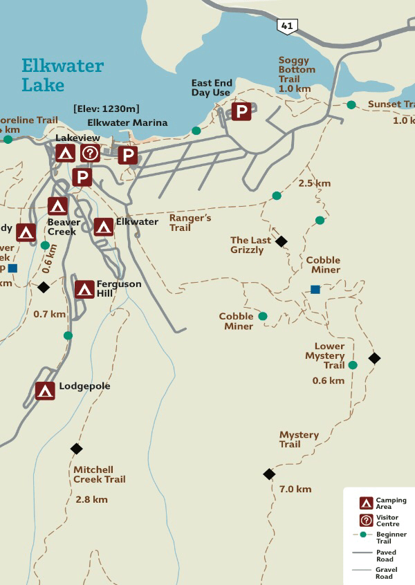


 The weather had been cloudy, damp and misty most of the time so when we woke to more of it on our third day there, we decided to pack up and head directly to Kenora. The morning fog didn’t lift until sometime west of Thunder Bay and heavy grey clouds loomed on the horizon ahead but we were teased with patches of blue sky along the way. We were longing for sunshine again.


 Moosomin must be train central! We heard trains passing all night long…each of them blowing their whistle as they passed through town. When we were woken by the 7am train, we decided to get up and hit the road again. The sun was just getting up and there was a chill of autumn in the air. Coffee at Timmies and we were heading west again with a breakfast stop an hour up the road at a pretty little roadside rest area. Birds and squirrels were busy in the trees and we learned from a plaque that this had once been a major wagon trail during the days of the fur trade and later for the settlers to the area.


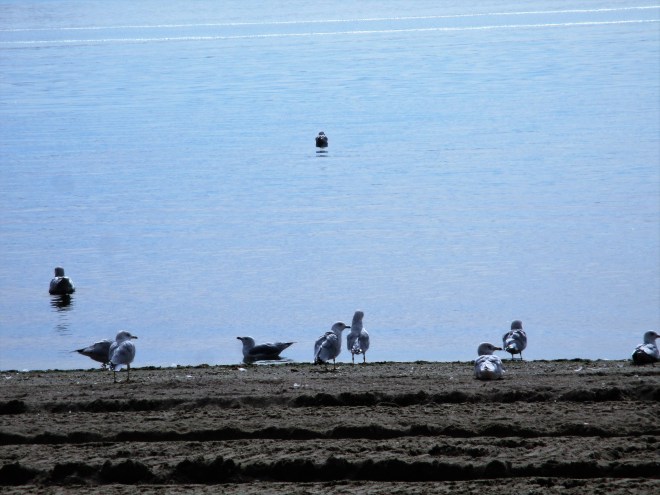


 After nearly four months living in less than 100 square feet, our house seemed humungous! We had two young ladies living in it till the beginning of September and they left it spotless…we almost wondered if they even stayed! The flowerbeds had filled with weeds and overgrown perennials, trees needed to be trimmed and planters required my attention but that could all wait. We wandered from room to room, marvelling at the space!


 Operated by Parks Canada as a national historic site, all the staff are dressed in period costume and demonstrate daily activities in the life of a member of the fortress. We got a glimpse into the past in terms of ship building, lace making, guard duty, etc.


