Miles Meets Newfoundland (Part Two)

There are things we left undone…we didn’t get northeast of St. John’s where shrimping is apparently the main industry, we didn’t get a chance to visit The Rooms, apparently an amazing museum, and we didn’t get “screeched in” but you can’t do everything!  It was hard to leave the St. John’s area of Newfoundland but we have a lot of area to cover in order to be home by the end of September.  So, with Miles perched on our dash, we headed west on the Trans Canada highway, more or less void of potholes.  It felt foreign, but good, to drive at a normal 100kph for long stretches!

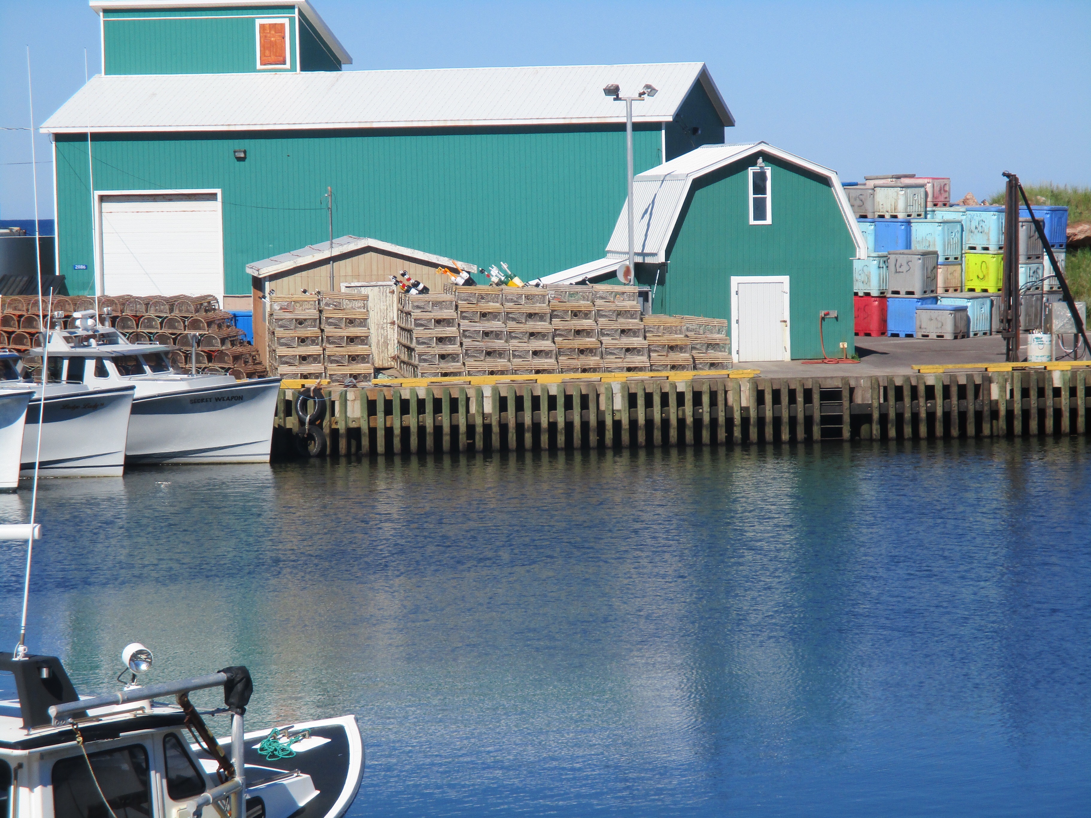
A short diversion of about 5 km took us to Southern Harbour, another little fishing village in Placentia Bay.  Not a store or restaurant to be found…people must all go into the city for everything.  We had hoped to grab a coffee!  Instead, we poked around the harbour a bit…the tide was out.  And when the tide is out, the garbage is in!  Amazing the amount of trash that is left on the shore when the ocean retreats…cups, bottles, etc.  It always makes me wonder why people litter in the first place.


Back on the highway and a stop for lunch in Clarenville which used to have a fishery that employed a major part of the population.  While we were having our picnic, one of the locals was chatting with us.  He has been working in Ft. McMurray since the fishery closed a few years ago.  He says it is too expensive to live in Newfoundland anymore.  We have noticed as well that everything is more expensive here than anywhere else in the country.  Gas is at least 25% higher and kicking our budget to death!

We left the Trans Canada at Clarenville to explore the Bonavista Peninsula. Our overnight spot ended up being the absolutely beautiful town of Trinity.  Although there are only about 500 residents, the town houses many more in the summer.  It has numerous Bed & Breakfasts and is a centre for whale watching and other boat adventure experiences.  It has been used in a TV mini-series called Random Passage as well as a location in a couple of movies…I don’t remember the names of the movies but apparently Kevin Spacey starred in one of them.


The other thing the town is renowned for is its live theatre.  It offers four or five plays throughout the season with showings six days a week.  We went to see “West Moon”.  It was unusual in that all the cast were actually dead!  Once a year, on All Souls Night, they communicate with each other and get news of happenings above from the most recently perished.  It dealt with the problem of resettlement, a very real issue here as the government, many years ago, could not sustain all the tiny villages so it forced people to leave the villages and resettle in larger communities where schools and hospitals could be provided.  This, of course, left all the little graveyards unattended so you can imagine the way the play went!


The next day we headed for Cape Bonavista.  Cape Bonavista is where John Cabot first landed in 1497.  There are more historic sites here than we could possibly see in a day.  We had heard from others that this would be the best place to see whales and they were right.  We saw many!  One we watched for more than half an hour, rolling, jumping, and slapping his tail against the water as he dove.  It was fascinating!  I wish I had a camera with a telephoto lens to capture such a magnificent mammal.  Instead, it is etched in our memories.


From Cape Bonavista we drove a few kilometres more to Elliston, the root cellar capital of the world!  There are hundreds of root cellars here, some still very much in use.  They are an example of the ingenuity of the pioneers from this area…frost free rooms built into the cliffs to preserve the root vegetables that grow so well here so they could be eaten all winter.  An early version of our present day cold rooms.


Although the root cellars were interesting, the real reason for going to Elliston for us was to see the Puffin Colony.  Hundreds…no, thousands…of these cute penguin-like birds nest on the loam and moss covered rocks overlooking the ocean.  We saw a few at Cape Bonavista but for some reason there are so many more here!  We loved it.


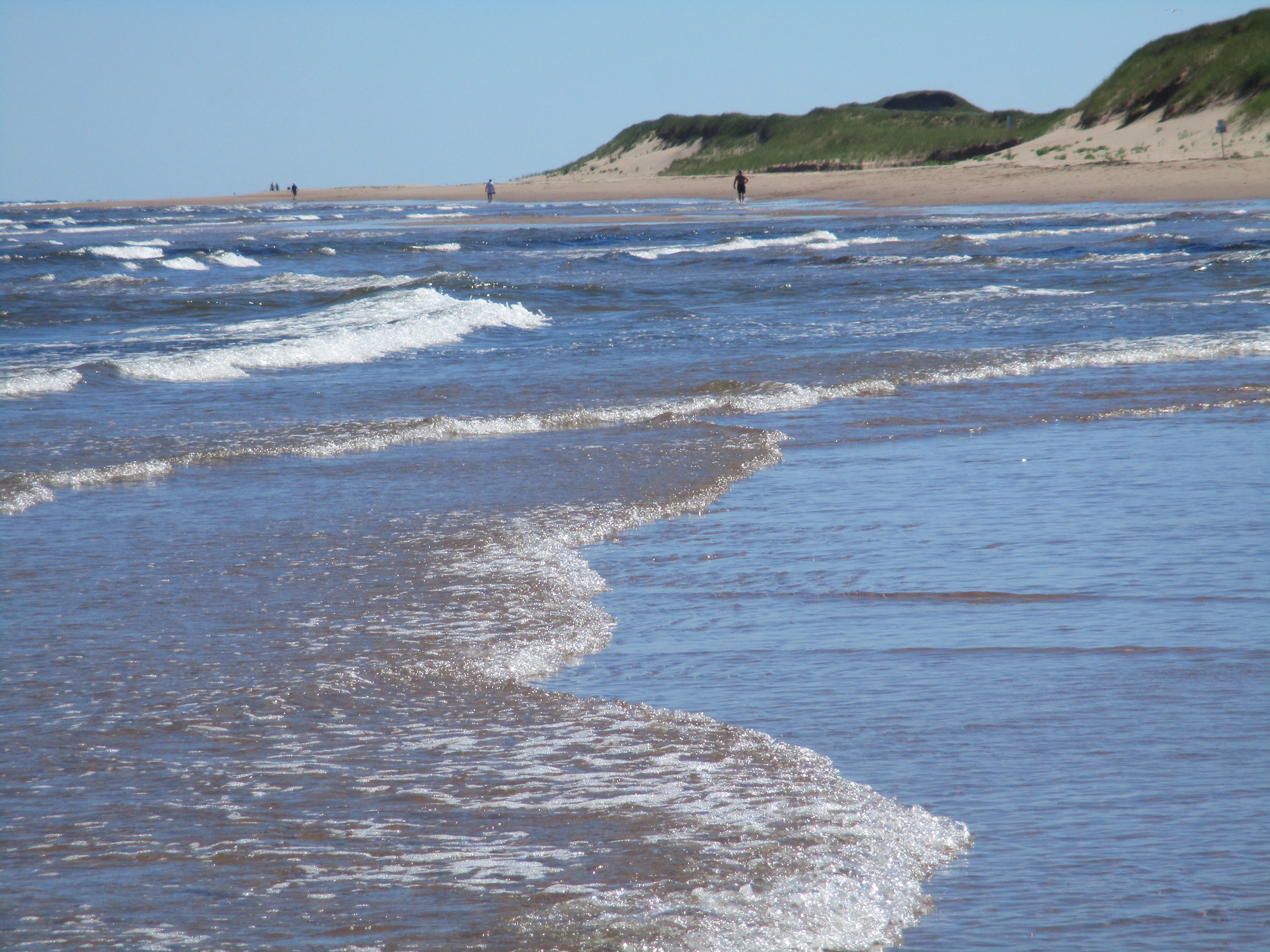
On our way back to the Cape we noticed a somewhat sandy beach area and people swimming.  No way was it hot enough for me to swim in the Atlantic!  Rounding the Cape and heading down the west side of the peninsula, we stopped at Knights Cove to watch the waves crashing against the rocks, something we never seem to tire of.


By evening we were in Gander enjoying a pleasant walk around Rotary Park, watching the sun set before heading off to find something to eat. We were surprised at how small Gander is.  For some reason, we expected a major city…maybe because it has an international airport but it must be on the map because of the airforce base there.  Huge military planes came and went throughout the night.


From Gander, we left the main highway again, taking “The Road to Islands” highway to Gander Bay.  From there we headed northwest along causeways connecting the islands in the water passage called Dildo Run.  The largest of the islands is called New World Island.  We continued on to Twillingate Island.  In the spring and early summer this would be an ideal spot to see icebergs floating by but it is too late in the season for that now.  This part of Newfoundland was pretty remote until the causeways were built in the 60’s so some of the people have pretty thick accents.  Jim was getting the propane filled on the van and he couldn’t understand a word the fellow was saying to him!  He just nodded and smiled!


We were pleasantly surprised to come across a winery in the area.  Auk Island Winery produces about 15 varieties of fruit and berry wines.  Grapes do not grow in the region.  I was able to taste a number of them…some were good, some not so good…but I came away with a couple to serve at our next family dinner.

We headed back towards the Trans Canada, passing lumber mills in the interior and then more fishing villages along the coast.  We drove through Campbellton, quite different from the Campbellton of Jim’s youth in New Brunswick and stopped to sit on a rocky beach with our books for a break.  Lewisporte gave us a history of the Newfoundland Railway which really never should have been built given its poor record and many accidents during the few years it was in operation.


We stopped at Bishop’s Falls to have supper by the dam.  While there, we walked across an old train trestle, the longest in the province at 927 feet, longer than the Titanic, built in 1901 and spanning the Exploit River.   The evening was beautiful and the river was calm.  Then on to Grand Falls-Windsor for the night.


The next morning we were up and on the road relatively early.  Our destination for the next few days:  Gros Morne National Park.  We passed small lake villages surrounded by dense forest and steep mountains.  The day was overcast, our first day here without sunshine and what a pity.  The rounded tops of the Appalatian mountains would have looked even more spectacular against a blue sky.  We checked into a campground at Norris Point and got our awning out just as rain started to sprinkle.  To be honest, it didn’t matter.  We had been on the road for close to five hours and were ready to just veg.  We would have a few days here.


The forecast had looked bleak but we woke to a lightly overcast day with the sun trying to make an appearance on and off throughout the day. We had decided to spend the day in the campground, leaving the van parked.  There was a nice trail…The Moose Path…that circled the small lake which we walked a couple of times but mostly we played games and enjoyed the solitude of the forest.  By evening it was pouring rain and we were forced inside, thankful to be in a van rather than a tent!


It rained heavily throughout the night and into the morning.  We packed up in the dampness, determined to see some of Gros Morne Park, regardless of the weather.  A short drive into Norris Point offered us an opportunity to go on a guided tour of the marine aquarium there.  We were able to view and sometimes hold a huge array of marine animals including the likes of crab, periwinkle snails, moon snails, Connors, starfish, sea urchins, anenomies, blue, red and green lobsters and a wolf fish that, given the chance, could and would bite your finger off!  The animals are kept in huge tanks with water circulating continuously through them from Bonne Bay.  This maintains as natural an environment as possible as they study the different species.  At the end of the season, most of them are returned to the bay along with the tank water.  A few of the more rare species are kept over the winter and maintained by a skeleton crew of marine biologists.


Also in the aquarium were samples of whale bones, including a nearly complete skeleton that was recovered from a beached whale in 2014.  Pieces of baleen, the weird part of a whales mouth that filters the krill from the seawater, is also on display…it feels like a brush of horsehair!


By the time we left the aquarium, bits of blue sky were visible.  We headed out on a 3km hike which followed the shore of the bay along a slate path that was efficiently draining the forest of the water of last night’s rain.  As we neared the corner of the bay, the path took an abrupt turn and headed up the mountain with the help of many wooden steps and natural steps made of tree roots and slate outcropping through dense spruce and birch.  Occasionally we would get a glimpse of the bay and the mountains across. By hiking path standards, this trail would likely be rated as moderate.  As we huffed and puffed our way up and down the 302 wooden steps…yes, Jim counted every last one…our poor old out of shape bodies were challenged!  Note to self: get back in shape when we get home!  We were rewarded with a nearly clear blue sky as we descended the last of the steps down to shore level again.  Yay!


Off we went, through Rocky Harbour, and north along the Viking trail.  If we were to follow this road for another 550 km or so, we would arrive at L’Anse aux Meadows where the first Viking settlement was established in North America in the year 1000 A.D.  And we would most assuredly see moose and caribou…But we don’t have time for that trek.

A stop at Lobster Cove gave us a panoramic view of the Gulf of St. Lawrence where it enters Bonne Bay.  The beacon on the lighthouse there can be seen from 22 km away.  A tour of the lighthouse reminded us of the isolated life of the light keeper and his family in the early 1900’s.  Keeping the light burning (using oil) was a daily job, not to mention the daily chores of tending to a small mixed farm to feed a family of seven year round.  Music was and is a big part of Newfoundland culture but a lighthouse keeper could not leave for an evening of socializing.  Luckily, neighbors a few miles away would sometimes come to them and the lighthouse home would turn into a kitchen party.


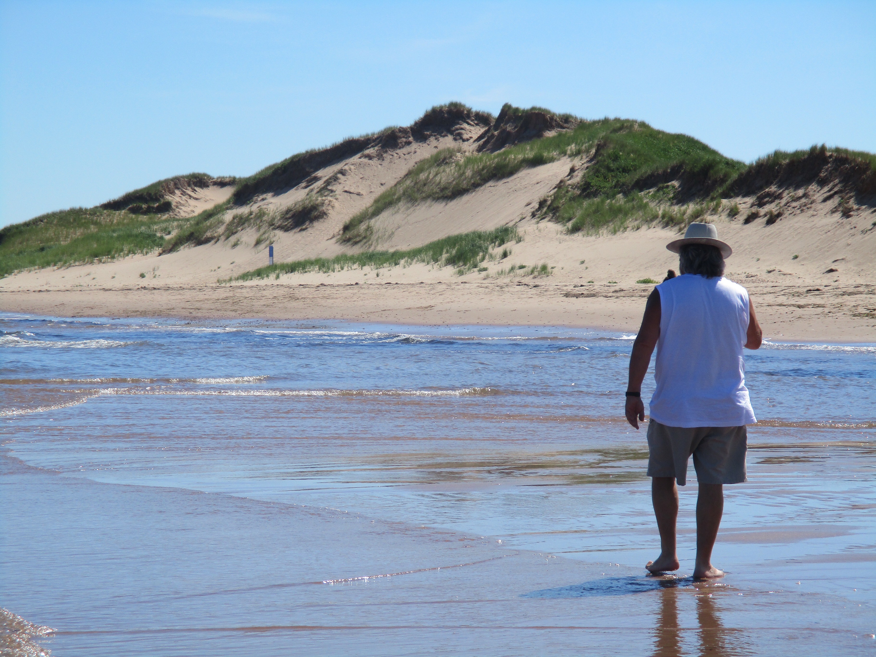
Our drive ended at Shallow Bay, just north of Cow Head. Here we found a true sandy beach stretching 5 km along the coast of the Gulf.  This is the first time we have seen fine white sand here…most of the beaches are cobblestone or gravel size rocks, sometimes a bit smaller but never what we would call sand.  We wandered up and down the beach searching among the seaweed for unique shells to add to our collection.  Mussels and periwinkles seemed to be all we could find, along with bits of crab that we left lie.  The sky had cleared completely and the hot sun felt good on our faces as we watched the shadows grow longer.


Back at the campsite, with a full moon shimmering on the water, we tried to locate the various constellations in the sky, watched for satellites orbiting above us, and were warmed by the blazing campfire…a perfect end to another day.


Our last full day in Gros Morne was terrific.  We were booked onto a cruise of Western Brook  Pond.  Around here, a lake is called a pond.  It was a 3km hike over the bogs on a gravel and boardwalk path from the parking lot to the lake.  That in itself was wonderful as we could see the mountains looming closer as we inspected all the wild flowers along the way and checked out the weird formations in the trees that have been stripped and killed by the winter winds.


This would be ideal moose country but in the nearly two weeks we’ve been in Newfoundland, we’re beginning to think the whole moose thing is a lure to get tourists here…we’ve not even seen one!  We always “just missed a big bull half an hour ago”, or “two cows just went through the campground ten minutes before you got here.” Sure! Right!  Anyway, we are always on the lookout.


While we were standing in line to board the boat, chatting with people around us, I jokingly mentioned my moose theory to them.  Of course, every one of them, even the couple that had just arrived yesterday, had seen at least one…some had seen several.  Lamenting our lack of good fortune as our time on the Rock was coming to an end, the lady next to me pointed across the lake.  “Look at that…there’s a bull moose right there!” Finally!  And what a magnificent creature!


The boat tour took us deep into the mountains.  Steep cliffs and granite rock faces were right beside us.  Many years ago, this lake was an inlet of the Gulf of St. Lawrence so it would have been filled with salt water, a true fjord.  Whales and other sea creatures would have lived in here, as evidenced by fossil remains that have been found.  Then, after at least six glaciers carved their way through, the earth shifted, the bog we walked through rose, the inlet became landlocked. The water, over many years, lost its salinity as glaciers melted.  Today it is one of the purest water sources in the world, so pure that very little plant life can grow in it, making it very clear and deep.  There are some fish, and moose and caribou roam the mountains around it.  Because it is landlocked with no roads to it, activity on the lake is limited to these tours and the odd canoe that a hunter may portage in.


The mountains are old…much older than our Rockies.  They are like old men, backs hunched, years of hard work and struggle weighing heavily on their shoulders. They are rounded on top, having lost their peaks over millions of years of erosion. Crevices formed by shifting and heaving have created an amazing picture for us to enjoy.  Waterfalls happen only if there has been rain and since we have had some recently, we were treated to a few of them.  Our favorite was the one called Pissing Mare…or is it Mayor?  Such unique names around here!

Because the pond is not fed by any streams or glaciers, it takes much longer than average to fully replenish its water supply.  Where an average lake of this size would take 6-7 years, this one takes 15 plus, depending on the rain and snowfall in the area.


By the time we had finished the cruise and hiked back to the parking lot, it was getting late in the afternoon. We still needed to drive 100 km to the south part of Gros Morne Park.  The park is separated by the Bonne Bay and Bonne Lake.  Our destination would be about 15 minutes by ferry from Norris Point where we were camped for the last three nights to Woody Point area where we had planned for our last night in the Park.  But since the road was built, ferry service no longer exists except for walking passengers.  So, up and down and around we went through the steep mountains to camp near the base of the Tablelands.


The Tablelands are quite fascinating.  A UNESCO World Heritage site, they are one of the few areas in the world where the earth’s mantle has been heaved up and sits in a mountainous pile above the ground.  As we walked over the yellowish rocks, void of any vegetation, it felt like we were walking on the surface of the moon!  In the lower areas, surrounding the mountain, vegetation is starting to get established between the rocks.  Moss and low lying alpine type plants are filling in the spaces but the Tablelands themselves are barren.


That evening, in a campground that was no more than a parking spot overlooking the bay along the side of the road,  Jim got talking to a couple of men and a young boy fishing off the wharf.  They were pulling mackerel out of the lake three and four at a time.  They ended up giving four of them to Jim!  When the sun went down, we were invited in to visit our next door neighbors, Marcy and Tex, in their big Pace Arrow bus…it seemed as big as our house after being in our little van for three months!  They were from Corner Brook, not far away and they were out on their first road trip “just getting their feet wet” as they said.  No wet feet in that fancy unit!


The next morning we were on the road early, stopping for breakfast just out of the National Park and then back on the Trans Canada heading south.  As suggested by our neighbors, we stopped at the lookout on the mountain for a view of scenic Corner Brook, it’s north arm and its south arm reaching out into the Bay of Islands.


Then on to Stephenville Crossing on St.George’s Bay to visit Bernice and Kevin, the couple we had met on our first night in Newfoundland.  They had insisted we stay with them on our last night here as they were only a two hour drive from the ferry at Port aux Basques.


They treated us to an authentic “jig’s dinner”: roast beef, salt beef, potatoes, carrots, turnips, cabbage and gravy. Then we all piled into their car to explore the area.

Stephenville Crossing is suffering from population depletion like so many other small towns across Canada. During World War II, the Americans had occupied several acres of land there for an Airforce base.  It was the perfect spot to refuel its military planes on their way to Europe.  25,000 soldiers were living in the barracks there and a large number of civilians were employed at the base.  Many people, including Bernice’s parents, moved their young families there from elsewhere in Newfoundland for work as carpenters, mechanics, etc. After the war, the Americans moved out, selling all the hangars and barracks to the Government of Newfoundland in 1966.  The buildings were eventually sold off privately, and reused.  The barracks were renovated into apartments and condos, still in use today.


Kevin drove us west along the coast to see the huge limestone quarry.  This is an international operation that supplies limestone, dolomite and rock aggragates  to many places in North America, Africa, and other points in the world.  We watched the huge trucks and cranes as they dug and dumped the rock from the pits right to the ships via large conveyor belts that went underneath the road.


We stopped on Father Joy’s Road to see a massive wooden Roman Catholic Church, the largest wooden structure in Newfoundland, built in 1914. Apparently the inside has been conserved beautifully but it was closed by the time we got there.  It is still used for special events like concerts and weddings but no longer used as an actual church.


We also stopped at an Alpaca Farm to feed the alpacas and get our daily dose of ice cream.


Back to the house for an evening of chatter around the kitchen table and then a night of sleep in a real bed.   We were up very early the next morning to make the two hour drive to the ferry for our 9:30 check-in.  One more moose sighting was our hope but it didn’t happen.  It’s really hard to believe that the island is suffering from overpopulation of this massive animal.  Apparently, it is not at all indigenous to the island.  The first two were brought to Newfoundland a number of years ago.  They flourished well, so four more were brought from New Brunswick.  With no natural predators, the population grew steadily until, when they reached 10 per square kilometre, the government knew they had a problem to deal with. Now, they open hunting season for the moose every year to get the population down, even allowing hunting in the National Parks. Presently there are approximately 3 per square kilometre, the goal being two.  Studies, using vegetation enclosures to keep the moose out, have recorded an annual 10 percent loss in forest growth due to overpopulation over the years.  Sustainability is now in sight.


Through strong winds, drizzly fog and rainbows in the mist, we approached Port aux Basques ferry terminal, sad to be leaving this wonderful island but excited to know we still have the whole of Nova Scotia and Cape Breton to explore.

Miles Meets Newfoundland via Nova Scotia (Part One)

The decision to visit Newfoundland before properly exploring Nova Scotia and Cape Breton was purely due to timing.  Knowing we would want to spend about two weeks on the Rock, we felt that we should get there earlier in August rather than later.  The days would be getting shorter and the nights cooler.

Coming back over the Confederation bridge from Prince Edward Island, Miles lead us back into New Brunswick for a short time, following the shore of the Northumberland Strait past the wine region and into Nova Scotia at Tidnish.  We continued east on the North Shore road past small lush farms and fishing villages…working people’s homes rather than summer resort towns.  Little houses painted in bright colours were spaced along the water’s edge making it easy for the fisherman to identify them from the water.  Piles of firewood and lobster traps or small herds of dairy cattle gave us some indication of where their income came from.

We passed the town of Pugwash and then Tatamagouche!  Nearby was Camp Tim Horton.  Tatamagouche had a local craft brewery that Jim stopped to check out.  At $27 for a six-pack he decided to leave it on the shelf.  At the small town of Seafoam, we stopped to see a Lavendar farm.  I was amazed at all the different varieties of Lavendar, as well as all the uses for it.  This farm had recently been featured on a couple of Culinary TV shows as well as the “Live with Kelly” show so they were having trouble keeping their shelves stocked with products like tea, sea salt, chocolate, oils, etc.


At New Glasgow we decided to get on the main highway since it was getting late and we had made plans to meet up with our friends, Des and Vicki, whom we hadn’t seen since Sault Ste. Marie.. .remember way back when?  They were now heading west again and would be in Antigonish to visit family of our mutual friend, Jean, from Claresholm.  The four of us had been offered a space for our motor homes and a home cooked BBQ dinner that evening…certainly not something we would want to deny ourselves!  We ended up having to detour off the main highway and back onto the Shore road when we were just 25 km from their home!  This added more than an hour to our trip, making it one of our longest driving days since leaving home in May.  This route, of course, was much more scenic.  The homes here were larger and so well kept with a beautiful ocean backdrop. By the time we got to the home of Jean’s family just east of Antigonish, we were glad to be out of our van!


Two nights we stayed with Bernie & Jane, Chris & Tom.  And what fun we had!  They fed us an amazing BBQ that first night and we all sat up visiting around the pool and in the house till past midnight.


They toured us around the area, showing us the house they and Jean had grown up in, the homes of other family members in the area, their one hole golf course and the Pipers Pub in town. Vicki and I each managed to get our hair cut as well.  Then time to say farewell with the promise to stop for a visit on our way back.


When we left on Saturday morning, we had planned to take the shore road again but the wind was blowing so hard we decided the inland road would be better.  Just east of Antigonish we crossed the Canso Causeway into Cape Breton, the St. George’s Bay on our left and the Chedabucto Bay on our right. Road signs became bilingual…not English and French but English and Gaelic!

We passed the very pretty summer town of Baddeck and made a mental note to stop there on our way back.  From there, we drove straight through to Sydney where we were spending the night with Jim’s cousin, Glennis and her husband,  Garth. The last time Jim had seen her was 1959 so there was some catching up to do!  The four of us got along superbly and we look forward to a few more days with them when we return from Newfoundland.


We had the 5:30 ferry booked for Sunday from North Sydney to Argentia, NFLD.  That meant we had a bit of time to see the Sydney Harbour and some of the downtown area before lining up for the ferry.  Sydney used to be a steel town but that industry died out quite some time ago.  Unemployment is high and the city relies much on the tourist industry now.


We boarded the ferry and set sail on time.  This would be a 16 hour trip.  I prepared myself for the crossing by using the “motion sickness patch”. And thank goodness!  With a storm brewing out in the Atlantic and a show of lightening, the Atlantic Vision was pitching and rolling quite noticeably.  After listening to the band in the lounge and having some dinner on board, we settled into some recliners with pillows, blankets and things to keep us busy. We had opted to save $200 and not take a private cabin. We soon found out that the chairs do not recline very far and a good nights sleep would not happen in them.  Off we went for a walk around the ship and found we were allowed to stretch out to sleep on the benches in the lounge after the band had finished playing.  So we hauled our pillows and blankets out of the recliners and into the lounge.  We both ended up having pretty decent sleeps and feeling glad we had not stayed in the recliners all night!


By 10am we were docking in Argentia and it wasn’t long before we were driving on Newfoundland roads!  We went about 3km to the Visitor Information Center, pulled into the parking lot, closed our curtains and slept soundly in our bed for two hours…and we weren’t the only ones to do that!  Now we were ready to explore the Rock!

Most people head straight to St. John’s when they arrive.  We, however, decided to head south to Cape St. Mary’s, following a rugged coastline and climbing steep mountains.  We were surprised at how mountainous the province is, even along the coasts.  They were covered with stunted evergreens and shrubs…gooseberry, cranberry and other hardy ground cover.  Daisies and thistles lined the highways and purple rocket encircled the shrubbery.  The road to the cape was horrific beneath our tires!  We bumped along over deep potholes, sometimes only able to travel at 30kph.  There were times I felt I should be wearing a crash helmet!


But the drive was so worth it!  When we got to the cape, we hiked a couple of kilometres out to the Ecological Reserve where thousands of seabirds nest on the cliffs.  The walk took us through fields of daisies, asters, wild iris, thistles and clover.


The steep cliffs as they met the blue ocean were magnificent with the waves crashing against them.  In the distance we were fortunate to see three whales playing in the water.  What a great first impression of Newfoundland!


By evening, we were checked into a campground, our van facing a meadow backed by forest.  Now all we needed was a moose but it was not to happen.  But we did experience the friendliness of the locals…Kevin and Bernice from the other side of the province introduced themselves and offered some advise on places to see. We also met a woman from Ontario who, when she found out we were from Alberta, told us her sister lives in Granum!  What a small world!

The next day, we followed the “Irish Loop” around the Avalon Peninsula.  In contrast to the sandy beaches of PEI, the beaches here are rocky.  At the south end of the peninsula is St. Vincent’s.  In the spring, the humpback whales make their way past here all the way from the Carribean.  We didn’t see any but it must be quite a sight when they are migrating north.


All along the peninsula, the little villages look similar…small houses built into the mountainsides facing the water, a church somewhere amongst them and all types of fishing paraphernalia nearby.  The houses all seem to be staggered so nobody blocks another persons view.  Each village has a little harbour with fishing boats moored there.  We didn’t see many people.  With the lobster and crab season over, many of them are likely off to Alberta to work in the oilfields.  Nearly everyone we meet seems to know someone working in Alberta or used to live there for a few years!


Our first glimpse of the Atlantic Ocean, as opposed to the Gulf of St. Lawrence, was at Cappahaden as we rounded the south end of the peninsula. Wow!  It felt so strange to know we had actually arrived on the east coast of our country.


We stopped at Bear Cove where many shipwrecks have occurred over the years,miscalculating their position on the coast and wrongly thinking they had passed Cape Race, especially on foggy days.


After speaking to a local at a pub in Fermeuse (and not understanding a word he was saying!) we headed for Ferryland where an archeological dig is in progress.  The Colony of Avalon is currently being pieced together with evidence of inhabitants dating back to the 1500’s and proof of actual settlement dating back to 1621.  We were able to see the dig site and a 17th century kitchen has been recreated complete with a fair maiden that bakes yummy cookies in a cast iron oven over a fire!


Our campground that night overlooked a marshy lake with a beautiful sunset and sunrise.  The provincial campgrounds here are so cheap…$11 for unserviced, $18 if we had services.  It’s hard to get serviced spots unless you book ahead but we don’t need them.  The only drawback is that the water needs to be boiled before using it.


We were up early and on the road north towards St. John’s.  We stopped to have breakfast at a little place overlooking Witless Bay.  From here we could have taken whale watching and puffin colony tours on zodiacs but given my experience deep sea fishing, we didn’t even entertain the option!

Travelling north, we noticed that the roads were in much better condition and homes started looking much more modern, were larger in size, and lacked the obvious connection to the fishing industry. We drove through the city to Cape Spear, the most easterly point in North America. Canada begins or ends here, depending which way you are traveling.


We toured the original lighthouse, the first of many to be built around the shores of the Colony, built there in 1836. It was a low, two story house for the lighthouse keeper and his family of twelve children built around a stone tower….very interesting.  It was operated continuously by one family until a new lighthouse was built in 1957.


Also at Cape Spear is a military battery built during the First World War to protect against invasion.  It never saw any action but must have been cold and damp for the soldiers that manned it.


Before leaving we were lucky again to see a whale.  It was fairly close to shore and we usually heard him before we saw him…the hiss of his spray alerted us to his position in the ocean.  I was unable to get a photo but he was fascinating to watch.

From that point, our journey would be generally a westward one.  As evening approached, we headed into one of the oldest cities in Canada.  St. John’s is a true harbour city, with massive freighters in the harbour either loading or unloading supplies for offshore drilling rigs.


The city has had a couple of fires over the years that have had a devastating effect on the buildings but each time they have rebuilt.  Apparently, any new construction in the downtown area now has to conform to the existing architecture.  We saw a condo being renovated and the new floors being added were being built  to match the existing building.


We wandered along Water Street and then onto George Street.  George Street is where it all happens…traffic is not allowed on the street after 6pm and the street is lined with restaurants and pubs, each one offering live music and great food.  The menu looked foreign to us with things like Jig’s Dinner, scruntions, toutons, seal fin pie, cod tongue and blueberry spotted dick!


Jim’s cousin’s son, Tim, met us for a drink.  He, his wife and daughter are the  token McDavid family in Newfoundland, having moved here  from New Brunswick when he was 19.  It was fun to meet and get to know him.


The next day, we explored the Baccalieu Trail, stopping first at Dildo….really, where do these names come from?  We toured the museum there and discovered that the name may have French or Spanish origin but nobody really knows for sure!  Anyway, it was the location of the first cod hatcheries in the 1800’s, it was a busy whaling centre until whaling was ordered to be stopped in 1972, it was the location of a crash landing in the bay by the largest plane ever before the Spruce Goose, and the spot that a giant squid, measuring approximately 23 feet, was washed up on shore in the  mid 1900’s.  Who needs a name like that to give a town a place on a map?


Our journey north along the shores of Trinity Bay took us through towns named Heart’s Delight, Heart’s Desire, and Heart’s Content. Heart’s Content is where, in 1866, the first transatlantic telegraph cable arrived on the Eastern Star.  It had made a formidable journey, being dragged along the uneven ocean floor until it was pulled ashore and hooked in to the cable house, connecting North America with Europe.  This allowed instant communication with Europe, making the world a smaller place overnight.  The cable company was a huge employer in the area, bringing many of its staff from England and thereby creating a wealthy lifestyle previously unknown to the shores of Newfoundland.


Continuing to Old Perlican at the north end of the peninsula, we were in the heart of the fishing industry.  Quinlan and Quin Sea fisheries are major employers.  As we walked along the windy shoreline, flags flapping, gulls soaring, we spotted discarded hair nets, empty water bottles and pop cans along with broken shells brought to shore with the tide.  Men on forklifts were busy loading fish from boats to trucks and the salty smell of fish and sea was in the air.


We returned south via the easterly road of the peninsula, eventually coming to Carbonear where we pulled into Walmart for the night.  Lo and behold, right next to us was Kevin and Bernice, the nice couple we had met on our first night!  We visited in their motor home till 11pm then crawled into bed just as thunder and lightening rolled in and dumped rain on us.

Carbonear is the hub of the area.  The railroad station, no longer used, serves as a museum explaining the importance of the fishing industry to the area.  John Roarke, who was one of the original wealthy merchants from England, had a huge influence on the success of the industry in the area.  It was a true balancing act.  Without him, the fishermen would have had no market for the barrels and barrels of salt cod they pulled in every year, and without them, Roarke would not have had the control of the efficient fish industry with England.  His original warehouse still stands and his stone residence has since been converted to a restaurant.  It originally served as a store on the main level, his family living quarters on the second floor and the maids quarters on the upper floor.


Carbonear’s old post office with its clock tower showcased a bit more information and artifacts from days gone by.  The structure built in the early 1900’s is quite beautiful.


Continuing south, we stopped at Harbour Grace, known for its aviation involvement.  Many  people have registered their flights from the airport here, most notably Amelia Earhart when she embarked on her solo flight across the Atlantic.   The SS Kyle, which used to serve as a ferry from Newfoundland to Labrador, is anchored in the harbour there.


In Brigus, we had hoped to take part in their annual Blueberry Festival but unfortunately nothing would be taking place till the next day.  Campgrounds and hotels were all fully booked for the event.  We did stop to tour the Hawthorne Cottage, however.  This is the residence of captain Robert Bartlett who was the famous skipper for Peary’s expedition to the North Pole in 1908. In all, he made 23 voyages to the North Pole in his career.   Built in 1830, it was lived in continuously by his family until the 1960’s when it was donated long with much of the contents to Parks Canada as a national historic site.


Our last day in St. John’s was packed.  We started out with a visit to Quidi Vidi village, the iconic fishing village in the city.  There, we could see fishermen cleaning their catch of the day, as well as visit the local brewery that makes Iceberg beer.  Apparently, there is a company that goes out in the ocean to gather “Bergie bits” which are then melted down right on the boat, tested for purity…no more than 8 parts per ml impurities (drinking water is 50-60) and then delivered to this and only one other brewery.  It produces a crisp, clear beer and is served in most of the pubs around here.


Then off to Signal Hill.  There is so much significance to this area.  First of all, it served as a guard against attack from any ship approaching the St. John’s harbour with a canon aimed ready for firing and a fortress on the rock.  Ships had to come in through the narrows to get into the harbour so the harbour was well protected.


Also at Signal hill stands the Cabot Tower, built in 1897 to mark the 400th anniversary of John Cabots Landing in Newfoundland in 1497. At one time, two other buildings occupied the site as barracks which were later used as a prison and then a quarantine hospital until it was destroyed by fire in 1920.


Most significant, however, about Signal Hill is the fact that it was here that Marconi received the first transatlantic wireless signal on December 12, 1901.  Communication would be changed forever!

The view of the city from the hill is magnificent.  St. John’s has literally burned down twice over its many years.  Today it is a colourful array of houses built on the side of the mountains with a safe, busy harbour.  I couldn’t get enough of the unique houses!


Our trip through the city also took us past some beautiful estate homes facing the park and the river.  In areas like this, it is difficult to believe that times are depressed.


Having seen the spot that Terry Fox ended his Marathon of Hope near Thunder Bay, Ontario, it was good to see where he dipped his artificial leg in the Atlantic and started his journey on April 12, 1980.  He has been inspiring so many for years now.


Another walk downtown before heading to our campsite at Pippy Park Campground.  We stopped at Jungle Jim’s for the infamous “sticky toffee pudding” which was sinfully delicious!


There is so much to do and see but with wild roses blooming all over the countryside, reminding us of home, it is time to head west.


There is still much to experience as we travel the 900 km across this province to board the ferry at Port-aux-Basques.

Miles Meets Prince Edward Island

When Miles steered us over the 13 km Confederation Bridge from New Brunswick  into Prince Edward Island, it was like stepping into a charming miniature world encircled by red sand!  The map, which took up the same amount of page as any other provincial road map (except Ontario!) was difficult to get accustomed to at first because every inch was only 8km!  When we expected to be driving on one road for a bit of time, we were suddenly at the intersection that we needed to turn at!  And every turn produced amazing scenery.


img_0506
Confederation Bridge


Because of the shape of the island, it is easiest to explore it in three sections…The west cape, the centre, and the east cape.  Tip to tip, the island is probably about a three hour drive but we spent a lot more time than that exploring!


All the straight roads provide views of small, tidy farms.  The island is fairly self sufficient so you see all types of crops from potatoes to soya to wheat to corn and everything else in between. Dairy farms, cattle operations, sheep, goats, horses…everything is here…just in smaller scale than we see on the prairies.

img_0514

All the curved roads provide views of water.  The north side of the island is on the Gulf of St.Lawrence and the south side is on the Northumberland Strait.  These two major bodies of water meet at North Cape, the most northwestern tip of the province, and at East Point, the most northeastern tip of the province.  And all along the shores communities have been settled by fishermen around the various bays and coves.


Tourism is a very major industry here and for good reason.  The numerous beaches, each unique and yet each the same, provide all kinds of recreational activities.

We started out by exploring the west part of the island, loosely following the North Cape Coastal Drive as suggested by the tourist map.  We had arrived on the island late in the day so we immediately checked into a campground close to the bridge we came over on.  Situated in Sandy Cove on Bedeque Bay on the south shore of PEI, we were more than happy to accept an unserviced lot that overlooked the bay.  We watched the sun set over the water and woke the next morning to songbirds in the thicket next to us.  Large flocks of swallows swooped as though synchronized to the beach to feed off the insects along the waters edge, cormorants skimmed the water’s surface in search of breakfast and we cooked sausage and eggs with the hot summer sun on our backs!

IMG_0521.JPG


sunset over the bay

Driving along the west coast which, like the east coast of New Brunswick, was settled in the 1700’s by the Acadians, we came across an old church and graveyard.  The graveyard is the resting place for all the descendants of the first settlers to the area…the Gallants and the Arsenaults.


Many of the original settlers of the island


We stopped at Cap Egmont to have a look at a house made of all kinds of bottles.  What started out as a retirement hobby for the late Edouard Arsenault turned into a labor of love as he cemented over 25000 bottles together to create three structures as well as planting trees and gardens that rival Butchart Gardens in BC.


We arrived at North Cape as the tide was coming in.  Apparently, at low tide, you can walk a kilometre out on the longest natural rock reef in North America.  The lighthouse there, one of about 40 on the island, was built in 1865 and is still operational.  While we were there,  a big black Hummer Limo pulled in with a wedding party to take photos…what a beautiful spot for that!

hundreds of inuksuks all over the cape 


Also at the cape is the Wind Energy Institute of Canada and a number of wind turbines producing electricity for the island.


We passed the little fishing port of Seacow Pond where we saw lobster traps piled high.  The lobster catch is done for now but many of the restaurants have lobster pounds so they can serve fresh lobster year round.


love the little fishing villages


Our next campground, although not as lovely in terms of our particular space, offered a beautiful red sand beach on the Gulf of St. Lawrence.  Being a long weekend, we took what we could find!


From there, we headed to the centre portion of PEI.  En route, at Bideford on Malpeque Bay, we passed the beautiful historic residence of Lucy Maude Montgomery, the author of one of my favorite childhood book series, Anne of Green Gables.


Near there, we visited a ship building museum that highlighted the glory days of the ship building industry which had a major economic influence on the island in the early 1800’s.  By 1860, more than 400 marine merchants were located on the island.  With the advent of trains, and then trucks, ship building saw a steep decline for that industry.


mementos of ship building glory days


We also toured the restored Victorian  home of James Yeo, Jr., presumed to be one of the wealthiest and most influential ship builders in the colony.  The house is magnificent, complete with maid and manservant quarters.


Kensington was our first stop in the centre of PEI.  It was just a small village called Five Lanes End until the railroad announced it was planning to connect the Colony. Small businesses  in outlying areas moved inland in anticipation of greater transportation opportunities if this became a major stop on the line.  Due to the geography of the island with its odd shape and soft red sandstone, it was expensive to build a railroad.  Rock had to be hauled from New Brunswick to lay the tracks and every mile of track had at least two curves, bringing  the Colony to near bankruptcy by 1863.  When the Fathers of Confederation met in 1867 in Charlottetown, the Colonists, who were not too enthused about joining the Dominion of Canada, changed their minds when the Government promised to finish the PEI Railway, becoming Canada’s 6th provincein 1873 and the railway was finished and operational in 1875. Today, the railway no longer exists in the province, shutting down completely when the Confederation Bridge was built in 1993.


Arriving at the centre of PEI, we were surrounded by lush farms.  Cavendish Farms is a huge industry in the area.  So is tourism.  Large Fun Parks, water slides, mini golf, executive golf courses and plenty of traffic.  The north shore is operated by Parks Canada but we were unable to get a campsite there with it being a long weekend.

We settled for one inland and asked the locals where to get a good lobster dinner.  We were advised that the New Glasgow Suppers were worth every penny so off we headed to New Glasgow.  It was easy to spot the restaurant…the long lineup of people waiting to get in gave it away!  This place began operating in 1958 as a fundraiser offering a full lobster supper.  By 1963 they were doing weekly fundraisers and by 1968 they were offering daily suppers from 4-8pm.  The place was bought, expanded, houses a lobster pound holding 20,000 lobster and has lineups every day!  The supper, which sold for $34.95, included unlimited fresh rolls, seafood chowder, mussels, salads, dessert and non-alcoholic beverages along with a one pound lobster, served with a bib!  Amazing value for your dollar and soooo delicious!  We were sure we would not have to eat again for a week!


only a small part of the huge line-up we waited in
we finished off a full bucket of mussels before feasting on lobster!


We left the center and headed for the east cape stopping to see the Hillsborough River, the longest in the province, traversing 45 km until it reaches the bay in Charlottetown . With its combination of salt water bay and freshwater marshes, it is a World Heritage Site.


The white sand dunes and red sand beach of Crowbush Cove beckoned us!  We walked the beach in the sunshine for close to 3 km and back, hunting for shells as the tide was going out.  Imagine having a summer cottage along here…as many do!


amazing sandy beaches


we walked for miles


the red, red sand


After stopping for a cold one at St. Peter’s, a tiny little fishing village, we headed cross country to Souris.  This is where you would board the ferry for the little Quebec island of Iles de la Madeleine, 134 km away.

We picked up a few supplies and started making our way along the coast again, this time heading for East Point.  We stopped at Basin Head Beach, a very popular sandy beach lined with sharp red cliffs.  Piers have been built so people can jump into the deep channel where the river meets the bay.


another amazing beach

the river meets the sea

A quick stop at East Point to see the meeting of the waters again and another lighthouse.  The cliffs are steep here and there is no rock reef to walk on but they sell ice cream!

East Point


We checked in to another beachfront campground after a busy day!  Campbell’s Cove treated us to another amazing sunset and an equally amazing sun rise!


more amazing sunsets

and then the sun rise
exhilerating


We were up early in the morning to be at North Lake Harbour by 8:30 to go deep see fishing.  By 9 am the fishing charter and a crew of 22 left the harbour.  We bounced along the waves about 20 km northeast.  The wind was strong and the gulf was pretty rough, soaking us with it’s salty spray.  Along the way we saw a colony of seals swimming and playing.  We watched for porpoise and whales but saw neither.  By the time we were in the area to fish, I wasn’t seeing anything but the bottom of a bucket which I hugged tightly in front of my face for the remaining hour or so!  Jim, however, was feeling fine.  He and most of the others on board eagerly cast their lines into the water, each hoping to bring home supper for the night.  It would not be uncommon to catch some nice size fish in this area. It wasn’t long and he was pulling his line in.  By the time we were ready to head back to shore, he was fortunate to catch three fish, all too small to keep but he was pretty happy with his catch!  I would have got a picture of the fish but I couldn’t hang on to the camera and the bucket at the same time…the bucket won!  I now know for sure I am a landlubber and will not try anything like that again!


off to catch some fish!
Jim managed to pull three in…I just didn’t handle the camera well!

Thanks to my queezy stomach, I was done for the day!  We had planned to follow the coast to our campground at Seal Cove near Murrays Harbor on the east coast but I was in no position to deal with the curvy roads…so straight to the campground we went to relax the rest of the day.  A nice cool breeze blowing off the lake was just what the doctor ordered! In the evening we found out why it is aptly named Seal Cove….there in the middle of a platform in the cove was Mr. Seal enjoying the late day sun.  Jim was more than happy to share the binoculars with the children in the campground.
On to the historical city of Charlottetown, the birthplace of Confederation.  The city is steeped in history and has a wonderful small town feel about it.


The busy waterfront offers all kinds of water activities…harbour tours, deep sea fishing (no thanks!), seal watching tours, cruises, canoe and kayak rentals…as well as the marina to moor your yacht and places to eat, drink and shop.  Free musical entertainment is offered throughout the summer and city tours originate there.  It is a bustling area for sure!


The Charlottetown harbor


Not far from the port and harbour is the historic business district, flanked by old churches with intricate spires reaching to the bluest of blue skies.


downtown area
Look up…look waaaaay up!


church spires reach to the heavens


I loved this group of old buildings painted in lovely colours, each one of them named.  The buildings were all built between 1812 and 1853, two of them served as hotels in the 1800’s and now the cluster of 15 buildings serve as The Great Geoge Hotel, an upscale boutique hotel in the center of the city.  Definitely a lot more posh than our van!


1864 was the turning point for the Maritimes and Canada as we know it now.  In that year, a group of delegates from Nova Scotia, New Brunswick and Prince Edward Island were meeting in Charlottetown to discuss the possibility of a union of the three colonies.  Unexpectedly, politicians  from the Province of Canada arrived with the hopes of persuading these colonies to join them in forming one nation.  Funnily enough, when they arrived in port they couldn’t find any hotel rooms because the circus was also in town and there was no vacancy in any of the hotels!  They were forced to spend the night once again in their ship’s quarters!


That was the beginning of the confederation talks and in 1867 it was finalized.  Had these men not met, we may not being doing this trip today!  That also explains the reason for all the people wandering around the National Historic Site in period costumes, playing croquet, offering tours, etc.  We had hoped to tour the Province House but it was closed for conservation purposes.


Province House


Our last stop in PEI was the National Historic site, Green Gables.  This is the magical setting for the Lucy Maude Montgomery’s book series, Anne of Green Gables. So fun to see the house she grew up in and the whole farm that inspired the antics of that lovely red-head, freckle faced girl from PEI.  We walked through the “Haunted Woods” and marvelled at the imagination she had to write such wonderful stories about seemingly everyday farm activities.


Green Gables

Anne


Unlike the other provinces we’ve visited, leaving PEI was sad, knowing there would not be another chance to see it on our way home.  It is a beautiful province!  By mid-day we were heading back over the Confederation Bridge.  PEI to New Brunswick to Nova Scotia…three provinces today…heading to Antigonish to visit with the family of a dear friend from Claresholm as well as meeting again with Des and Vicki to spend a few days together as they are now on their way west.

Miles Meets New Brunswick

For Jim, Miles, our mascot, had led us to the highlight of our trip…The area he was born and spent the first eight years of his life! We arrived in Tide Head, NB in the late evening.  Lee and Henny got settled into their little house at Sanfar Cabins while Dave, the owner, guided us into a spot on the grass behind.  There had been so much rain in the area over the last few weeks that our van sunk right in!  Unable to move forward or back, a tow truck was called to pull us to higher and firmer ground a few meters away!  And that’s where we parked for the next four nights.  

Original plans were that two of Jim’s sisters and a granddaughter each would be joining us for a few days, driving from London.  Due to some unfortunate last minute circumstances, Shirley Ann was looking for a flight as she ended up being the only one of the four that could make it.  After much planning, she was able to coordinate four flights to get her from London, ON to Bathurst, NB the following afternoon.  Thank goodness!  Jim and Lee were only young boys when they moved from New Brunswick to Alberta so they needed someone here with more knowledge.  Shirley Ann had been back a number of times and is older so she is a wealth of information when it comes to family history…not to mention she’s a whole lot of fun to have around!


We took a quick look around the area the first morning, finding the spot that their house used to be in Atholville.  It burned down back in the 60’s and was replaced by a small bungalow.  A house two doors away is still standing that would be indicative of the style of the house his family lived in except that their’s apparently never saw ” a lick of paint”.  From the hill they used to live on, we could see the Restigouche River and the lumber mill that their Dad had worked at as a log jammer.


We decided to take the scenic highway along the Baie des Chaleurs to Bathurst to pick up Shirley Ann.  Thankfully, Lee and Henny had mistakenly been given a van from the rental company…they had requested a compact since Shirley Ann had planned to drive her car from London…five of us would fit comfortably in the van for the next  three days of touring around.

Before arriving at the airport in Bathurst, we made a stop at the little town of Belledune and wandered along the shore of the Chaleurs Bay.  So peaceful and scenic.  The downtown area of Bathurst was closed for a parade but we found a great ice cream shop while we waited for the plane to arrive.


She arrived on a small prop job…we were amazed how many people got off the plane!  Apparently, many people from this area work in Alberta and come home on their days off.  The job situation around here is very depressed.


The next two days were a whirlwind of re-living memories by visiting with family friends and relatives we had never met or not seen for a very long time.  We visited many graveyards, tracing the roots of Jim’s parents back a few generations.  


We checked out their school, their paternal grandparent’s farm in Glencoe and even saw the inside of it thanks to the wonderful couple who live in it now.  


We saw where their maternal grandparents used to live in Campbellton and their aunts operated a bakery from the front.  


We wound our way up McDavid Mountain to see where the clan originally settled when they came from Ireland in the 1700’s.  The original home of one of the earliest McDavid settlers is still there and now owned by another relative who uses it for storage.


There are still a couple of McDavid families on the mountain but the little community that used to exist with a school, store, and church is long gone.  One of their relatives has a two hole golf course on the mountain but we didn’t pull our clubs out!


We went to Morrisey Rock and the old swimming hole on the Restigouche River and visited McDavid’s Convenience Store for ice cream.


We visited their Uncle Bill’s farm in Flatlands, now vacant, and their Aunt Lucy’s farm in Upsalquitch which is now occupied by their cousin and has never seen any paint or changes in over 50 years!

Everywhere we went we met someone with some sort of connection to the family.  We even found out about some of the shadier bits of family history that we’re not so proud of, like murder suicides and horse thieving. Many of the older people remembered the family when they were kids and offered tidbits of information about their lives in the area.  We learned the local dialect too…a person could “take sick”, be “dead as a nit” and then “get planted” and it didn’t matter if “they was a bastard”…they all came from “nice f***ing families”!

When we were back at the cabins in the evenings, we were visited by friends and relatives. 


All in all, a very emotionally charged few days for Jim, Lee and Shirly Ann…and a chance for Henny and I to get things straight in our minds.  All these little towns that our husbands had alluded to over the years…Tide Head, Flatlands, Atholville, Glencoe,  Campbellton, Upsalquitch, McDavids Mountain, Mann Settlemennt and Matapedia…now made sense to us.

Wednesday, July 27, was Jim’s birthday…quite exciting for him to be in his home town with a brother and sister on his birthday. They were leaving after breakfast and we hung around for most of the day in Cambellton.  


Campbellton today is the major hub for the area and has a lovely waterfront and bridge connecting it to Quebec over the Restigouche.  It is a favorite destination for salmon fishing, canoeing and kayaking.  It is very mountainous, with houses built on hillsides and Sugarloaf Mountain standing behind it proudly!


By late afternoon we were heading east to Bathurst again.  This time we were able to cross the bridge to the downtown area for a quick look around and then onto the Acadian Trail past the small fishing villages that line the coast of Chaleur Bay.  Tiny houses, weather worn, had wood piled for the winter and lobster traps piled for the summer.  Fishing boats sat ready, colourfully painted.  The lobster season in this area is just recently over.


We camped on the beach at Caraquet, a tiny community on the bay.  We were treated to more than an hour of splendid heat lightening over the water with a few sharp strikes in the distance and rumbling skies overhead before the storm blew in on us, cooling us off for a good sleep.  Such a perfect end to Jim’s birthday…Mother Nature’s light show.


On the road early the next morning, we wound our way along the coast and up the Acadian Peninsula through the islands till we got to Miscou Point, the north eastern tip of the peninsula. This is where the Chaleur Bay meets the Gulf of St. Lawrence.  Standing at the point is the second lighthouse built on the shores of the Gulf of St. Lawrence, completed in 1806 and still in use today.  


The rugged shoreline with the tide receding, offered up vagrant lobster cages, seaweed, shells, and the odd crab here and there.  


A mid morning snack of warm tea biscuits served with homemade jam accompanied by tea in China cups was wonderful on the deck overlooking the water.  I mentioned to the waitress that Jim had celebrated a birthday yesterday and next thing we knew, the waitress and the cook were singing “Bonne Fete” to him and offering him a piece of cake with a candle!  


Everyone here in the Maritimes is so friendly!  Even on the highway, when we had to stop for construction, the young lad holding the stop sign saw our Edmonton Eskimos licence plate and sauntered over to chat with us!  Life seems simpler here and much less hurried.  We love it. 

By afternoon, we were back on the Acadian Trail with a stop at Neguac, headquarters of Beau Soleil cocktail oysters, for any of you oyster lovers.  This is the oyster hub of the Atlantic and they are farmed here year round.  We also saw the simple home of Otho Robichaud, a man from the 1700’s who had a huge impact on the re- establishment of the Acadian community after the Great Expulsion (1755-1763)


The Acadians are a group of people who settled this area in the 1700’s, coming up from France and sharing their cultures with the Micma’q who were native in the area.  Mainly fishermen, they used their big canoes in the waters throughout the Maritimes and enjoyed a simple life.  When the English conquered the area from France,  they were allowed to remain on their land and then 45 years later they were asked to sign an oath of allegiance to the Crown but they refused, wanting to remain neutral.  Consequently they were expelled from the area, many going to the Thirteen Colonies and Upper Canada.  Those who remained are extremely proud of their heritage.  Their homes display their flag and are decorated with banners…even the telephone poles are painted in the colours of their flag.  The government has proclaimed July 28 as Grand Expulsion Day in memory of the events that took place so long ago but Acadians celebrate their heritage on August 15 with parades and parties. 


By late afternoon we were booking into Kouchibouguac National Park to camp.  We no sooner got our awning out and our table pulled under and the rain came!  It rained all evening, stopping around 11 pm, forcing us to stay under the awning or in the van all evening.  I was beaten badly at Yahtzee too many times!  The campsites are beautiful in the park, each site surrounded by lush green forest and lots of hiking trails.  

We packed up our wet campsite in the morning and got back on the Acadian Trail through more pretty little fishing villages, the Gulf of St. Lawrence to our left.  At Lower Kent, just past Bouctouche, we hit the 10,000 km mark in our journey!  That means we’ve averaged about 150 km a day…perfect pace for seeing this great country. 


As we travelled south, we noticed that the closer we got to Moncton, the wealthier the area looked.  Instead of simple fishing villages, we were seeing big homes and summer cottages.  Small farms and vineyards were still dotted with lobster traps but that was obviously no longer the main source of income. 

We stopped at Cape Caissie and walked through the water at low tide.  We saw giant blue herons and plenty of evidence that gulls feast on what gets left on the beach as the tide goes out.  Open clam shells and crabs litter the beach along with seaweed. We spoke with someone that has a cottage there on the strait and found out she has a friend in Fort Macleod!  Small world! 


Shediac was a beautiful little city with restaurants offering fresh lobster.  We will wait for Nova Scotia for that!  


Leaving the city and heading towards the Confederation Bridge, we noted the soil was becoming more red.  We eventually drove through the marshlands and onto the 13 km bridge.  


We left New Brunswick for now and are moving on to the next chapter of our vacation…Prince Edward Island.

Miles Meets Quebec (Part Two)


When I left you last, we were just picking up a rental car for the week.  You may be wondering why.  Well, before leaving on our trip, we thought that by about the halfway point…which this is…we may be ready for larger living quarters for a bit.  Since we own  timeshares at Panorama, BC, we were able to trade a week there for a week at Sainte-Anne-de-Beaupre just half an hour east of Quebec City.  This would give Miles, our mascot, a new dash to sit on, give the van a rest and a good cleaning and we would explore the area by car.

img_0002

After settling into our condo in the ski region of Mont-Sainte-Anne, we set out to explore the area east of us along the St. Lawrence River.  This area is called the Charlevoix and is one of the prettiest areas we’ve seen.  The landscape is mountainous as you would expect in a ski area but the scenic road…the Route du Fleuve..takes steep declines to coastal towns and ports along the river. We spent a full day covering about 250 km and saw so many different things.


Our first stop was Petite-Rivière-Sainte-Francois.  A 15% grade took us into this little summer town, the first village established in the area.  In the 1800’s it would have been a schooner and ship building town. It was here, as we looked out over the mud flats from the pier, we discovered that the St. Lawrence River is affected by tides.  It’s not something I would have thought about since it’s a river, not an ocean, but of course it flows into the Atlantic not far from here.  You could tell the village was old because the houses were built right up to the roadside, clearly before there were proper roads.  Big, new summer homes have been built as well as lots of rental cottages.


Next was Baie-Saint-Paul.  Wow!  This is an artist’s paradise!  In terms of tourists and size it reminded us of Banff but no mountain atmosphere here!  The streets were lined with restaurants, art galleries and artisan shops with artists set up painting in various spots around the town.  Many famous artists have lived there including A.Y.Jackson, the founder of the Group of Seven artists.  If ever you’re looking for a good piece of art and your wallet is full, this is where you need to shop.


Taking the north loop of the highway, we passed through St-Hilarion and Clermont.  These are small mountain towns situated at the edge of the back country.  From here, you could go salmon fishing or take part in all kinds of mountain sports…the Laurentians beckon!  Rounding the east end of the loop, we stopped for lunch at a little French-style bistro at Port du Pointe-au-Pic in Malbaie.  Yummy homemade soups and sandwiches accompanied by local “Biere et vin” while overlooking the bay was a perfect way to curb the growlies.  After lunch we strolled out to the end of the pier, watching barges and sailboats sail past.  Malbaie is an early 20th century resort town where the wealthy from New York, Toronto and Montreal would spend their summers.  The majestic Fairmont Le Manoir Richileau with its world class golf course overlooks the river and tour buses can be seen everywhere.  This is the last stop for the Train de Charlevoix which carries sight-seeing passengers from Quebec City through the Charlevoix region.  The scenery was stunning as we drove along the river, climbing back up onto the highway.


Saint-Irenee was the next little village, built into the side of the mountain with abruptly steep roads down to a sandy beach at river level.  Jim tested the water but wasn’t willing to swim in it!  After leaving the beach and climbing steep roads back to our circuit route we stopped at an Alpaca farm where we got lots of photos of these cute creatures.  I thought I might do a bit of Christmas shopping at the store there but changed my mind when I saw the price of a soft alpaca scarf was $175.00!  Too rich for my pocketbook!  (Sorry, Holly)


After we went through Les Eboulements (named for the landslide that followed a major earthquake in 1663) and the summer town of St-Joseph-de-la-Rive, we joined the line up for the 15 minute ferry crossing to Ile-au-Coudres.  A thunderstorm hit us while we were crossing but cleared shortly after we arrived on the island.  There are three main small villages on the island but houses are positioned around the whole 23 km perimeter of the island, some big mansions and others small old cottages.  Lots of hotels, B&B’s and cottage rentals are evidence that it’s a popular summer vacation spot.


We caught the 8pm ferry back to the mainland and drove with caution back to Mont-Saint-Anne, being reminded every few kilometres of the risk of moose and deer crossing.  It had been an amazing day.

The next couple of days were spent exploring the immediate area of Beaupre where we were staying.  The town of Beaupre is situated between the St. Lawrence River and Mont Sainte-Anne.  It is the centre for outdoor activities in the Laurentians Mountains.

Mont Sainte-Anne is on the World Cup downhill ski championship circuit and the mountain is open during the summer for all kinds of outdoor activities.  We drove up the mountain where we had panoramic views of the St. Lawrence valley all the way west 30 km to Quebec City.


Mont Sainte-Anne Canyon was spectacular!  The falls are 75 meters high…15 meters higher than Niagara Falls but not as wide.  The river is fed by more than 30 lakes and then tumbles over the rocks into the canyon and makes its way to the St. Lawrence.  It was here that I decided to try something for the first time in my sixty years.  I gathered up my nerve, tucked my mature rolls into a harness, donned a helmet and snapped a caribiner onto a zipline to cross the canyon.  It was not scary at all!  Why had I waited till now to try it?   I tried to convince Jim to go but since he’s scared of heights, he was stressed enough by taking photos of me from the middle of the suspension bridge!


Back in the valley we drove around Sainte-Joachim where the first farm settlement in the St. Lawrence valley was established and visited an old cemetery with headstones dating back to the early 1800’s.


We also checked out Ile d’Orleans, an island in the river that was connected to the mainland in 1935.  It is a rural farming island…fruits, vegetables,vineyards…with a number of historical buildings.  It also has amazing homes with beautiful views and a great Chocolaterie!

Crossing the river from the port of Quebec by ferry, we had an amazing view of Quebec City and its beautiful skyline.  The iconic Chateau Frontenac stood proudly overlooking the water.


While in port, we saw a barge filled with shipping containers pulling out into the seaway.  Attached to the side of the barge was a smaller motor boat.  Apparently all ships, while in port, must  be captained by a Quebec captain because of the difficulty of navigating the boats in the port. Once the boat is out in the Seaway, the Quebec captain hands the wheel over to the ship’s captain and leaves by the small boat.


Arriving on the south shore of the St. Lawrence, we followed highway 173, the “Route du President Kennedy” through St-Henri to St-Marie.  This is the town that our son, Michael, lived in for three months when he participated in the volunteer program Katimavik.  Then 10 km further south to Vallee Jonction where he worked painting the old train station museum.  The Quebec Central Railway started serving the Eastern Townships in 1870 as one of about 80 stops but no longer operates. The museum has many artifacts related to train travel at the turn of the 20th century and showcases both a mens and a ladies waiting room as they would not have shared back then!  The station itself looks like it needs another paint job…it was about 15 years ago that Michael painted it!

img_0096 img_0103
Late on Wednesday afternoon, we were greeting Jim’s brother and his wife at the Quebec City airport.  Lee and Henny were on vacation from Edmonton and would be spending three nights and two days with us at the condo before renting a car and travelling to New Brunswick with us for a few days. It was great to see them and catch up on family news.

The four of us toured around Old Quebec.  The Chateau Frontenac, standing as a reminder of a grand era of luxury train and steamboat travel, was one of my most favourite stops.  Chauffeured limos still pull up under the portico to drop off or pick up guests with much deeper pockets than ours !  On the streets outside, tourists sit on benches eating icecream in the shade of the square while musicians play and horse drawn carriages trot past. Cameras click everywhere, mine included.

img_0112img_0122img_0118img_0124
We also marvelled at the opulent architecture of the huge cathedral built in the 1800’s without the aid of modern machinery…stained glass windows, intricate carvings and the huge domed ceilings are the work of true craftsmanship.

img_0143 img_0140
Parks Canada manages the Governors’ Walkway which is a combination of boardwalk  and stairs that took us from the front of the Chatea Frontenac to the Plains of Abraham.  From there we could enter the Citadel and see the fortified city that still houses the Governor General’s second official residence. The poor guards in their red serge and black hats….I don’t remember what they’re actually called…must be ready to faint in the heat!  Excavations and restoration is being done to the wall around the Citadel, revealing the original wall built by the French in the 1700’s.

img_0158 img_0159img_0155
Like Old Montreal, the ancient buildings are now home to shops, art galleries and restaurants.  The streets are much narrower here so there are less restaurants with patios but they all have windows that open to the streets and are bright and beautiful with awnings and flowers.

img_0133

img_0169 img_0149 img_0125
After walking for miles in the heat, we were glad to get back to the resort for a swim and a hot tub then out for dinner.

Our last day in  Quebec was rainy for the most part so we spent it playing board games and getting our van ready for travelling again.

We were travelling with Lee and Henny when we left the condo.  They were in a rental car so we sent them along the scenic route along the north shore of the river to cross by ferry from St-Simeon to Rivière-du-Loup.  We had travelled that same road earlier in the week.  We had to return our car to Quebec City so we decided to cross the river there and take the Trans-Canada to Rivière-du-Loup where we would meet up with them and travel to New Brunswick together.  Our drive skirted along the north edge of the Appalachians with farmland stretching north and south. We passed numerous RV’s, something we weren’t accustomed to seeing since we’ve rarely travelled main highways.

img_0177 img_0180

From Rivière-du-Loup we left the main highway and followed the St. Lawrence to Rimouski. Sailboats dotted the river on our left, pastures dotted with purple rocket and hedges of pink wild roses on our right.  The landscape became much more mountainous as we neared Rimouski.  It reminded us of the Cowboy Trail in southern Alberta without the backdrop of the Rockies.

img_0178 img_0186 img_0189img_0202 img_0200

A short while after Rimouski, we headed south through the Gaspe Peninsula.  We were immediately in the densely forested Appalatian mountains. Rain had recently fallen so we travelled past lumber mills, dairy farms, and lakes with a beautiful rainbow arching over the highway in front of us. The mountains are very old and rounded and very picturesque with quaint little French towns nestled into them.  I loved the drive but twilight would be upon us soon and the threat of hitting wildlife…especially deer and moose was very real so there was no time to stop.

img_0212 img_0207
Two and a half hours later we were wandering around a small cemetery in Mann Settlemennt where Jim’s Mom was born.  Minutes later we were entering New Brunswick.  Jim and his brother were born in Campbellton, NB in the 50’s and moved to Alberta in 1958…just young boys. Jim has been back once three years ago and Lee has never been back!  It was an emotional moment as they stood together in front of the “Welcome to New Brunswick ” sign.

img_2279
Next week I’ll fill you in on the “homecoming”!

Miles Meets Quebec (Part One)

Leaving the rain behind us, we headed straight east through fields of corn and soya beans, passing smaller wood frame houses and dairy farms along highway 43 into Quebec towards Montreal.  Miles, our mascot, knew we were craving some interaction with family so he steered us right into St. Lazare where Jim’s nephew Ken and his wife Lynn live.  It was so good to wrap our arms around family!  And the timing was perfect because Lynn would have two days off and Ken was on holiday.  How lucky for us!

A cold drink on the patio was followed by dinner and it wasn’t long before we had the board games out.  We played a game called Buccaneer which involves gathering treasure legitimately as well as stealing treasure from opponents by attacking them if they passed by.  Twice I missed the chance to attack and I was soon labelled the “nice pirate”…a name that would remain with me the duration of our stay there!  Incidentally, nice pirates don’t win!


The next three days were packed with fun.  Ken and Lynn were wonderful hosts, touring us all over the area.  They live west of Montreal where little towns like St. Lazare,  Hudson, Senneville, and St. Anne de Bellevue merge into each other with little winding roads lined with huge oak, ash, maple and elm trees.  There are flowers everywhere and historic buildings and homes are interspersed with modern homes, all with what we would consider pretty large yards.  In one spot, they showed us a stone fence that was built by hand by piling stones of various sizes with no mortar and it was as straight as could be!  The Ottawa River and the St. Lawrence River meet in this area and surround the island that Montreal sits on.  Traffic to and from Montreal is heavy but Lynn has it mastered so we relaxed in the back seat while she just took it in stride!


We spent a full day in Old Montreal and the Old (Vieux) Port.  Cobblestone streets and three hundred year old buildings give it so much charm, not to mention the horse drawn carriages and the musicians in the squares. One could tell that so many years ago, Upper Canada was bustling with everyday commerce.  Today, the old liveries and warehouses are filled with restaurants, art galleries, museums and upscale shops.  Awnings and flowers adorn their facades and tourists fill their spaces!  The Old Port is lined with outdoor artisan markets and expensive luxury yachts are moored at the marina. Climbing apparatuses have been installed as if they are masts of old ships and it’s not unusual to have someone zip line above your head as you walk along the promenade.


We toured the Notre Dame Basilica in all its extravagantly ornate glory and wondered how much it must have cost to build back in those days.  I was amazed at the intricate details in the carvings and the stained glass.  Not a corner of the church was left unadorned in some way!

img_1934

img_1924


We also checked out the Bank of Montreal, the first banking institution in British North America.  This particular bank was erected in 1847 and is still in use.  I thought the BMO in Winnipeg was beautiful…this one is even more magnificent with black granite columns and marble floors.  It also has a small museum in it that shows the cage that the teller would have stood in as well as money and bank books from the Dominion of Canada to present.


We saw the Hotel de Ville (City Hall), the Chateau Ramezay which was Quebec’s first building to be deemed a historical monument and lovely parks and gardens. We wandered the streets and checked out a couple of galleries until our feet were aching. The day was hot…we were glad to sit in the rooftop patio of one of the pubs and enjoy some cold beverages at tourist prices!


The highlight for me while visiting Ken and Lynn was going for a ride in a glider!  Ken is a member of the Montreal Flying Club so he took me out for a morning.  I was rigged up with a parachute and a quick lesson on what the various controls are for and how they work.  Then I climbed into the front seat of a dual glider and Ken took the controls in the seat behind me.  Either person can operate the controls but I left the flying up to him!  Once we were strapped in and the cockpit was closed we were towed by a small plane to 4000 ft.  My job was to release the tow line when we reached that elevation, at which time Ken swerved the plane to the right and the tow plane swerved to the left.  Now we were on our own at the mercy of the atmosphere.  It was an extremely hot day with very stable air.  Ken tried hard to find a thermal that would give us lift and take us higher but we weren’t able to gain much in elevation.  So we settled for a nice slow glide over the Ottawa River in the area of Hawksbury, Ontario.  We flew over Quebec on one side of the river and Ontario on the other.  Eventually we glided our way back to the Flyimg Club runway to land and my job was to let the landing wheels down.  Woohoo!


Jim was merciless with his crib games against Ken, skunking him more than once so we thought it was time to repack the van and move on before we got kicked out!

Next stop was to see another former roommate of mine from the U of A.  Sally is a Postmaster and lives with her husband and three boys in a little village called Durham Sud on the edge of the Eastern Townships, not far from Drummondville. We had lunch with her at her little house which is 116 years old…yellow with a white veranda on the front…so cute. Then she took us to see the house her husband has been building for them in his spare time on a 25 acre parcel of land they own.  She’s looking forward to the day he tells her it’s ready to move in but she’ll miss being able to walk home from work on her lunch break. It was great to see her after so many years and we were thankful that she could so easily switch from speaking French to English because my French needs a lot of work!


By late afternoon we were on the road again travelling through little towns and villages marked by church spires rising above the trees.  The landscape was changing as it became more hilly.  Large crop fields and pastures were defined by strips of thick forest.  One town after another was named after a Saint…we felt well protected as we headed through a thunderstorm so heavy we had to stop to let it pass!


Arriving in Trois Rivières, we were met with open arms by a dear friend from Claresholm who had moved away about 10 years ago.  Jeanne was the reason we had moved to Claresholm back in 1994 in the first place…she and my sister Kathy were selling their little restaurant, the Old Fox, and we bought it from them and operated it for the next ten years.


After many years in western Canada, Jeanne decided to move back to Quebec to be near her family.  We spent two nights and a day with her and had a chance to meet a few members of her crazy family!  When we first arrived, she was rattling off a whole conversation to us in French.  I must have looked like a deer in the headlights!  I know a bit of French but she was speaking so quickly I couldn’t make out a word she said! She suddenly realized, laughed so hard and then started over in English.  Her French speaking  sister and brother-in-law arrived and she would do the same to them but in reverse.  It was so funny…everyone was so confused! Finally she settled into a groove and switched back and forth, interpreting for all of us.

The next morning, after a gourmet breakfast, we were joined by Jeanne’s bilingual sister and walked downtown to see Trois Rivières.  The city was incorporated in 1634 making it 382 years old!  This would have been a major shipping port carrying goods down the St. Lawrence River to Montreal.  Even as we were there, a huge barge was sitting in port.  Hard to believe that a river could be wide enough to carry these big ships but it is.  Also in port was a luxury yacht from Great Britain.  Apparently it has been docked there for a couple of weeks now.


I’ve heard of cities putting pianos in their downtown public areas but never seen it until now.  What a good idea…two little girls were having fun with it as we went past.


We walked everywhere, through Champlain Park, past old monasteries and ancient hospitals, as well as modern theatres and office buildings.  Old houses backing onto the river were converted to B&B’s and restaurants with outdoor patios lined the downtown streets.

img_2180 img_2155 img_2162 img_2167

When black thunderclouds started building we made our way back to Jeanne’s place, arriving just in time to avoid a heavy rain.  From her balcony we watched it pound down, welcoming the cooling effect it had on the hot, humid air. Sleep would come easier tonight.

It had been a great week of visiting family and friends.  We left Trois Rivières via the Chemin du Roy (the Kings Highway) which followed the north shore of the St. Lawrence past little farming villages.  Houses painted in cheerful colours…red, purple, bright yellow, and navy blue…all with white trim and verandas were so pretty surrounded with orange day lilies and large hostas.  “Fruites et Legumes” were being sold at roadside stands all the way to Quebec City. img_2173 img_2175Once we arrived at Beauport, just east of Quebec City. we picked up a rental car for the week.

img_2179

Thanks to all who are reading this faithfully.  I love sharing this trip with each of you.  Until next week, au revoir!

Miles Meets Ontario (Part Four)

From his viewpoint on our dash, Miles, our ever faithful moose mascot, confirmed our next destination point.  It was Canada Day and we knew we wanted to be in a bigger city as opposed to a small town but which one?  We were fairly close to several but we settled on Barrie…the main reason being that it is situated on Lake Simcoe so we were pretty sure the fireworks would be over the bay.

Canada Day in Barrie is actually the kick-off for the town’s Promanade Days so there were plenty of activities happening.  Unfortunately, the weather had decided to be less than cooperative for the day.  A cool rainy drizzle caused problems for many of the outdoor vendors that lined four or five streets  blocked to traffic other than pedestrians. But the restaurants on those streets saw a booming business as people needed to get inside to warm up and dry out!  We had fully expected to be out and about all day but we were cold and wet so we headed back to our van, which was parked for the night in the Walmart parking lot, to play a few games of cards and dry off.  By evening, we were ready to venture downtown again…due to parking restrictions in the centre of the city, the day pass we had purchased for the city transit had definitely worked out to our advantage!  As 10:00 pm approached, the skies began to clear and we joined the throngs of people lining the stone wall around the harbour in anticipation of the fireworks.  As expected, the fireworks display was amazing over Kempenfelt Bay.  Following that, the evening warmed up and we enjoyed wandering around watching people and listening to music spilling from various bars for the next little while…the last bus got us back to our van for the night.  Canada’s 149th birthday had been fun, not withstanding the weather.


We were on the road early the next morning heading north to go around Lake Simcoe. By the time we had passed Orillia and rounded the north end of the lake we were entering the Kawartha Lakes region.  This is a huge area of lakes and rivers that can be travelled a full 386 km through the Trent Severin Waterway from the Bay of Quinte on Lake Ontario to Lake Huron’s Georgian Bay.  Back in the mid 1800’s it would have been the main mode of transportation for steamers getting lumber, supplies and people to and from Toronto.  Today it is used mainly by pleasure craft and is protected by Parks Canada, whose staff operate all the locks throughout the waterways.


We had seen a small locking process last week in Port Colbourne but what we witnessed here in the Kawartha’s was far more interesting!  We stopped first in Lindsay, which in itself was a very pretty town with huge churches, a farmer’s market and a patio that sold cold beer!  The lock was operated manually, meaning that the lock operators opened the gates using a turnpike system.  Upon speaking to the lock master there, he suggested we also go visit locks at Fenelon Falls and Bobcageon, so off we went.  Fenelon Falls transport boats 50 feet up or down, depending on the direction they are travelling.  Bobcageon, just a few kilometres further up the waterway was the original lock built back in 1833 and is built of timber. It has a swing bridge to stop traffic crossing the river when the boats are locking whereas most locks have lift bridges. The little town by the lock is so pretty and offered an ice cream place with many flavors to choose from!


From here we travelled on to Peterborough…an absolutely beautiful small city with a peaceful riverside walk, a beautiful garden planted in honour of all children who had passed away and streets lined with red brick two story homes with white verandas. As evening was approaching, we decided to walk along the river.  We could hear music playing in the distance and we eventually ended up at the marina and beside the marina we could see that something was happening in Del Crary Park.  Apparently, throughout the summer, the city has a Music Fest and offers free music in the park every Wednesday and Saturday night.  We were fortunate to stumble upon the park on the night that I Mother Earth was playing.  Although we weren’t completely familiar with their music, we knew it had been played in our house when our kids were in high school!  Amazing that a city offers so many free concerts…they are huge supporters of the arts, even displaying a Walk of Fame along the edge of the Marina as a tribute to journalists, writers, musicians, songwriters, etc who have made significant contributions to the Arts in the city over the years.


Peterborough is also known for the hydraulic lift lock in the middle of downtown.  It is the highest lift lock in the world, built in 1904 and still operates today.  We took a cruise in a steam boat to experience the locking system firsthand.  The lock lifted us something like 88 feet and deposited us in the next lake.  It was amazing how quickly the whole operation took.  We passed through a second lock, where we turned around and came back the same way, this time we were lowered 88 feet.  Quite amazing!


Following the Loyalist Highway through large cornfields, wineries and orchards, massive solar panels,  and past many “Turtle Crossing” signs, we arrived at a beautiful campsite at Sandbanks Provincial Park in Prince Edward County.  As the name suggests, there is plenty of sand…long beaches lining the north shore of Lake Ontario.  A  day at Dune’s Beach was just what we needed!  The water was clear and warm and the day was hot!  I was beginning to understand what “humidex” means!


Then we were on the road again, through a beautiful little town called Bloomfield, established in 1799 and then Picton, where Sir John A. MacDonald grew up.  We stopped to see the Lake on the Mountain where a very pretty lake seems to maintain a constant level even though it falls continuously into the Bay of Quinte.  It is a mystery as to how the lake remains constant but it is believed that there must be underground streams feeding it yet none have been found.  Legends offer much more interesting theories!


The Glenora Ferry carried us further along the Loyalist Highway past many more historic sites like the launching spot of the Frontenac at Bath and the Fairfield House at Amhustville.  This was interesting because instead of showing the Loyalist farmhouse as it would have been when it was built in 1793, it showed the changes it had gone through over five generations of the Fairfield family until it was offered as a historic site by the last member of the family.  The original limestone and timber construction is evident as well as the changes made to accomodate for a growing family, electricity and running water.


The Loyalist Highway brought us to Kingston, a city founded in 1673 by Count Frontenac of  New France where he set up a trading post.  It was later conquered by the British and established as a  colony of Britain.  It is located at the point where the Saint Lawrence River, the Cataraqui River and Lake Ontario meet.  Because of it’s position at this point, Fort Henry was built during the War of 1812 to guard against the threat of American invasion.  The fort never saw battle and the cannons have only been fired for ceremonial purposes but it is an imposing structure and it’s very presence may be the reason it never saw action.


Sir John A. MacDonald was the first mayor of the city and later went on to be the first Prime Minister of Canada.  While in office, he was instrumental in the building of the Rideau Canal as a means of transporting supplies from Kingston to Ottawa and on to Montreal without having to use the St. Lawrence River, which was always under threat of attack.  Kingston was originally to be the capitol city of Upper Canada but after the city built a huge and ornate City Hall in 1843 with money lent to them by Queen Victoria, the government of the day changed their mind and moved the Capitol to Ottawa as it would be less likely to suffer attack from the Americans.


While in Kingston, the Buskers Festival was happening so the historic downtown area was packed with people and fun.  We took a Paddlewheeler cruise into the 1000 Islands where we saw beautiful homes situated on tiny islands and learned about the history of the area.  Later that day, we took a trolley tour around town and through Queens University.

The next morning we were touring Kingston Penitentiary, the longest continuously running prison in Canada. It closed down in 2013 but over its time in operation it saw 3 major riots…1932, 1954 and most recently in 1971 when inmates were protesting overcrowding as preparation was being made to move some of them to Millhaven.

By afternoon we were ready for some downtime again.  Heading north through Smith’s Falls, which is the half way point of the Rideau Canal, we arrived at Rideau River Provincial Park.  Expecting some beach time and relaxing, we were disappointed to get rain, rain and more rain!

img_2071

So much heavy pounding rain, in fact, that we ended up with a leak in our roof, possibly from the seal around our vent.  There we were at midnight trying to position a tarp across the roof of the van to keep the water from dripping through!  Soaked to the bone and giddy with fatigue, all we could do was laugh!  But the highlight of the stop was a visit in the little town nearby with old friends from our days in Edmonton.  Karen and Tom, who now live in Florida, were visiting family in Ottawa so it was easy to meet up with them for lunch.


Packing the next morning was not fun…tarp, tablecloth, stove, towels…everything was soaking wet!  Time to get out of Ontario and head for Quebec!  Family near Montreal was expecting us.  Join us again next week to hear more!


Miles Meets Ontario (Part Three)

Miles, our trusty mascot, settled himself once again on the dash of our van to guide us east toward the Niagara Escarpment.  We would end up staying in various places along the escarpment over the next week.

After saying goodbye to our lovely and hospitable family in London, our laundry done, our fridge restocked, oil changed, minor repairs looked after,  our gas and propane tanks full, we travelled east through farmland…fields of tobacco, strawberries, corn and all other grains and vegetable crops.  Even with no rain in the past few weeks, the crops looked good.


We stopped in Ingersoll first.  Ingersoll was known for its production of soft cheeses until the cheese factory was bought out by a big corporation and eventually closed down.  The museum there highlighted the difficulties and achievements experienced by the agricultural industry during the war.  Farmers were needed to feed the troops on one hand and scorned for not enlisting on the other hand!


Another noteworthy fact about the town is that in 1937 a young man named Douglas Carr set out to journey around the world by bicycle, travelling for thirty months. This impresses me in two ways; first because my brother Richard and his wife Barbara attempted a similar journey but for a shorter time and secondly because we find there is so much to see in a four month journey by car in only one country!  What he must have experienced!


We travelled through Amish country; Tillsonburg, Delhi and Simcoe until we stopped at a little campsite at Cayuga on the Grand River.  Another pretty spot to stay where people fishing in the river were pulling up perch, pickerel and bass.  We enjoyed the sunset and hit the sack after a full day of travel.

img_1307img_1308
We were up and gone fairly early the next morning, stopping for breakfast at a park in Dunnville, a pretty little town not far from the southern beaches.  We’re missing our grandsons so it was fun to watch a family with similarly aged children play in the park.  In our distorted minds we saw Carlo and Lewis on the swings!

Port Colbourne, at the south end of the Welland Canal was an interesting stop.  We watched as the lift bridge across the canal rose for a ship entering the last lock, making its way to Lake Erie.


We visited the museum where we learned about the Fenian Raid on Fort Erie in 1866.  Irish Americans thought they could conquer Canada by invading the fort but they were stopped by a quickly assembled battalion of volunteers in the night.  Many were honoured for their bravery and offered land or cash for their efforts.  Some actually chose the $50 cash reward!

Port Colbourne also served as a means of transportation for smuggling liquor into Canada from Buffalo during the years of prohibition.  Apparently, the liquor would be lowered into the water with salt blocks to keep it down and would then be dragged along the bottom by boat.  The salt would eventually dissolve on the other side of the border and the loot would float to the top and be gathered up by the Canadians!


On to Fort Erie where the Peace Bridge spans Lake Erie, accessing Buffalo, NY.  It celebrates the longest continuous peaceful border between nations.   We walked along the lake, under the bridge and into town where we sat in the sun enjoying a cold drink and a hot lunch!


From there, we followed the Niagara Parkway passing massive estate homes facing the Niagara River.  Lack of money is obviously not a problem for the residents of this part of the country.  Being the scenic highway it is, motorcyclists also use the road.  At one point we pulled over for a group of about 100 of them to pass!


Later in the afternoon we arrived at Niagara Falls. Jim had been there before but I hadn’t.  The first indication of the falls was a mist off in the distance…I was pretty pumped!  We got into town, drove along the river so I could really see them before we booked into a campsite.  Wall to wall people and bumper to bumper traffic reinforced the fact that we would bus in to town from the campsite!


After settling in to the campsite at an exorbitantly high price of $59 a night… a plot measuring about 12’x24’with water and electricity where the neighbors could undoubtably hear us snore… we had a quick supper and then hopped on the WeGo bus back into town to see the falls at night. Because the temperature was dropping, the mist was like rain.  We bought ponchos to stay dry and snapped a million photos of both the American Angel Falls and the more impressive Canadian Horseshoe Falls with the rainbow coloured lights projected on them. Horse and buggies carried tourists along the promenade and as the lights came on in the various restaurants, towers, hotels and parks, it felt like we were in Vegas!  We caught the last bus back to the campsite at midnight and fell quickly asleep with aching feet from the miles we had walked today.


Early the next day we packed up and moved the van to a shopping centre where we could leave it while we spent the day in town.  We had booked three activities.  First was Journey Behind the Falls.  We were transported by elevator down to tunnels that took us to a lookout beside the falls and behind the falls.  The power of the water was incredible!


Next, we were ushered into a round room where we watched a 4D movie about the formation of the falls over time.  With the surround screen, we experienced the fury of the falls from the ice age to now, the fourth dimension being touch.  We were hit with snow, rain, wind and mist from the falls.  It was a spectacular experience!


Finally, the Hornblower Cruise, formerly named the Maid of the Mist.  We boarded an open double deck boat and sailed right out to the falls.  The perspective from water level was unbelievable! And the wind and mist created by the never ending rush of tumbling water soaked us.  Fifteen million litres of water spill over those falls every minute!  What an amazing force of nature!


By late afternoon we were back on the bus to our van and away from the crowded streets of Niagara.

We stopped at St. Catherine’s, the entrance to the Welland Canal from Lake Ontario.  We watched the complete locking procedure.   Because Lake Ontario sits at a much lower elevation than Lake Erie, boats go through a series of 8 locks to lower them.  This being lock 3 meant they were nearing the end.

First the gates at each end were closed, then the canal lock filled with water until it was level with the south end of the river.  A horn blew and the bridge in the distance rose to allow a yacht from Toronto with 50 foot masts enter the lock.


Then the south gate was closed, the lock was drained, lowering the yacht about 50 feet to the level needed to move north.


When the lock master gave the signal, the gates at the north end opened and the yacht sailed on.  The whole procedure took approximately an hour.


After that interesting diversion, we headed to the outskirts of Hamilton where we had dinner out and took advantage of the free accomodation at Walmart!  The weather turned extremely humid and calm.  We popped into the store for a couple of supplies and came out to a torrential downpour!  Thankfully the wind blew as well so the van cooled nicely for sleeping.

Hamilton is known as the city of steel with Stelco being one of its biggest employers.  After the hoards of people at Niagara, we didn’t feel like city exploring so we headed down through the city to Burlington Bay, the largest freshwater bay in North America, where we took a cruise to learn about the harbour city. This harbour was at one time so polluted that even the birds avoided it.  Since the 1970’s when industries became more conscious of the environmental effects of their production, the bay has slowly returned to a viable habitat for fish and waterfowl alike.  The shunned dirty neighbourhood of the north of Hamilton has seen a transformation with old historic homes facing the water being  remodelled and new luxury homes being built.  Plans of new hotels and condos along the waterfront are part of the city’s plan for revitalizing the downtown area.


The city is known also for its Royal Canadian Yacht Club as well as a working mans yacht club with a waiting list of ten years!  The existing marina houses about 700 yachts with plans of tripling its size in the next few years.


By afternoon we were fighting traffic to get out of the Hamilton and greater Toronto area.  This is the point where all highways lead to the infamous 401 and we wanted no part of it!  At the advise of some locals we met at the bay, we headed west through Dundas and Guelph and stopped for a couple nights of camping downtime at Elora Gorge campground, a part of the Niagara Escarpment again.


The Elora Gorge is on the Grand River.  The gorge itself has 22 meter high cliffs bordered by dense forest of spruce and maple.  The campground we were in is popular for tubing and kayaking with designated spots for putting in and getting out of the gorge with minor rapids along the way.  We didn’t tube or kayak but we walked the full length of the gorge, watching a family of tubers far below.


After two nights at the campground relaxing and playing numerous rounds of Yahtzee, we were on the road into the towns of Elora and Fergus.  The Elora Falls in Victoria Park feed into the gorge we had camped beside.


These two communities are the oldest towns in southwestern Ontario, settled originally by a Scot named Ferguson.  Today, they maintain the look and feel of Scotland and hold the annual Highland Games every August. The old limestone quarry is now a hertage site used for swimming.

img_1555

img_1554
Our general destination was northeast but we realized we had missed stopping in Brantford.  Being an avid Oiler fan, Jim couldn’t miss seeing the Wayne Gretzky Sports Centre!  Filled with memorabilia and facts about The Great One, we were happy to see that it also recognized many other athletes from the Brant area.  The centre housed hockey rinks, swimming pools, weight rooms, etc. and is surrounded by ball, soccer and football fields.  It was worth the trip south again.


While in Brantford, we also visited the Bell Homestead.  It was at this location that at the age of 23 Alexander Graham Bell perfected his idea of transporting voice through wire with a rudimentary telephone.  The first long distance call from Brantford to Paris, Ontario, utilizing the existing telegraph lines happened at this residence. Nowadays, it’s hard to imagine life without a telephone.  Even more so since I am presently using mine to publish this blog!


North again, skirting Burlington and Brampton and stopping in Orangeville to pick up a few groceries.  Orangeville has amazing wood sculptures lining the streets, all carved by different artists.  Such talent!


We also came across a car show that Jim thoroughly enjoyed.  We’ve seen so many beautiful sports cars across the country…this was great to see so many in one spot.


A short drive further north and we arrived at Earl Rowe Provincial Park, checking in for two nights.  This is the one and only Nudist Provincial Park in Ontario. The weather cooperated by offering hot sun during the day with cool nights.  We caught up on laundry and blog posts and cooked yummy meals on the barbecue.  We were entertained by lightening bugs in the trees while we sat by our campfire in the evening.  I haven’t seen lightening bugs since I was a kid!

img_0396

Now I know what you’re thinking….a NUDE campground?  Haha!  Our friendly neighbor suggested I write something like that to find out who is really  following the blog!  I couldn’t resist!

So that brings us to the end of June.  We will head to Barrie for Canada Day.  One more Ontario instalment to come so stay tuned.  Thank you for all your encouraging  comments.  We miss you all and we’re happy to keep in touch this way.  Happy Canada Day!

Miles Meets Ontario (Part Two)

If you read my previous blog, Part One, you know that we parted ways with our friends and headed south after leaving Sault Ste. Marie.  Miles, our mascot, figured we needed to see some beaches!

Driving south from Espanola, we stopped at the little town of Whitefish Falls for a scramble over the rocks to view the falls under the bridge at the Bay of Islands.  We travelled from one little island to another until we reached Manitoulin Island.

Manitoulin Island is the ultimate destination for people living on the north channel of Lake Huron. It is the world’s largest freshwater island and has more than 100 lakes in it. The largest lake, Lake Manitou, is actually the largest lake within a lake…so Manitoulin Island sits in Lake Huron and Lake Manitou sits in Manitoulin Island…hard to wrap your head around at first! We only spent one night on the island but we had two full days of exploring before heading south to the mainland.

Our first stop was Little Current,  a very pretty little town that served us a cold beer and a fresh shrimp appetizer on the patio of a big old hotel with magnificent flowers in front.  As we strolled along the dock we discovered that the town’s sole source of transportation was by ship until the railway was built in 1913.  Eventually, the bridge from the mainland was built and recreation became a major industry on the island.  Boat tours are offered along the North Channel but we didn’t take one.

Kagawong, an Ojibway word meaning “where mists rise from the falling waters”, was our next stop. We ran down 78 steps to the base of Bridal Veil Falls where, if wearing appropriate footwear and clothing, you could hike in behind the falls.  We had neither but many families with young children had stopped for that reason. Logging would have been the main industry in this area years ago but tourism…kayak and canoe rentals…have long since taken over. I can tell you we did not run up the 78 steps when we had finished dipping our feet in the cool water below the falls!


Gore Bay was our next island stop. Situated in the northwest part of the island, it provided a lookout area where we could see the town below and far out into the North Channel of Lake Huron.  We had hoped to visit the museum there, which is housed in the old jail, but got there just at closing time.


We headed instead to the centre of the island and camped at Stanley Park on the shore of Lake Mindemoya.  People in kayaks, canoes, sea-doos and motor boats shared the lake with ducks, geese and other water birds.  Bugs were virtually nonexistent.  Our site was beautiful…we could lie in our bed with the back door of the van open and watch the sun set over the lake!  Life is good!


Our next day took us to the south end of the island through meadows covered with blue, yellow and white flowers.  As Jim would say, “‘Tis the season for construction”.  Most of the roads on the island are under repair and many of them are being upgraded to make cycling on the island safer.  Gravel shoulders, a norm in much of Ontario, are slowly getting paved. The interior of the island is mainly pasture with a few small farms.  The perimeter, however,  is mainly beaches, summer cottages and beautiful beach homes. We arrived at Providence Bay where we walked along the boardwalk beside Lake Huron and then back again through the sandy water of the beach itself.  A picnic lunch and a date with our books made for a wonderful afternoon at the beach!


Then off to South Baymouth where we boarded the Chi-Cheemaun Ferry to south Ontario.  Passing through large farmlands, both cattle and grains, we started to notice that nearly all the homes are built of brick or limestone and they are all massive homes!  Hay was being cut already…it seemed we had stepped into a completely different temperate zone!


We had heard that Owen Sound has free entertainment on Sundays  throughout the summer and that tonight was featuring a blues artist.  With both of us being big fans of the blues, it seemed a fitting end to Father’s Day.  Morgan Davis entertained us for close to an hour on the stage outside the old train station which has been turned into a visitor centre.  We sat in lawn chairs along the railway track with large oaks and maples behind us.


Beyond the trees was the Owen Sound Harbour where a huge freighter, the Algoma Olympic,  was docked.  The port of Owen Sound used to be the eastern terminus for the CPR steamship line.  Thousands of immigrants and millions of bushels of grain would be transported  through this “gateway to the west” until the CPR pulled out.  A night stroll along this pretty harbour would make a perfect  end to a special day.


Having stayed in the Walmart parking lot, we were on the road early and heading south along the west shores of Ontario with Lake Huron almost always in view to our right.  It was  hot with a west wind blowing inland.  We visited three different beaches throughout the day and each was different.

At Sauble Beach, we walked for miles along the sand watching and speaking with windsurfers.  It was a perfect day for their sport and the beach was nearly deserted being a week day in June.


Further south, after travelling through Southampton and Port Elgin with their many wind turbines…we thought we were in Pincher Creek!…we stopped at Kincardine Beach.  A lighthouse stands beside a huge pier and canal which extends out into the lake with waves crashing into a rocky beach on the north side of the pier and waves crashing into a sandy beach on the south side.  The sand and the air were hot, the wind was blowing about 60kph.  We had a picnic lunch,  sat at the beach for a bit and then moved on.


Goderich was our next beach stop, known as “Canada’s prettiest town” and the location of the first lighthouse erected on the Canadian side of Lake Huron in 1847.  It has stately homes and a thriving salt mine industry, established in the 1950’s. We learned from one of the miners there that they drill down 1700 feet through the rock into the salt bed and at this point are mining two to three miles horizontally out under Lake Huron.  He even gave us a sample of a chunk of salt!


The old train terminus sits across from the beach and has been converted to a nice restaurant.  We decided to stop for happy hour and enjoy the beach without the wind!


We were worn out with the wind.  It made driving difficult and being outside difficult.  Our plan had been to camp one more night before moving on to London but we called Jim’s sister, Shirley Ann, to see if she would mind if we arrived early.  Of course she did not!  We ended up visiting late into the evening and spent the next four nights in an air conditioned house instead of our little van.

Shirley Ann and her family treated us to the perfect mix of down time with family and sight-seeing in the area.  We spent an afternoon in Stratford, famous for its quaint beauty and its vibrant theatre scene.  Like most of Canada, the depression of the 30’s hit hard. In 1950, Tom Patterson, a native of the city, had dreams of revitalizing the community after the Second World War with the establishment of a world renowned Shakespearean Festival and by 1953 the dream was realized, opening with a production of Richard III.  Theatre soon became an integral part of the city and famous actors, such as Chritopher Plumber, have played on its stage.

img_1179Beside the theatre, the city has the beautiful Thames River running through it with lovely parkland on each side of it.  We watched as a dragon boat team practised for upcoming competitions and families of swans floated gracefully back and forth.  A visit to the renowned Rheo Thompson Chocolate store finished off our visit!

The next day, Jim had the pleasure of golfing with his nephew Allen at the The Oaks Golf and Country Club, of which Allen is a member.  I toured London with Shirley Ann, visiting Western University, all built of limestone, as well as Brescia College which at one time was for women only.  Big, beautiful homes adorned with ivy and oak forests sharing space with ancient grape vines that likely arrived with Phoenicians from Egypt long ago make London a beautiful city.


Port Stanley, on the south coast was our destination the next day.  This would be our first visit to Lake Erie. A visit to the beach, fish and chips for lunch and a stroll through the little shops with a stop for ice cream.  We came across a very unique house which the owner explained to us started with the main house dating back to the early 1900’s.  He has since added up and out with a little bridge to the forest behind, a sun room facing the lake and an old fisherman’s kiln in its original spot on the front street.  Because cork was hard to come by at the turn of the century, the fishermen dried out cuts of cedar, varnished it over and over and cured it in the kiln to use as floats on their boats. Jim was most impressed with the 1971 Mercedes Benz 550 SEL red convertible sitting in the driveway…Shirley Ann was most impressed with the owner!


On our way back to London we stopped at St. Thomas to see the life size statue of Jumbo, the circus elephant that had escaped from a Barnum and Bailey Circus in 1885 and killed by a Grand Trunk locomotive. It was erected in his honor 100 years after the event and was apparently brought by truck all the way from New Brunswick through the centre of town to its destination at this spot overlooking the highway.


We finished off our day with dinner by the pool at Allen and Karen’s house where we met their kids and 10 month old grandson.  Jim went for a swim, then a visit around the fire and it was time to say goodbye.  We would be leaving in the morning.


Thank you for reading.  Stay tuned for Part Three…destination: the Niagara Escarpment!

Miles Meets Ontario (Part One)

With our trusty mascot, Miles the Moose, leading the way from his perch in the middle of our dash, I was unprepared for the vastness of  Northern Ontario!

Kenora, just barely inside the province from the western border, was our first stop.  So beautiful!  We had arrived late in the day and been given a campsite overlooking the lake in Anicinabe Campground.  It had been a long day of travelling…not so much in terms of distance travelled but because we had made numerous stops to explore and the route we had chosen for most of the day had not been in the best condition.  The last few kilometres, however, had been on the Trans Canada highway and at that point it was merely a slight improvement!  Somehow we had expected better!   Regardless, we were ready to call it a day and looked forward to seeing Kenora in the next day or two.

Caterpillars were undoubtedly causing a huge problem in Kenora. They were crawling all over the campsite and had completely cleared the leaves off the trees by the lake making our view of Lake of the Woods much clearer.  We prepared dinner over our first campfire since leaving home and then settled into our lawn chairs to watch the sunset over the lake. It was a lovely clear evening and we were looking forward to exploring the area the next day.


We woke the next morning to a cold rainy day.  Not at all what we had expected.  So, because we would undoubtedly have to return home through Kenora in September, we decided to move on and make this a stop on the way back.

Leaving Kenora, the landscape started to change.  Red and black rock cliffs, lakes and thick spruce and birch forest provided fabulous vistas around each corner.  Granite quarries in the area of Vermillion Bay are likely operating at top capacity with the resurgence of granite in the housing industry.  Every few kilometres we see hunting and fishing lodges and road signs depicting a moose warning us of the dangers of driving at night in this area. How exciting it would be to see a moose along the shores of one of these lakes but it didn’t happen!


Dryden would be our stop for the night.  We had a minor repair that needed done on the van and Dryden RV offered to help us out first thing next morning.  So we set off to explore the city.  For any hockey fans reading this, Dryden is the home of Chris Pronger of the Anaheim Ducks who played with Team Canada and brought home a gold medal in both the 2002 and 2010 Olympics.  They’re pretty proud of their boy!

Dryden is situated on Wabagoon Lake…love that name….which we walked around until we were stopped by rain.  The railroad came through this area in the 1800’s giving access to the forests and it wasn’t long before the logging industry brought the people in.  Saw mills and pulp mills grew and the town grew.  In recent years, however, the mills have seen a huge decrease in production and a facility that used to employ over 1200 people in the 60’s is now only employing about 200.  Only the pulp portion of the Domtar mill is operating now  and the town’s survival has shifted to tourism in the form of charter fishing and hunting.  We spoke to a retired employee of the mills and he was sad to see the demise of a once vibrant part of the community.


Our van repair was completed early the next day and we were on our way.  The overcast skies and drizzly rain meant less stops today but this highway would be travelled on our return so we weren’t too worried about missing things.  We stopped at a little town called Ignace, named after Ignace Mentour, an Iroquois guide from Montreal who was hired by the Hudson Bay Company as a guide for the company’s governor, George Simpson.  Then the railway came through and a granite quarry was established which of course brought more people to the area.  Granite is still a big industry there.


Heading for Thunder Bay, we stopped for the night just west of the city at Kakabeka Falls.  Magnificent!  It was the original mountain portage linking the waterways of Lake of the Woods with Lake Superior when the canoe was the most efficient form of travel.  It is a must-see for anyone travelling through the area.  There are hiking trails and board walks with amazing views of the falls.  It makes me wonder how the early voyageurs could have loaded their canoes and all the contents and packed them across places like this!  Things that we do today for recreation are things they did for survival!


We arrived in Thunder Bay the next day, a quick visit with friends, and then an afternoon walk at Marina Park with its old 1905 CN Railway Station.  The sun made a brief appearance so we got some beautiful shots of the area.  Again, just passing through for now with plans to stay longer on our return.


By late afternoon we were on the road again.  We could not pass up a stop at the Terry Fox Memorial just east of the city commemorating the courage of the young man that set out to walk across Canada from east to west with a prosthetic leg in an attempt to raise awareness and promote cancer research.  He was forced to end his journey at this point when his cancer recurred.


Off again with Lake Superior to our right, the sun trying to make an appearance off and on.  Over a beautiful bridge at Nipigon, through the pretty little town of Schrieber, past little islands in the lake and a stop to see the Aguasabon Falls and the lighthouse near Terrace Bay and we finally arrived at Neys Provincial Park.  After seeing a black bear on the highway, we realized it was getting late for travelling and stopped for the night.

Neys had a beautiful wild beach, naturally littered with driftwood of all shapes and sizes and fine white sand. The sky was beginning to clear and the sunset was lovely.  The beach was virtually deserted and had an extremely tranquil quality to it.


After a saunter along the beach with our coffee in the morning, we discovered that our friends, Des and Vicki who were also travelling Canada, were in Sault Ste. Marie, a mere 450 km away.  We had originally planned to make one more stop before the Soo but decided to push on all the way to meet up with them for a day or two to compare notes…we were travelling much different routes and this may be the only time our paths would cross.

This part of Ontario is abundant with wildlife.  We had seen cranes, eagles, rabbits, foxes, a bear…but between Obatanga and Wawa we were thrilled to see a wolf crossing the highway.  That was by far the highlight of the drive!

The rocks in Wawa are among the oldest in Canada, dating back to the pre-Cambrian period and therefore making Wawa an area rich in all kinds of minerals, most notably gold and iron ore.  When the Klondike Gold Rush was occurring, minerals were also being discovered and mined in this area.  Wawa saw three gold rushes, each one lasting about ten years.  The most recent one was in the 1980’s.

We arrived in Sault Ste. Marie, which means Rapids of St. Mary, in pouring rain.  This is where Lake Superior and Lake Huron meet.  The four of us went out for dinner together.  By the time dinner was over the rain had ceased and we wandered all around the canal area watching big ships come in from Lake Huron on St. Mary’s River to enter the locks and get transported onto Lake Superior.


The next day was hot, sunny and humid.  The four of us spent the day together, visiting the Bush Plane Museum first. There we watched a 3-D film about fighting monster forest fires in the north as well as a short film about the famous bush plane, the Beaver, which was built in the 1960’s and still operates around the world where bush planes are needed.  In fact, when we were in Sydney, Ausralia a couple of years ago, we rode in one when we went on a harbour tour.


Vicki and I spent the afternoon at the Ematinger Museum and Clergue Blockhouse, brushing up on our history of the area.  Charles Ematinger was an independent trader from Switzerland with the Northwest Company in 1795 and later he became an agent for the HBC until he retired in 1828.  His house remains in the same spot and many artifacts have been recovered by archeologists in the area.  We found it very interesting.


After a full day we were on the road again, heading around the north shore of Lake Huron about 200km through pretty little beach towns to Chutes Provincial Park.

The falls here, or chutes, were at one time a means of transportation for getting logs from the forest to the booms at the bottom where they were sorted according to their markings and delivered to the various logging companies in the area.

Here the four of us would camp for two nights, soak up the sun that had finally emerged and share some meals.  We hiked to the falls, waded in the warm water, read books and chatted around late evening campfires before saying farewell and heading our separate ways, they going east toward Ottawa, us south toward London.


…..to be continued.